ALTA VIA AMELIAPrimo diario di completamento / First completion diary, 2016

Questi sono i post del Blog realizzati alla fine di ogni tappa nel rifugio e pubblicati quotidianamente. Tutte le fotografie sono state scattate lungo il percorso e indicano le diverse condizioni meteorologiche.

20 giugno

Pronto per partire dall'Aquila Nera dove tutto ebbe inizio nel 1872. Ho appena incontrato Carlo Gandini - uno Scoiattolo di Cortina degli anni '50 - scalatore incredibile e persona meravigliosa. Mi ha augurato un buon viaggio - mi sento incredibilmente fortunato.

Tanta neve sopra i 2000m, ma qui in valle piove. Mannaggia! Mi sarei dovuto portare gli stivali di gomma!

Non vedo l'ora di intraprendere questo viaggio seguendo le orme di Amelia.

These are the Blog posts made at the end of each stage in the rifugio and posted daily. All the photographs were taken along the route and indicate the different weather conditions.

20 June

Ready to go from Aquila Nera where it all began back in 1872.  

Just met Carlo Gandini - one of the Cortina squirrels in the 1950's - amazing climber and great guy.  Wished me well - I can't believe my luck.

Lots of snow above 2000m and it's raining down here.  Should have brought my wellies.

Can't wait to get going in Amelia's footprints.


TAPPA / STAGE 1, Cortina—Rifugio Galassi: Un inizio difficile / A hard start, 21 giugno/June

Il momento clou di oggi è stata la traversata di Forcella Piccola tra le enormi lastre innevate del imponente Antelao, la seconda vetta più alta delle Dolomiti, e dalla Cima Scotter.

Inizialmente scopro che la seggiovia non è ancora in funzione e mi tocca sgobbare fino al Rifugio Scotter. Visto che non l'impianto di salita era ancora chiuso ... anche il rifugio lo era, quindi niente cappuccino.

Ero felice ci fosse sole e facesse caldo, sebbene si stesse rivelando abbastanza impegnativa come prima giornata. Ho deciso di seguire il sentiero più lungo fino al Rifugio San Marco dove ho pranzato divinamente.

La salita finale fino alla Forcella era faticosa, ma il sentiero era contornato da centinaia di genziane di un blu quasi cobalto che sembravano strombazzare incitandomi ad andare "più avanti e più in alto"!

Quando sono arrivato al Rifugio Galassi stavano riparando il tetto. Ho trascorso una bella serata in compagnia di Will da San Diego e Hans da Norimberga - che seguivano l'itinerario giallo della Via Alpina.

Today's highpoint was crossing Forcella Piccola between the snow-plastered slabs of the mighty Antelao, the second highest peak in the Dolomites, and the Cima Scotter.

Earlier I discovered that the chairlift wasn't running so I had to slog it all the way up to Rifugio Scotter. As the lift wasn't working the rifugio was shut so no cappuccino.

Glad to say it was hot and sunny but hard going for me on my first day out. I decided to take the long route to Rifugio San Marco where I enjoyed a fantastic lunch.

The final climb up to the Forcella was tough but the path was surrounded by hundreds of Everton-blue gentian flowers which trumpeted me onwards and upwards.

Arrived at Rifugio Galassi to find builders fixing the roof. Had a great evening chatting with Will from San Diego and Hans from Nuremberg - fellow travellers on the Via Alpina yellow trail.


TAPPA / STAGE 2, Rifugio Galassi—Rifugio Baión: Una giornata lunga e favolosa / A long and fabulous day, 22 giugno/June

Questa antica fattoria Baión è stata ristrutturata per dare vita ad un bellissimo casolare antico in cui si trova ora il Rifugio. Con il suo panorama mozzafiato, è un vero piacere passare la notte in un ambiente così romantico.

Stamattina era tutta discesa dal Rifugio Galassi fino all'isolata Val d'Oten. Alla Capanna degli Alpini ho goduto un buon cappuccino.

Salita tosta per arrivare al Rifugio Chiggiato, ma ne è valsa la pena. Da qui la visuale degli Spalti di Toro - Monfalconi è magnifico. Uno sfondo stupendo per il mio pranzo a base di minestrone.

This beautiful old farmhouse Baión has been converted into a Rifugio.  Apart from the stunning views it's just great to spend a night in such a romantic setting.

It was all downhill this morning from Galassi into the secluded Val d'Oten. Enjoyed a cappuccino at Capanna degli Alpini.

Tough climb up to Rifugio Chiggiato but it was worth the slog. The view of Spalti di Toro - Monfalconi is magnificent.  It was a great backdrop to my minestrone lunch.


TAPPA / STAGE 3, Rifugio Baión—Albergo al Mughetto: Rinascita / Revival, 23 giugno/June

Svegliato dal sole che scaldava il mio cuscino. Affacciandomi alla finestra sono rimasto a bocca aperta nel vedere la sagoma delle creste seghettate degli Spalti di Toro contro il cielo sereno dipinto di un blu profondo. Era ora di tirare fuori dallo zaino i pantaloncini e di coprirmi di crema solare fattore 50.

Dino, il gentilissimo oste al Rifugio Baión, mi ricorda la gente che Amelia incontrò e che descrisse nel suo libro. Le caratteristiche umane perdurano da generazioni tra queste montagne.

Ho lasciato questo incantevole rifugio con un tepore che scaldava il cuore. È uno dei segreti meglio custoditi delle Dolomiti, ma forse non per molto…

Dopo un’ora di cammino e una pausa cappuccino al Rifugio Ciaréido, mi attendeva una ripida discesa sotto il sole scottante. Nell’arco di due ore le mie ginocchia si sono fatte sentire, vendicandosi per tutti questi anni in cui le ho torturate. Il mio passo in discesa è stato addirittura più lento di quello in ascesa, che è già a velocità di lumaca!

Ho raggiunto il mio limite, sia fisico che mentale, allo Chalet La Primula, dove mi sono fermato per il pranzo. Nonostante aver bevuto una Lemonsoda per alzare un po’ la glicemia, e aver mangiato una scodella di ottima zuppa d’orzo, mi sentivo ancora stanco e con ogni probabilità lo dimostravo pure. Ho deciso di ordinare un caffè. Il gestore mi ha guardato in faccia e mi ha portato un caffè con la correzione – un bicchiere di grappa a parte che mi ha gentilmente offerto.

Non so quale delle due mi abbia rincuorato di più, la sua gentilezza oppure l’alcool. In ogni caso ho lasciato lo Chalet rinvigorito e ho preso d’assalto la salita fino a Pian de Sèra; andando come un treno - alimentato da grappa. Giù dall’altra parte fino alla Val d’Ansiéi e a quest’albergo a bordo strada, per il lusso di una doccia calda.

Woken up by sunshine on my pillow.  Looked out the window at the jaw-dropping, saw-toothed Spalti di Toro peaks silhouetted into a cloudless, deep-blue sky. Time to dig my shorts out of my backpack and slap on the factor 50 sunscreen.

Dino, the naturally gracious host at Rifugio Baión, reminded me of the people that Amelia met and wrote about. Human characteristics seem to endure among generations in these mountains.

I left this charming Rifugio with a warm heart and a desire to return. It is one of the Dolomite's best-kept secrets, but maybe not for long.

One hour to a cappuccino at Rifugio Ciaréido; then it was downhill steeply in the hot sun. After two hours my knees reminded me, with a vengeance, how I have tortured them all these years. My downhill pace ended up slower than my uphill and that's a snailpace.

I reached my physical and mental lowpoint at Chalet La Primula for lunch. After a lemonsoda, to restore my blood sugar, and a wonderful bowl of orzo soup, I still felt, and probably looked, jaded. So I ordered a coffee. The landlord took one look at me and brought out a caffè corretto - an espresso with a grappa on the side, and in this case on the house.

I'm not sure which lifted my spirits most - the kindness or the alcohol.  In any case I left the chalet revived and steamed uphill to Pian de Séra like a train - fuelled by grappa.

Down the other side into Val d'Ansiéi and this Albergo on the roadside for the luxury of a hot shower.


TAPPA / STAGE 4, Albergo al Mughetto—Rifugio Fonda Savio: Ispirato / Inspired, 24 giugno/June

Niente al mondo t’ispira di più che salire tra le guglie dei Cadini di Misurina. Oggi ho scoperto una nuova variante per l’Alta Via Amelia – quello che originariamente pensavo fosse il sentiero normale – ma non c’era null’altro di normale nella giornata odierna.

Sentiero Bonacossa è tra le vie ferrate più facili – livello A1. L’inizio, partendo dal Rifugio Col de Varda, è andato bene e stavo godendo il mio lento cammino su per lo zigzag verso Forcella del Diavolo – che prende il nome dalle forme delle vette che assomigliano alle corna del diavolo. Stavo per raggiungere la cima del passo e mi sono ritrovato a scansare i massi che venivano smossi da due uomini che giungevano dalla direzione opposta. Quando li ho incrociati, mi parevano un po’ pallidi per essere italiani, ma sono riusciti a farmi capire, parlando in italiano, che dall’altra parte del passo c’era un profondo burrone ghiacciato.

Non mi aspettavo nulla di simile e ho cominciato a pregare. Poco dopo la prossima cosa a cui mi sono aggrappato per mantenere l’equilibrio era un bastone di legno lungo circa 30 cm con l’estremità appuntita. Non credevo ai miei occhi – qualcosa da usare come freno nello sfortunato caso dovessi scivolare sul ghiaccio. Il Diavolo ha gelato anche l’inferno oggi. In cima il ghiaccio era ripidissimo e scendeva nel burrone per ben 300m. Fortunatamente c’erano dei gradini scavati nel ghiaccio da precedenti avventori, e quindi sono sceso lentamente, all’indietro, con molta prudenza, e con il mio pugnale di legno pronto a sfidare il Diavolo.

La discesa è stata lunga e lenta ma sono arrivato sano e salvo alla fine. Quest'esperienza non ha fatto che confermare quanto fosse sensata la mia decisione di controllare l’intero percorso prima di pubblicarlo. Giornata spettacolare per i drogati di adrenalina. Fuori c’è una tempesta in arrivo, ma io sono al sicuro per stasera.

There's nothing more inspiring than to climb between the spires of the Cadini. Today I discovered a new variant for this Alta Via - what I originally thought was the normal route. There was nothing normal about today.

Sentiero Bonacossa is among the easiest via ferrata - grade 1A.  The start from Rifugio Col de Varda was fine and I was enjoying my slow plod up the zigzag to Forcella Diavolo - the Devil's pass - named after the peaks that look like the Devil's horns. As I reached the top of the pass I had to dodge some boulders being kicked down by two guys coming the other way.

When we met they were looking very pale for Italians but they managed to let me know, in Italian, that the other side of the pass was a steep ice gully.

I was not expecting this and started praying. Next thing I touched to keep my balance was a short wooden pole about 30cm long with a spike at one end. I couldn't believe it - something to give me a brake if I slipped on the ice.

The Devil had frozen hell over today.  The ice was very steep at the top and ran down the gully for 300m. Fortunately there were steps in the ice made by others going up and down, so I went down backwards very carefully and slowly using my wooden ice dagger to defy the Devil.

It was a long and slow way down but I made it safely. It confirmed my decision to check this entire route before publishing it. A fantastic day for an adrenaline junky. Storm brewing outside but I'm safe for the night.


TAPPA / STAGE 5, Rifugio Fonda Savio—Rifugi Auronzo / Lavaredo / Locatelli-Innerkofler: Moltitudini / Multitudes, 25 giugno/June

La veduta delle maestose Tre Cime di Lavaredo dal Rifugio Locatelli è possibilmente l’immagine più iconica delle Dolomiti, ma non c’è niente di isolato di questo posto. Centinaia di turisti arrivano a Rifugio Auronzo in auto e in pullman per una facile camminata e un pranzo vivace al Rifugio Locatelli.

Ho provato una sensazione molto strana nel trovarmi circondato da tanta gente allegra e loquace dopo quattro giorno di quasi solitudine tra le Marmarole e i Cadini. Mi ha anche ricordato l’attrattiva diffusa che ha questo luogo in quanto Patrimonio Mondiale Unesco. È bello socializzare con altre persone che provano le stesse emozioni per queste montagne. Oggi era il primo giorno d’apertura estiva 2016 per il Rifugio Locatelli e nonostante ciò mentre scrivo il rifugio pullula di vita e mi sento in mezzo ad una grande festa.

Dal rifugio Fonda Savio questa mattina ho seguito un classico percorso alpino, su un bel sentiero che passava per i Cadini, attorno a grossi precipizi, con la sicurezza di un cavo di acciaio per le parti più impervie. Mi sono messo l’imbracatura per fare un’arrampicata di 30m su un camino scivoloso e sgocciolante con l’aiuto di una scala e un cavo. Ero al sicuro con tutta la mia attrezzatura, ma mi sono reso conto che questa sezione fa del rende il percorso di oggi una variante. Sono comunque a conoscenza di un sentiero alternativo, più facile, per il Rifugio Auronzo.

La cena servita al Rifugio Locatelli rivaleggia qualsiasi piatto offerto dai migliori ristoranti di Cortina. Come fanno a servire piatti così prelibati a una moltitudine di persone a un altitudine di 2405m è davvero incredibile.

The view of the majestic Tre Cime di Lavaredo from Rifugio Locatelli is possibly the most iconic image of the Dolomites but there is nothing secluded about this place.  Cars and buses drop hundreds of tourists at Rifugio Auronzo for an easy walk and a lively lunch at Locatelli.

For me it was a strange feeling to be surrounded by so many happy chatty people after four days of near solitude through the Marmarole and Cadini mountains. Also, a reminder of the widespread appeal of this world-heritage site. It's good to mingle with people who share our emotions for these mountains.  It was opening night at Locatelli, today is the first day's business for 2016 and as I write the hut is really rocking; it feels like there is a party going on.

My journey here from Fonda Savio followed a classic mountaineering route along a safe path which works its way through the Cadini, around huge precipices with the security of a steel cable across the scariest sections. I tooled up with my harness and safety gear for a 30m climb up a dripping wet and slippery chimney helped by a ladder and cable.  I was secure with my kit but reminded that this section makes today's route another variant. There is an easier alternative to Rifugio Auronzo.

Dinner at Locatelli rivals anything the best restaurants offer in Cortina. How they serve up gourmet meals for multitudes at 2405m. altitude is incredible.


TAPPA / STAGE 6, Rifugio Locatelli-Innerkofler—Hotel Croda Rossa: Solitudine / Solitude, 26 giugno/June

Il Locatelli era veramente animato stamattina, con gente dappertutto che chiudeva zaini, allacciava stringe degli stivali, trafficava con imbracature, aggiustava mountain bike, o che semplicemente si imbambolava come un allocco intralciando tutti. Nonostante la folla frenetica, lo staff è riuscito a servire la prima colazione puntualmente e con un sorriso.

E se ieri ho goduto le cime maestose, oggi mi toccava una valle appartata. Dieci minuti dopo aver lasciato il Rifugio Locatelli stavo scendendo nella pace e solitudine di Val Ribon, seguendo un ottimo sentiero che zigzaga dolcemente giù dai pendii ripidi fino al fondo della valle.

Presto mi gustavo il sole che filtrava tra gli alberi decorati da bellissimi clematis selvatici e una serenata cantata dagli uccelli appollaiati nei rami superiori. L’unica anima che ho incontrato era un corridore di trail che mi ha passato come un razzo mentre saliva per poi, dopo due ore, schizzare giù mentre raggiungevo la fine della valle a Landro.

Grosse nuvole pesanti oscuravano il cielo e ha cominciato a piovere a dirotto. Quando sono arrivato a Hotel Croda Rossa a Carbonin, sgocciolavo dappertutto con i miei impermeabili, ma sotto ero asciutto. Nessuno si è lamentato, fortunatamente, della scia di piccole pozzanghere che ho lasciato dietro di me.

Oggi ho fatto una camminata di quattro ore in discesa e mi riposerò per una mezza giornata per fare un po’ di bucato e una bella doccia calda in quest’albergo confortevole.

Locatelli was really buzzing this morning with people everywhere: packing rucksacks, tying bootlaces, fiddling with climbing harnesses, adjusting mountain bikes, or just standing around gawping at everyone and generally getting in the way. Among this hectic throng the staff managed to serve everyone breakfast promptly and with a smile.

While yesterday I enjoyed majestic peaks, today it was the turn of a secluded valley. Ten minutes after leaving Locatelli I was climbing down into the peace and solitude of Val Rinbon along an excellent footpath that zigzags gently down steep slopes at the head of the valley.

Soon I was enjoying sunshine through the trees, serenaded by birdsong and decorated with beautiful wild clematis hanging from branches overhead. The only person I met was a trail runner who blasted past me on her way up and then flew past me again, going down, two hours later as I reached the end of the valley at Landro.

Heavy, dark clouds filled the sky and it started to rain hard. By the time I reached Hotel Croda Rossa at Carbonin I was dripping everywhere from my waterproofs but dry underneath. They didn't complain about the trail of little puddles I was leaving behind.

Today was four hours downhill and a half-day rest while I do some washing and enjoy a hot shower in this comfortable hotel.


TAPPA / STAGE 7, Hotel Croda Rossa—Cortina: Ritorno al futuro / Back to the future, 27 giugno/June

Quando Amelia fece la sua escursione a Landro per disegnare le Tre Cime e il Monte Cristallo, si fermò in una locanda per pranzo e le fu servita “un’ottima trota salmonata del Lago di Misurina”. Perciò era una piacevole coincidenza quando ieri sera per cena ho mangiato una trota dallo stesso lago – tra l’altro era deliziosa e ben presentata. Ero la prima a scendere stamattina a colazione per gustare il suntuoso buffet di prelibatezze dolci e salate. Mi ha dato la carica giusta per finire l’ultima tappa del primo anello che mi riporta a Cortina.

Avendo perso 1100m di altitudine ieri, ho dovuta risalire 975m per varcare il Passo Forcella a 2241m attraverso la selvatica e accidentata Val Popena. Questa vallata isolata è del carattere molto diverso da quella di ieri. L’ampio letto del fiume era pieno di alberi caduti e immensi massi caduti durante le tempeste invernali. A tratti sembrava una zona di guerra con detriti ovunque.

Salendo la valle ero in compagnia di una famiglia italiana fino alle rovine di un vecchio rifugio, dove loro si sono fermati per pranzo. Ancora pieno dall’abbondante prima colazione, ho proseguito il mio cammino per scendere dall’altro versante del passo.

La cresta del burrone era molto ripida, pericolosa e friabile, ma protetta da due scalette in legno. Sono sceso all’indietro, aggrappandomi ai bordi delle scalette per mantenere l’equilibrio. Appena sotto, ho incontrato un’altra alpinista solista che veniva dal Belgio. Lei stava salendo, quindi abbiamo fatto due chiacchiere e ci siamo rassicurati a vicenda sulla percorribilità del sentiero.

Presto ero a bordo della strada che porta al Passo Tre Cime e sono ricaduto nelle vere orme di Amelia. Nel 1872 la strada non esisteva ancora, e di conseguenza Amelia varcò il passo a cavallo ma, essendo il sentiero piuttosto ripido, dovette scendere dal cavallo e proseguire verso Cortina a piedi. In breve tempo stavo attraversando dei coloratissimi campi pieni di fiori selvatici ai piedi delle – ormai molto familiari – cime che circondano Cortina.

When Amelia took a day trip to Landro in a Landau, so she could sketch the Tre Cime and Monte Cristallo, she enjoyed trout from Lago di Landro for her lunch in the hotel by the lake.  So it was a fitting coincidence that trout from the same lake was served for dinner last night at Hotel Croda Rossa; it was both delicious and beautifully presented. I was first down this morning to a sumptuous breakfast buffet that included all sorts of savoury and sweet delights.  It set me up well for the last stage of the first loop back to Cortina.

After losing 1100m in altitude yesterday, I had to regain 975m to cross Forcella Popena at 2214m by climbing the wild and rugged Val Popena. This secluded valley is very different in character from yesterday's.  The wide river bed is littered with smashed trees and huge boulders washed down in the winter storms. In places it resembles a bomb site with debris littered everywhere.

I had the company of an Italian family all the way up the valley until we reached the ruins of an old Rifugio where they stopped for lunch. Still replete from breakfast I carried on down the other side of the pass.

The top of the gully is very steep, loose and perilous but protected by two short flights of steep wooden stairs. I went down backwards holding the sides to keep my balance. Just below I met another solo climber from Belgium; she was going up so we stopped for a chat to reassure each other that the path was OK.

Soon I was down at the roadside at the Tre Croci pass where I stepped back into Amelia's footsteps. In 1872 there was no road here, so Amelia crossed the pass on horseback but the track down to Cortina was so steep she had to dismount and walk most of the way down. Before long I was crossing colourful wildflower meadows beneath the now very familiar peaks that surround Cortina.


TAPPA / STAGE 8, Cortina—Passo Falzàrago: Una giornata stimolante / A thought-provoking day, 4 luglio/July

Quando Amelia arrivò al Passo Falzàrego seduta su un’asse di legno poggiata sopra una caretta trainata da cavalli, l’equivalente ottocentesco dell’odierno furgoncino, decise di farsi una frittata presso l’ospizio sul passo, facendo ridere tutti. Le rovine del vecchio ospizio sono nascoste dietro un enorme palazzo, dove oggi si può trovare ogni gingiglio pacchiano immaginabile relativo alle Dolomiti, oltre a qualche libro più interessante e serio sulla Grande Guerra combattuta tra queste montagne.

Molto bello essere di nuovo in pista oggi, lasciando Cortina per raggiungere il Passo Falzàrego, sebbene per la maggior parte della giornata ci fosse una nebbiolina attorno, con nuvole che scendevano a quota 1500m. I sentieri erano buoni per tutto il tragitto, ma mi sono mancate le viste favolose delle Cinque Torri, il Nuvolau e il Monte Averau che avevo ammirato in visite precedenti. Comunque, tutto andava bene, l’aria è pura e la quiete della foschia può essere molto evocativa in questo bellissimo paesaggio.

Avvicinandomi al Passo Falzàrego, ho passato le rovine della caserma militare occupata esattamente 100 anni fa dalle truppe italiane che lottarono contro quelle austro-ungariche sul Monte Lagazuoi. La prima linea passò attraverso la montagna sulla quale camminavo, e la nebbiolina rendeva inquietante l’atmosfera in questa zona delle Dolomiti che racchiude una storia così tragica.

Rifugio Col Gallina si trova a bordo strada sul passo e sembra più un albergo che un rifugio, offrendo pure camere con bagno privato, oltre ai normali dormitori. Apprezzo molto questo lusso dopo una giornata così emozionante.

When Amelia visited Passo Falzàrego sitting on a plank of wood fixed across a horse-drawn caretta, the 19th century equivalent of a pick-up truck, she made an omelette in the Hospice on the pass to the amusement of everyone. The ruins of the old Hospice are behind a huge building where today you can buy any tacky knick-knack you can imagine about the Dolomites, plus a few interesting and more serious books about World War 1 in these mountains.

It was great for me to be back on track today from Cortina to Passo Falzàrego even though I was in mist for most of the day with cloud down to about 1500m. Good paths all the way although I missed the fabulous views across Cinque Torri, Nuvolau and Monte Averau that I know from earlier visits. But the going was good, the air is pure and the stillness of mist can be evocative in this beautiful landscape.

Approaching Passo Falzàrego, I passed the ruins of the military barracks inhabited exactly 100 years ago by Italian Alpini troops fighting their Austrian counterparts on Monte Lagazuoi.  The front line ran through the mountain I was walking on and the mist added an eerie atmosphere to this part of the Dolomites with such a tragic history.

Rifugio Col Gallina sits on the roadside at the pass and is more like a hotel with en-suite rooms available as well as the normal dormitory. So I'm delighted with this treat after such a thought-provoking day.


TAPPA / STAGE 9, Passo Falzàrago—Caprile: L'occhio delle Dolomiti / The eye of the Dolomites, 5 luglio/July

Il Monte Pore è una bella vetta da scalare ma, a un’altezza di 2450m, è molto più bassa rispetto ai giganti che la circondano. Vale la pena scalarla per la bellissima vista panoramica dalla croce piazzata sulla cima. Il Monte Pore è isolato da tutti gli altri gruppi montuosi e per questo ti trovi circondato dalle maggiori vette delle Dolomiti con viste libere su tutte. Quest’isolamento ha il suo lato negativo, però. È molto distante da qualsiasi strada e quindi, a prescindere dal percorso che si sceglie, il camino è senz’altro lungo.

Ho messo due ore per salire dal Passo Falzàrego al Rifugio Averau col mio passo lento. Un cappuccino veloce e sono andato avanti per altre due ore fino alla sommità. Quando ho cominciato, il Monte Pore era avvolto in nuvole, ma si sono disperse strada facendo e ho potuto godere delle viste stupende dalla cima.

Caprile si trova a fondo valle a quota 1000m, perciò la discesa era lunga e, in parti, assai ripida. Verso Caprile ho varcato quello che fino al 1918 fu il vecchio confine tra l’Austria e l’Italia. Quando Amelia passò da qui nel 1872 fu un posto di controllo presenziato dalla guardia di finanza. Dal quel punto fino a Caprile seguivo le orme dell’Amelia.

Monte Pore, at 2405m high, is a good peak to climb, but much lower than the 3000m giants that surround it. What makes it worth climbing is the panoramic view from the summit cross. Here you stand, surrounded by all the major peaks in the Dolomites, with unobstructed sight because Monte Pore is isolated from other mountains. This isolation has a downside, it's a long way from any road so whichever route you take is sure to be a long one.

My climb from Passo Falzàrego to Rifugio Averau took two hours plodding all the way. After a quick cappuccino I was off again for another two hours to the summit. When I started Monte Pore was in cloud, but that lifted and I had great views from the top.

Caprile lies at the bottom of the valley at 1000m so I had a long descent that was very steep in places. Approaching Caprile I passed through the old national boundary between Austria and Italy that existed until 1918. When Amelia passed this point in 1872 it was still a functioning border post. From there to Caprile I was in Amelia's footprints.


TAPPA / STAGE 10, Caprile—Agordo: A ruota libera / Freewheeling, 6 luglio/July

Il massiccio e maestose Monte Civetta domina la vista da Caprile, così vicino da perdere di vista tutto il resto. Il percorso di oggi offriva un gran sollievo per le mie povere gambe dopo le ripide e spigolose salite e discese di ieri. Era una passeggiata dolce lungo la stretta Val Cordevole, partendo dalla riva del fiume a Caprile e raggiungendo l’affascinante cittadina storica di Agordo, sede della Luxottica, una dei maggiori produttori mondiali di occhiali (Ray-Ban ti dice qualcosa…?)

La prima sezione da Caprile ad Alleghe costeggia il Lago di Alleghe formatosi nel 1771 quando una frana disastrosa inghiottì alcuni villaggi e i loro abitanti. Oggi, ammirando il lago così pittoresco, ci ricordiamo che la natura spesso unisce la bellezza e la tragedia.

La sezione da Ghirlo a Listolade segue la vecchia strada, attraversando la parte più stretta della gola con le sue scogliere verticali a strapiombo su ambedue i lati, mentre, per fortuna, il traffico sparisce dalla vista e dall’udito entrando in un lungo tunnel.

Altra valle appartata e silenziosa dove ho inseguito un airone che cercava il suo pranzo lungo il fiume.

Ad Agordo Amelia soggiornò all’Hotel Miniere, un ricordo della vocazione storica del paese. Oggi non sono più in operazione le miniere e neppure l’albergo, ma puoi assaporare un bel bicchiere di prosecco, come ho fatto io, sotto la loggia ombreggiata del frequentatissimo Caffè Miniere, e contemplare il mondo che passa.

The massive and majestic Monte Civetta dominates the view from Caprile, so close it squeezes everything else out of sight. Today's route was a huge relief for my aching legs after yesterday's steep, craggy climbs and descents.  It was a 22km gentle stroll along the narrow Val Cordevole, starting on the river bank in Caprile and ending in the fascinating old town of Agordo, the home of Luxottica - one of the world's major manufacturers of spectacle lenses.

The first section from Caprile to Alleghe skirts around Lago Alleghe, formed by a disastrous landslide which drowned several villages and their inhabitants.  Today, as you gaze across the stunningly picturesque lake, it reminds us that nature often combines beauty with tragedy.

The section from Ghirlo to Listolade follows the old road through the narrowest part of the ravine with vertical and overhanging cliffs closing in on both sides while the traffic thankfully disappears from sight and sound down a long tunnel.

Another silent, secluded valley where I followed a heron fishing its way along the river for lunch.

In Agordo, Amelia stayed at Hotel Miniere (Miner's Hotel) a reminder of the town's industrial heritage. Today, neither the mines nor the hotel are functioning but you may enjoy a leisurely glass of prosecco, like me, under the shady arcade of busy Caffè Miniere, the same place where Amelia stayed, and watch the world go by.


TAPPA / STAGE 11, Agordo—Rifugio Scarpa-Gurekian: Dolcetti di compleanno / Birthday treats, 7 luglio/July

Scendendo la Val Cordevole a ruota libera ieri ha dato un sollievo alle mie gambe ma oggi ho pagato le conseguenze. A soli 610m s.l.m. Agordo è la tappa più bassa di tutta l’Alta Via Amelia, e tutti sanno che ciò che scende, alla fine deve risalire. Ora mi toccava recuperare in altezza per arrivare a Rifugio Scarpa-Gurekian a quota 1748m.

Alcune tappe dell’Alta Via Amelia propongono delle opzioni per i pigroni o i vecchietti, come me – colpevole per entrambi i capi! Quindi oggi, per festeggiare il mio 71esimo compleanno ho scelto un’opzione facile e ho preso un taxi per Frassené, dove sono passato dal Little Bar per salutare Luisa. Ci siamo conosciuti l’anno scorso e ci ha raccontato la loro celebrazione della pubblicazione della traduzione in italiano del libro di Amelia, con tanto di personaggi in costume dell’epoca che hanno viaggiato in caretta e a cavallo da Frassené a Forcella Aurine. La versione italiana è ancora disponibile (Nuovi Sentieri ed.).

Purtroppo, tutto era sottosopra al Little Bar, c’erano degli imbianchini ma Luisa non c’era; di conseguenza ho salutato sua figlia e mi sono precipitato al Bar Alpino, dove ho festeggiato il mio compleanno con un pranzo a base di uno spettacolare panino di speck.

Nel pomeriggio era una salita ripida e sudata attraverso la foresta su un buon sentiero che mi ha riservato due sorprese. La prima, il sentiero era foderato di dolcissime, rinfrescanti fragole selvatiche – vero e propri frutti di bosco – e la seconda una geniale fontana da sorgente costruita dalla sezione di Frassenè del CAI.

Fuori dal bosco mi sono trovato in un campo di fiori selvatici più alti delle mie ginocchia, circondato dal ronzio delle api e diverse altre bestie più grandi ma dell’aspetto molto meno benigno. Sono stato fortunato a scampare senza ricevere alcun bacio di compleanno. Rifugio Scarpa-Gurekian si trova ai piedi dell’imponente e magnifico Monte Anger. Ron ed io volevamo conquistare questa vetta insieme, ma non abbiamo mai trovato il tempo. È bello esserci così vicino, anche se in questo momento è nascosto dalle nuvole.

Mi ha fatto molto piacere conoscere Tania Noakes, guida alpina inglese con cui ho avuto l’occasione di scambiare due chiacchiere circa la nostra passione comune per queste montagne, prima che sia scesa in valle.

Freewheeling down Val Cordevole yesterday relieved my legs but there are consequences. At 610m altitude, Agordo is the closest Alta Via Amelia gets to sea level and what goes down must come up again. Now was the time to regain some lost height up to Rifugio Scarpa-Gurekian at 1748m.

Some stages of Alta Via Amelia have options for lazy sods or old crocks like me, guilty on both counts. So today, to celebrate my 71st birthday, I took the soft option of a taxi ride to Frassené where I called in at The Little Bar to give our regards to Luisa. We met last year when she told us how they had celebrated the publication of Amelia's book in Italian by dressing in period costume and riding on a horse-drawn caretta from Frassene to Forcella Aurine. The Italian version, published by Nuovo Sentiero, is still in print.

Unfortunately The Little Bar was topsy-turvy with decorators today and Luisa was out of town, so we passed our best wishes on through her daughter while I dashed down to Bar Alpino for a spectacular speck-panino birthday lunch.

This afternoon I made a steep, sweaty climb through the forest along a good track with two surprise birthday treats. First the path was lined with sweet, refreshing, wild strawberries - genuine frutta di bosco - followed by an ingenious spring-water fountain, constructed by the Frassene section of CAI (Italian Alpine Club).

Out of the woods I was knee-deep through a wildflower meadow, surrounded by buzzing bees and bigger bugs which looked less benign. I was pleased to escape without a birthday kiss from one of them. Rifugio Scarpa-Gurekian is at the foot of the mighty and magnificent Monte Agner. Ron and I always wanted to climb this peak together but we never managed to find the time. It's good to be so close even though it's hidden by cloud at the moment.

It was also great to meet Tania Noakes, an English Alpine guide, here and I enjoyed chatting about our shared passion for these mountains before she departed to the valley.


TAPPA / STAGE 12, Rifugio Scarpa-Gurekian—Rifugio Treviso-Canali: Attraverso la porta sul retro / Through the back door, 8 luglio/July

Ho scalato più volte il meraviglioso gruppo Pale, cominciando da San Martino o Primiero, oppure lungo la Val Gares dal Rifigio Mulaz, ma non ero mai entrato da Forcella Mughe. Era talmente silenzioso che mi sembrava di entrare furtivamente dalla porta di servizio. Questo è, senza dubbio, l’ingresso più bello, su un sentiero di foresta imbottito da foglie cadute e attraverso dei campi di fiori selvatici che sgocciolavano rugiada dove le farfalle formavano delle aureole attorno a te mentre disturbi la loro pace.

Ieri sera Aron, il gentile e generoso oste al Rifugio Scarpa-Gurekian, ha organizzato una festa per il mio compleanno. Gli altri ospiti erano il suo assistente, Andro, e Zampa, il gatto di casa. La cena era deliziosa, a base di spaghetti con salsiccia, polenta con formaggio locale fuso e fagiolini, con lo strudel per il dolce. Tutto consumato davanti al camino tradizionale e accompagnato da una bottiglia di ottimo vino.

Questa mattina Aran mi ha fato una foto che intende pubblicare su mountainblog.it  insieme ad un racconto su Amelia. Lo stava stilando quando sono partito sul sentiero ad alto livello verso Forcella Luna, e oltre, fino al Bivouac Menegazzi dove mi sono fermato per pranzo.

Era una giornata nebbiosa con aria calda e umida che saliva dalla pianura al sud. Adesso siamo nella parte meridionale delle Dolomite e perciò questo clima perdurerà finché la pianura non si prosciuga, tra poco.

La scalata fino a Forcella Mughe è andata bene, ma ero alquanto sconcertato trovando un cartello indicando il mio sentiero con la scritta Forcella del Grave, perché la parola “grave” in inglese significa tomba. Forse ero sulla strada per l’inferno, ma ho deciso di godermela lo stesso.

Superato il passo, il versante sud ovest del Sass d’Ortiga era un’arrampicata in discesa su terreno roccioso, ma c’erano diversi appigli robusti per la sicurezza. Di seguito, una lunga discesa verso il rifugio con l’ultima sezione la più ripida, precipitando giù nella Val Canali su radici scivolosi e pietre lisce mentre arrivava la tempesta.

Al sicuro e al caldo nel rifugio affollato, aspettando la cena.

I've climbed in the fabulous Pale group many times, starting from San Martino or Primiero or along Val Gares from Rifugio Mulaz, but I've never entered the range through Forcella Mughe before. It was so quiet I felt as though I was sneaking in through the back door. Without any doubt this is the most beautiful way in, along a forest track cushioned by fallen leaves and through dew-drippy wildflower meadows with butterflies forming halos as you disturb their peace.

Last night Aron, the kind and gracious host at Rifugio Scarpa-Gurekian, laid on a birthday party for me. Other guests were Andro, his assistant, and Zampa the rifugio cat. We enjoyed a delicious meal of spaghetti with sausage, polenta with melted cheese & green beans, plus apple strudel, which we ate sitting round a crackling log fire built in the traditional style with a huge canopy to suck out the smoke.

This morning I posed for a photo which Aron will post on mountainblog.it with a tale about Amelia. I left him composing that and set off along a high-level trail to Forcella Luna and beyond that Bivouac Menegazzi where I stopped for lunch.

It was a foggy day with the hot moist air coming up from the plains to the south. We are now in the southern-most parts of the Dolomites so we're likely to get this until the plains are dehydrated, sometime soon.

The climb up to Forcella Mughe was good although I was mildly perturbed to see a signpost later indicating the same path to Forcella de la Grave. Maybe I was on the road to hell, but I decided to enjoy it anyway.

Over the pass it's a rock scramble down on the south-west slopes of Sass d'Ortiga with plenty of good juggy hand holds for added security. Then a long descent to the rifugio with the last section the steepest, plunging down into Val Canali over slippy tree roots and polished rock just as a storm broke.

Safe and warm in the busy rifugio waiting for dinner.


TAPPA / STAGE 13, Rifugio Treviso-Canali—Rifugio Rosetta: Vagabondo del altipiano / High plains drifter, 9 luglio/July

Il nuovo giorno ha portato un cielo sereno e la prima vista del percorso d’oggi verso Passo Canali lungo il sentiero 707. Il coro di allodole di ieri è stato rimpiazzato dai richiami degli scalatori che si erano già appollaiati sulle pareti verticali del Pala del Rifugio. La tappa di ieri costituiva la salita più sostenuta dell’Alta Via Amelia finora compiuta, dovendo guadagnare 1400m di quota. Ho impiegato tre ore di cammino implacabile e faticoso sulla Val Canali per raggiungere il passo dove ho disturbato una greggia di pecore alla ricerca di cibo sul terreno roccioso.

Le viste erano davvero incredibili – ho scattato questa foto dal Passo Canali e si vedono le vette che ieri erano avvolte in nuvole quando ho attraversato Forcella Mughe e il sentiero che porta alla mia posizione attuale. Non potevo che fermarmi ogni due passi per fare una foto – e ognuna era più meravigliosa dell’altra. La vista dal passo si estendeva per tutte le Dolomiti, e mi sono dedicato a scattare foto delle vette già passate e quelle ancora da incontrare.

Ulteriore salita per raggiungere gli altipiani dell’aspetto lunare dell’Altipiano delle Pale che è pieno di cratere, doline, laghetti di ghiaccio nascosti, e gole dalle pareti ripidissime. Si proseguiva sempre su e giù. Navigare è difficile col bel tempo, e con nuvole basse richiede la massima vigilanza. I sentieri sono ben marcati, perciò se non vedi un segno rosso e bianco o un omino davanti a te, sai che ti sei perso e che devi tornare all’ultimo segno e ricercare la direzione giusta. Oggi non c’erano problemi di visibilità, ma sono comunque dovuto tornare sui miei passi qualche volta.

Ho raggiunto Rifugio Rosetta dopo sette ore di cammino, e domani, che è domenica, mi prendo un giorno di riposo.

The new day dawned with a clear sky and the first sight of today's route to Passo Canali on path 707. Yesterday's skylark chorus was replaced by climbing calls from rock climbers already perched on the vertical walls of Pala del Rifugio. Today's stage is the most sustained climb so far along Alta Via Amelia with 1400m. altitude to be gained. It took me three hours of relentless plodding up Val Canali to the pass where I disturbed a flock of sheep grazing for scraps in the rocky terrain.

The views today were incredible - the picture was taken on Passo Canali and shows the peaks that were covered in cloud yesterday as I came through Forcella Mughe and the path up to where I was standing. I kept stopping to take photos, each one more amazing than the previous one. Across the pass the view ranged over all the Dolomites and I was busy snapping away at peaks just passed and those to come.

There was more ascent yet to reach the moon-like high plains of Altipiano delle Pale which is full of craters, sink holes, hidden ice lakes and vertical-walled canyons. It was still up and down all the way. Navigation is tricky in good weather and with low cloud it demands the utmost vigilance. The trails are well marked so if you can't see a red and white paint splash or a cairn ahead then you know you're lost so get back to the last waymark and try again. No problem with visibility today but even so I had to backtrack a few times.


Reached Rifugio Rosetta in seven hours and I'm having a rest day tomorrow (Sunday)


TAPPA / STAGE 14, Rifugio Rosetta—Rifugio Passo Valles: Incontri animali / Animal antics, 11 luglio/July

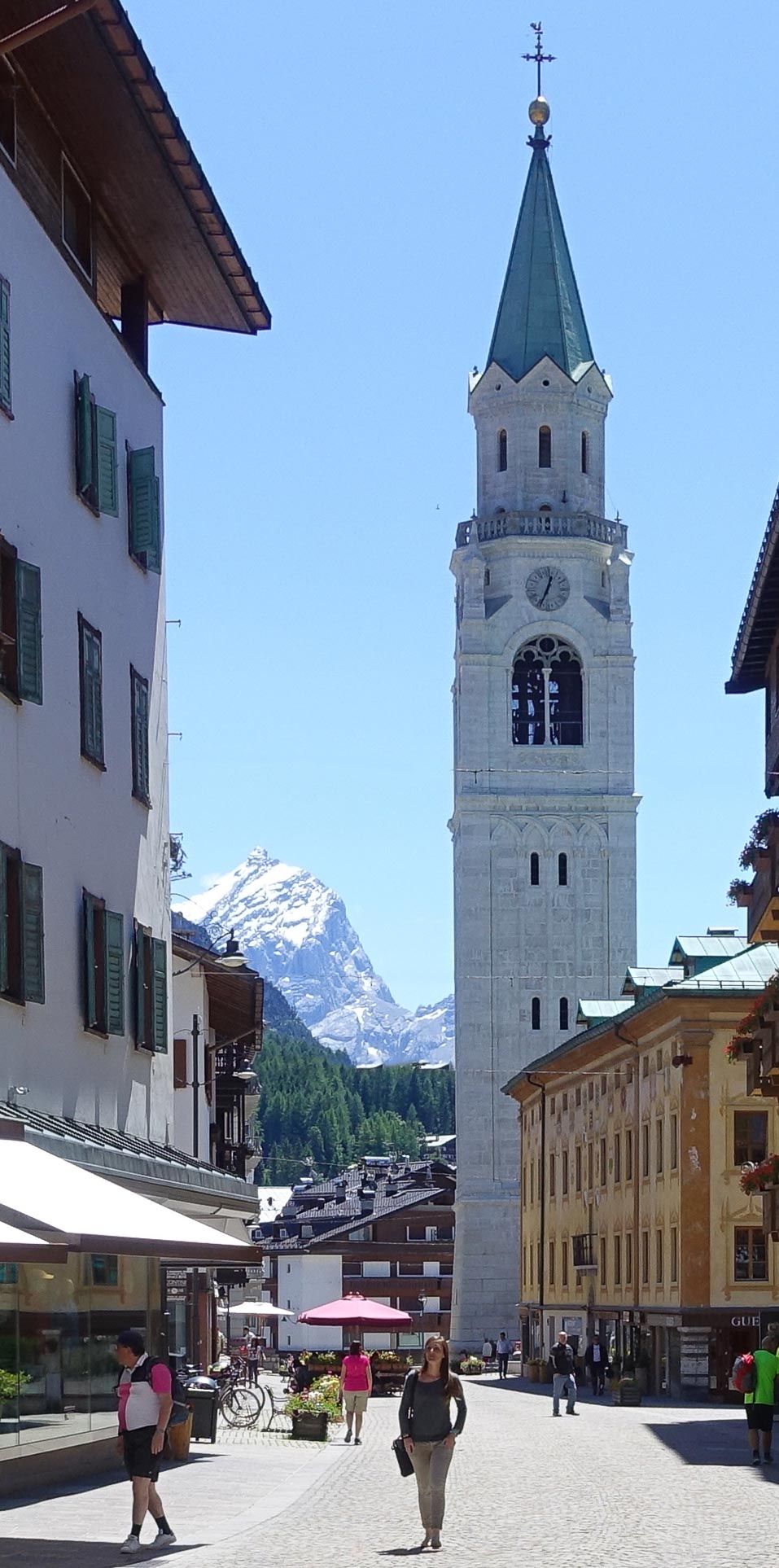
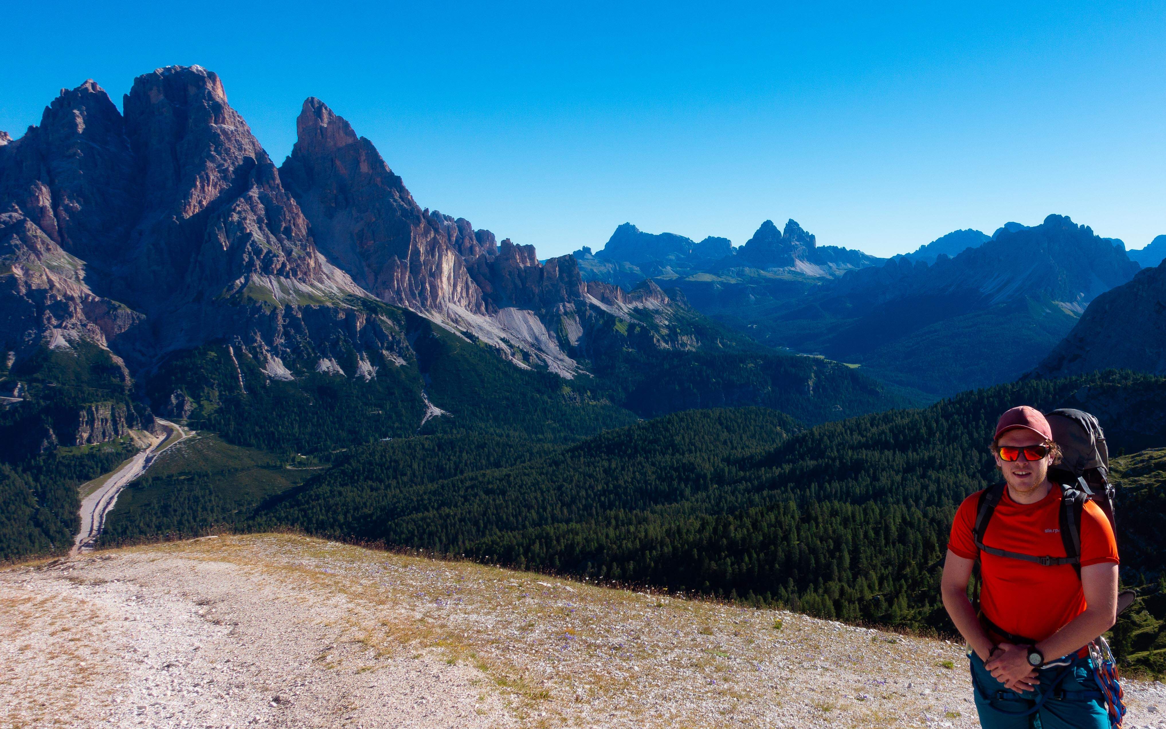
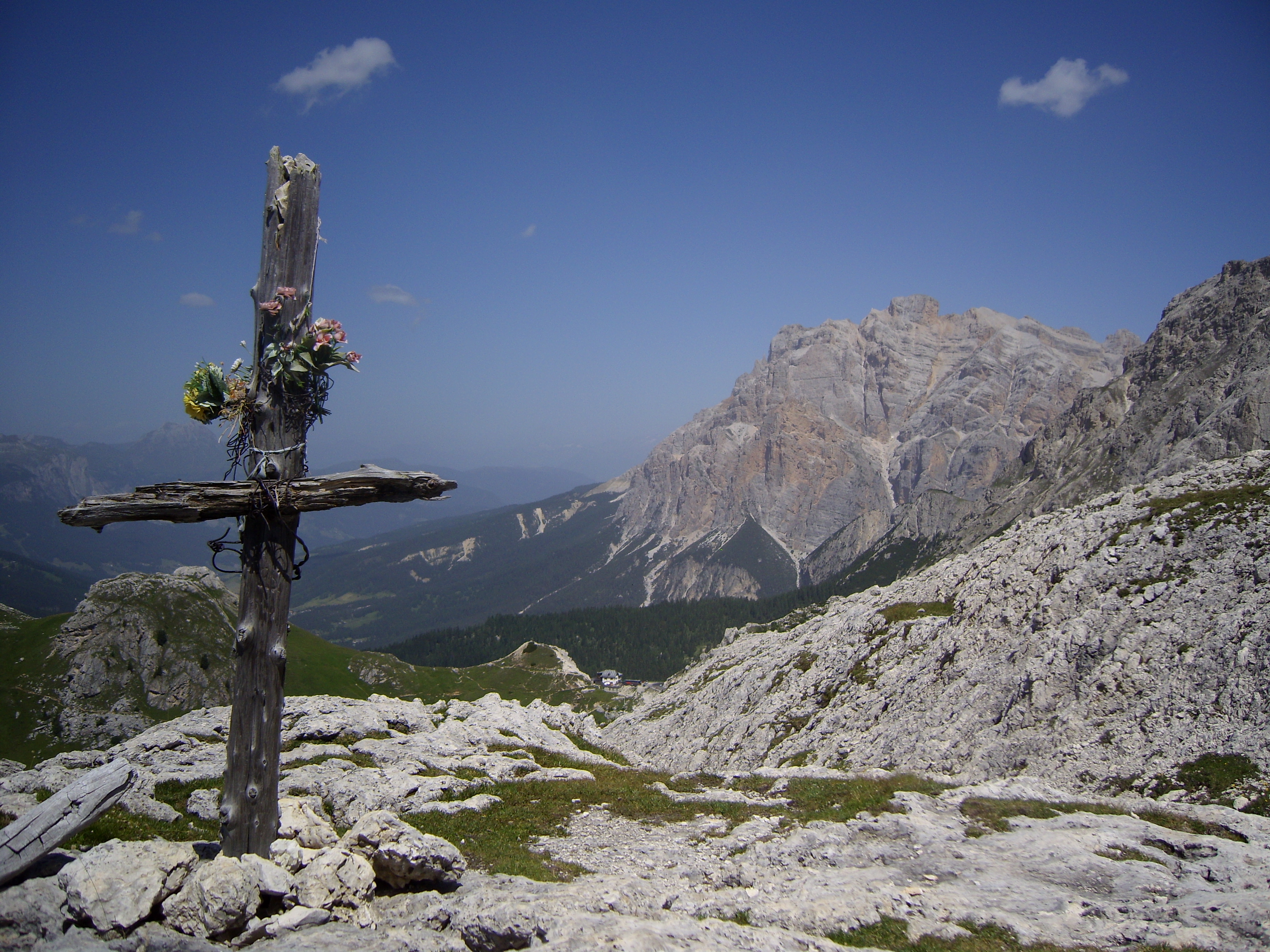
Se Cortina è famosa per i suoi scoiattoli, allora San Martino sarà infame per i suoi furetti. Queste creature enfatiche e vivaci sono rinomate per la loro capacità di infilarsi 
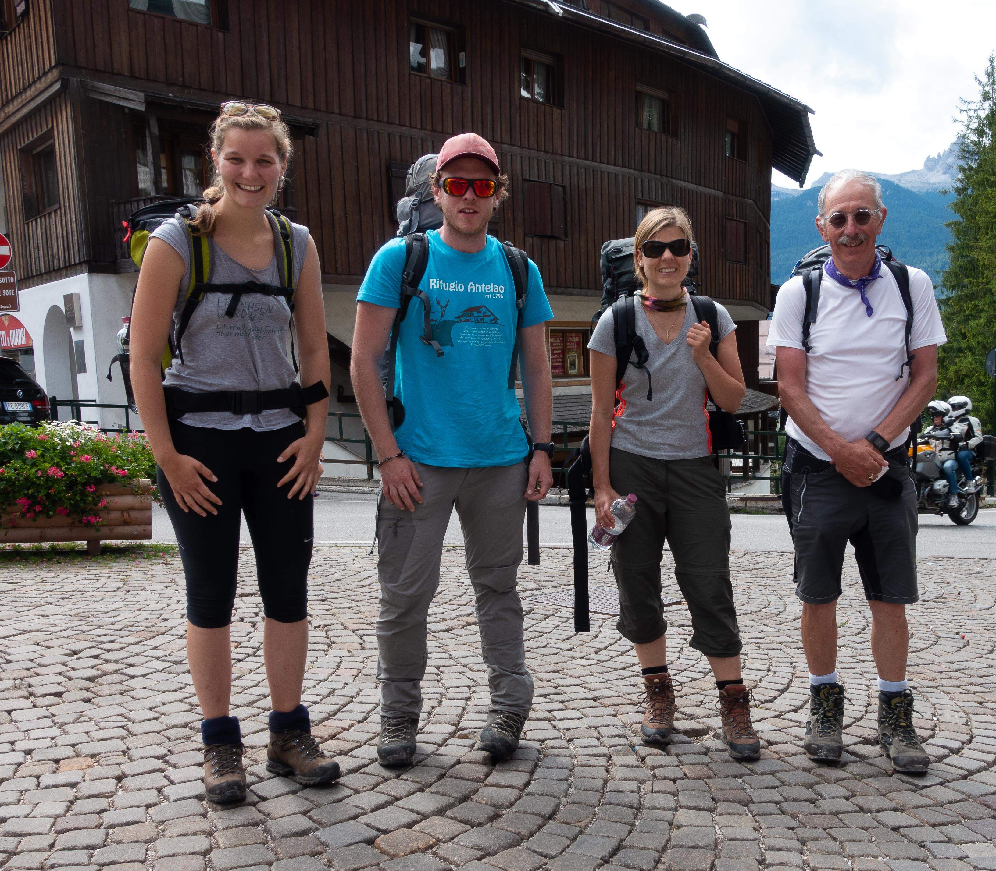
nella più piccola crepa possibile, ovunque. Salendo da San Martino ieri mi sono imbattuto in sei esemplari 50enni di Furetto Alamanni, una specie particolarmente arrogante e sovraccarica di testosterone.

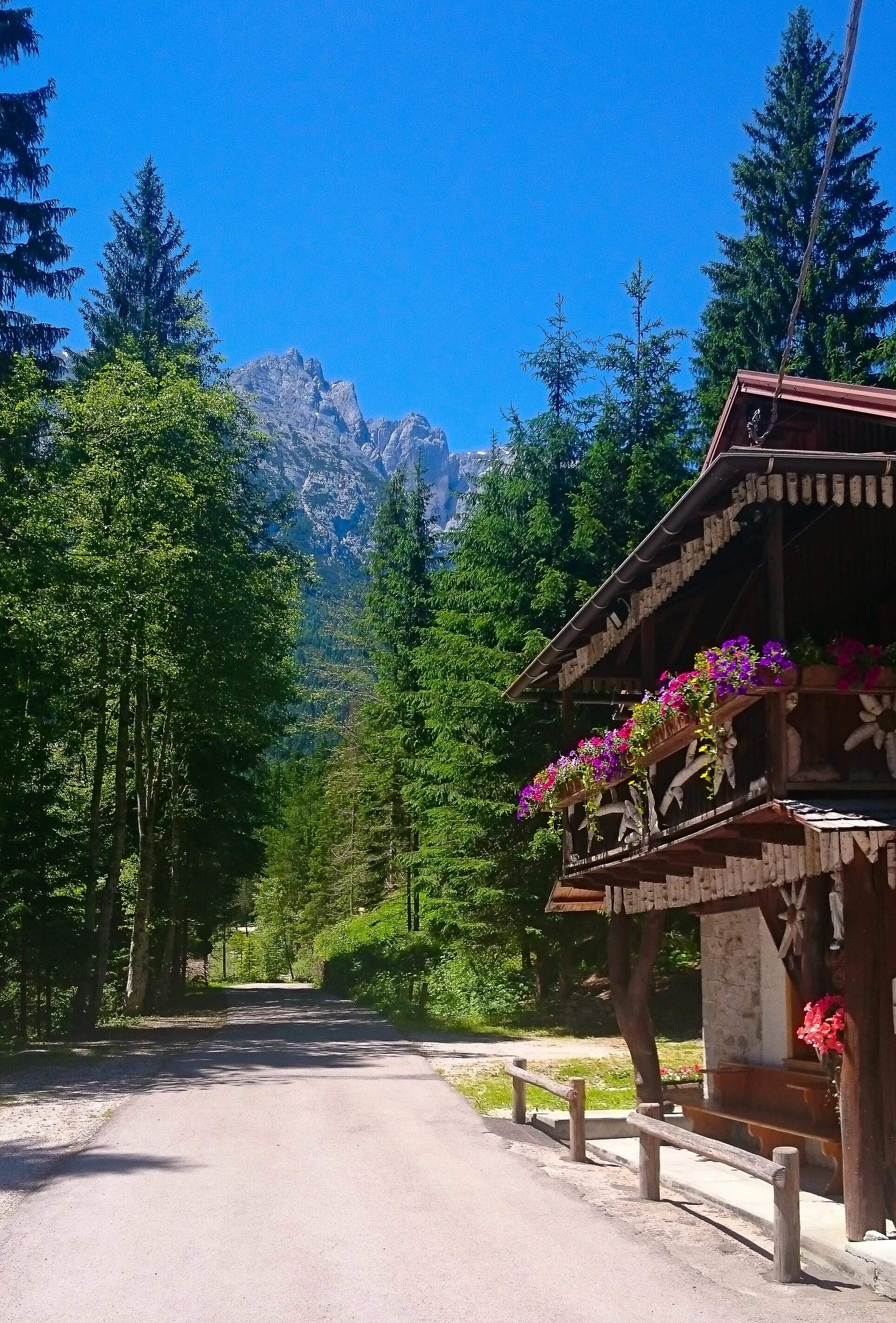
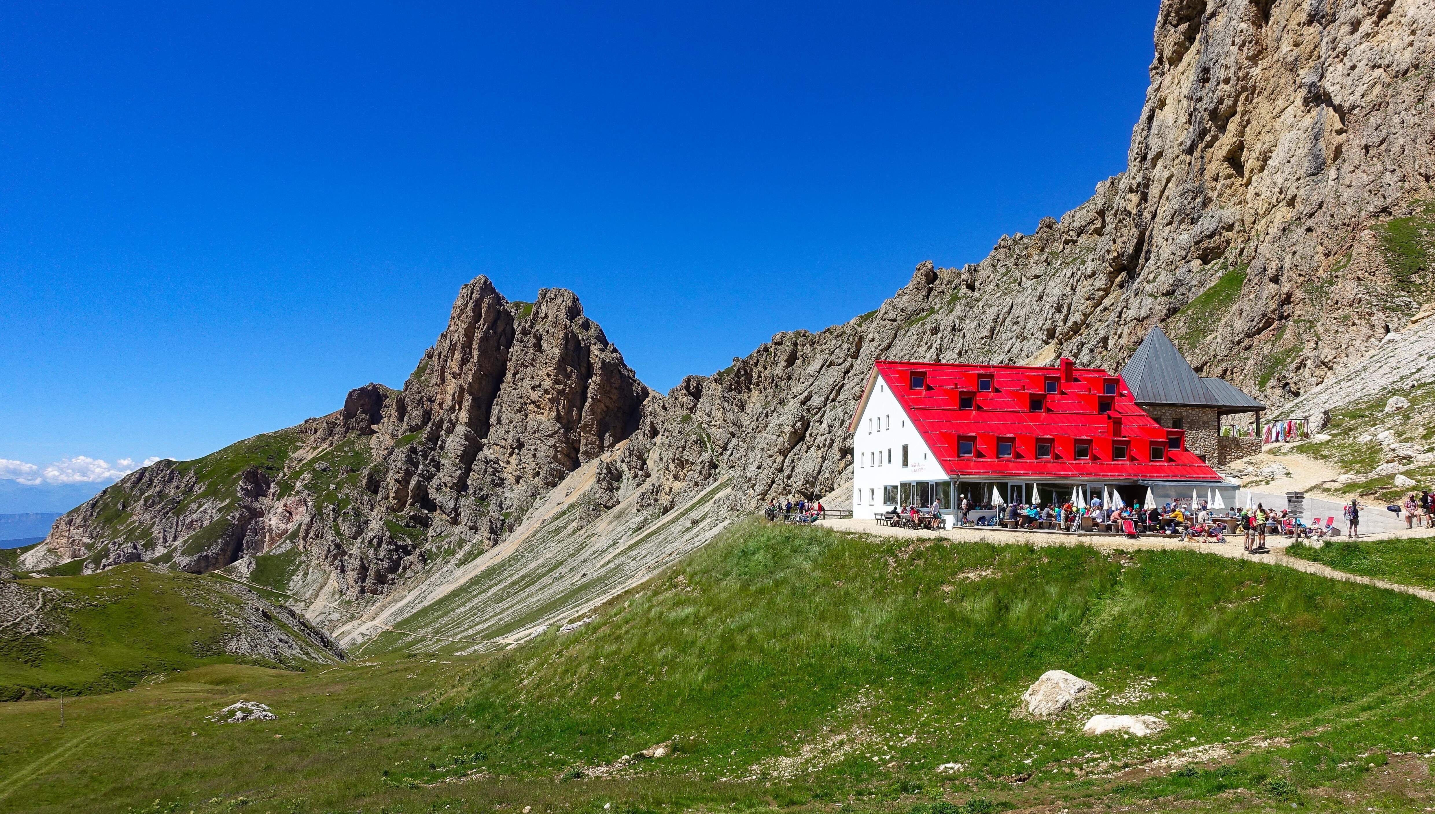
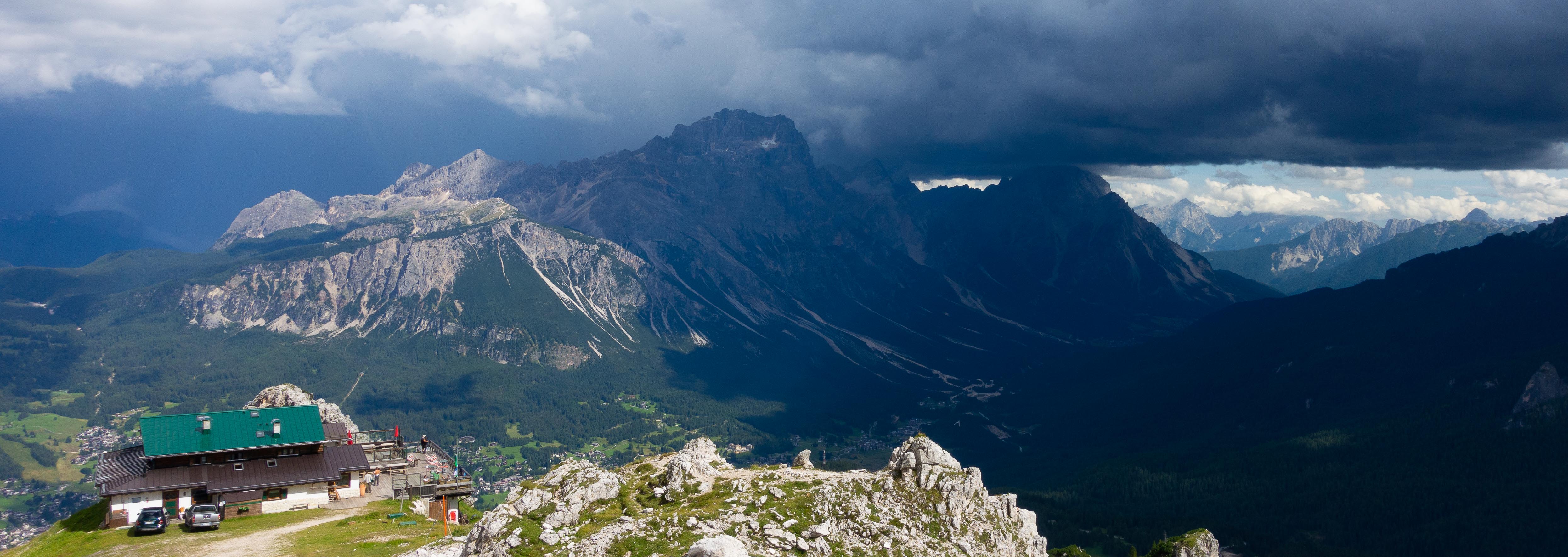
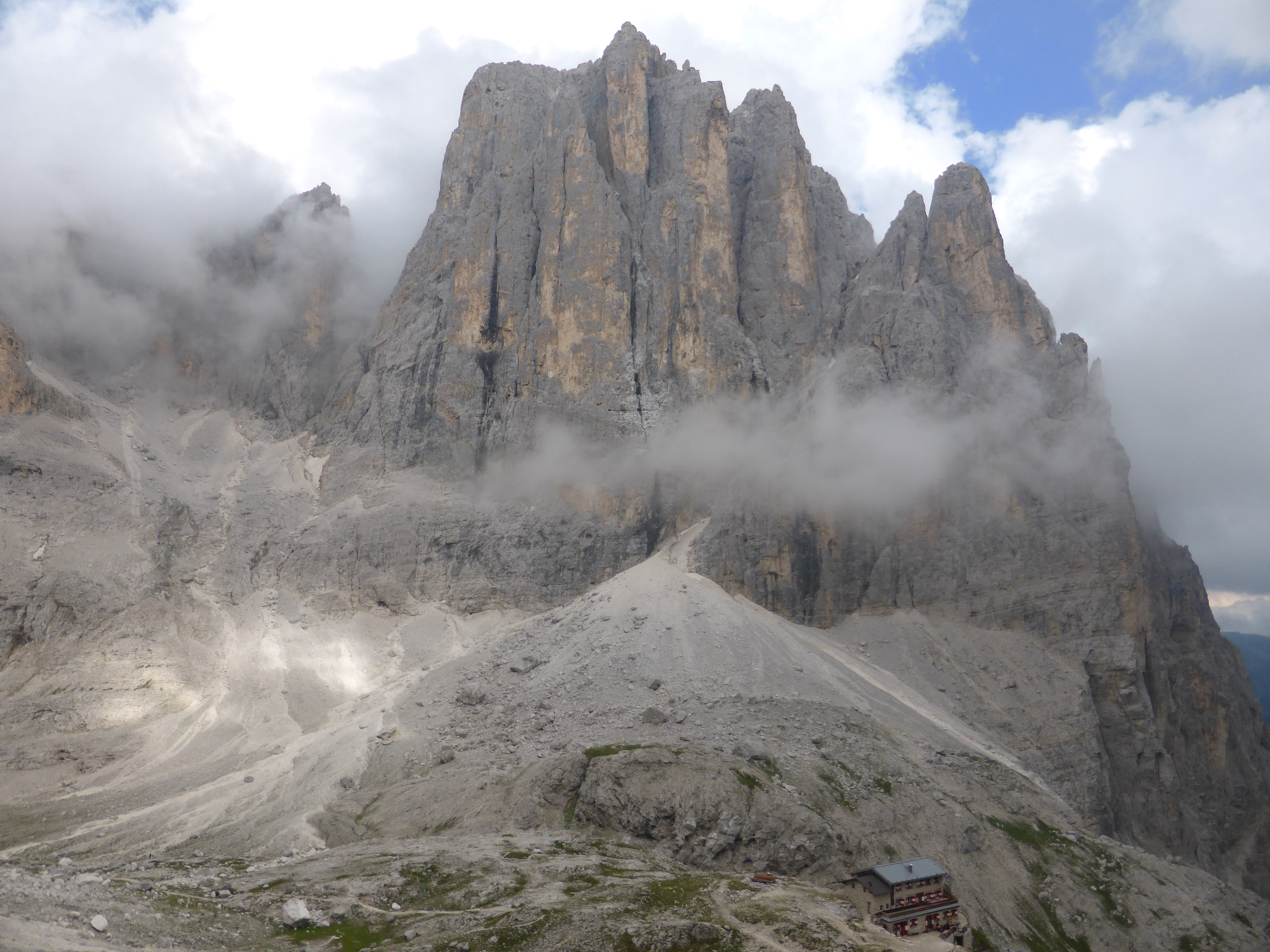
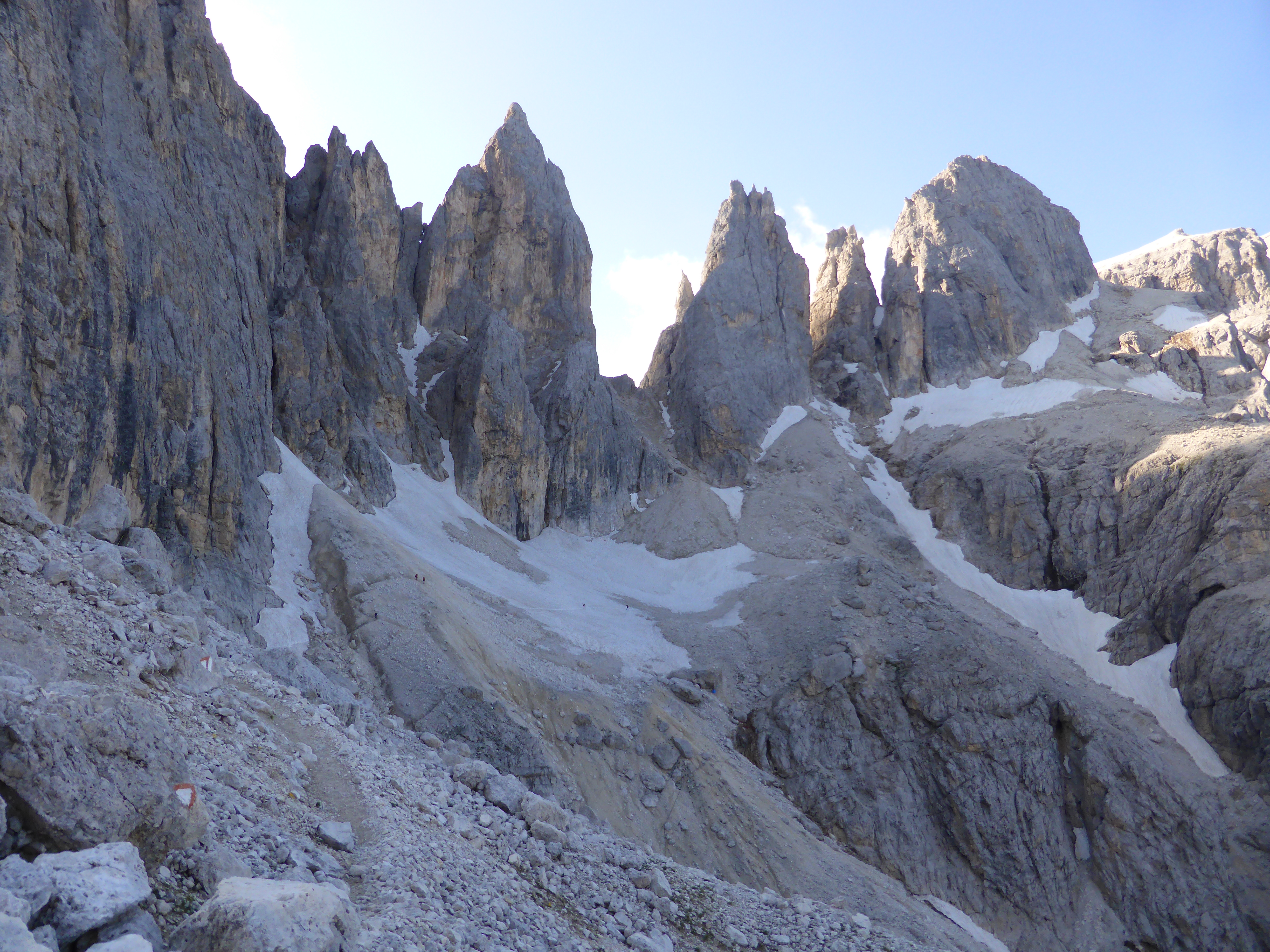
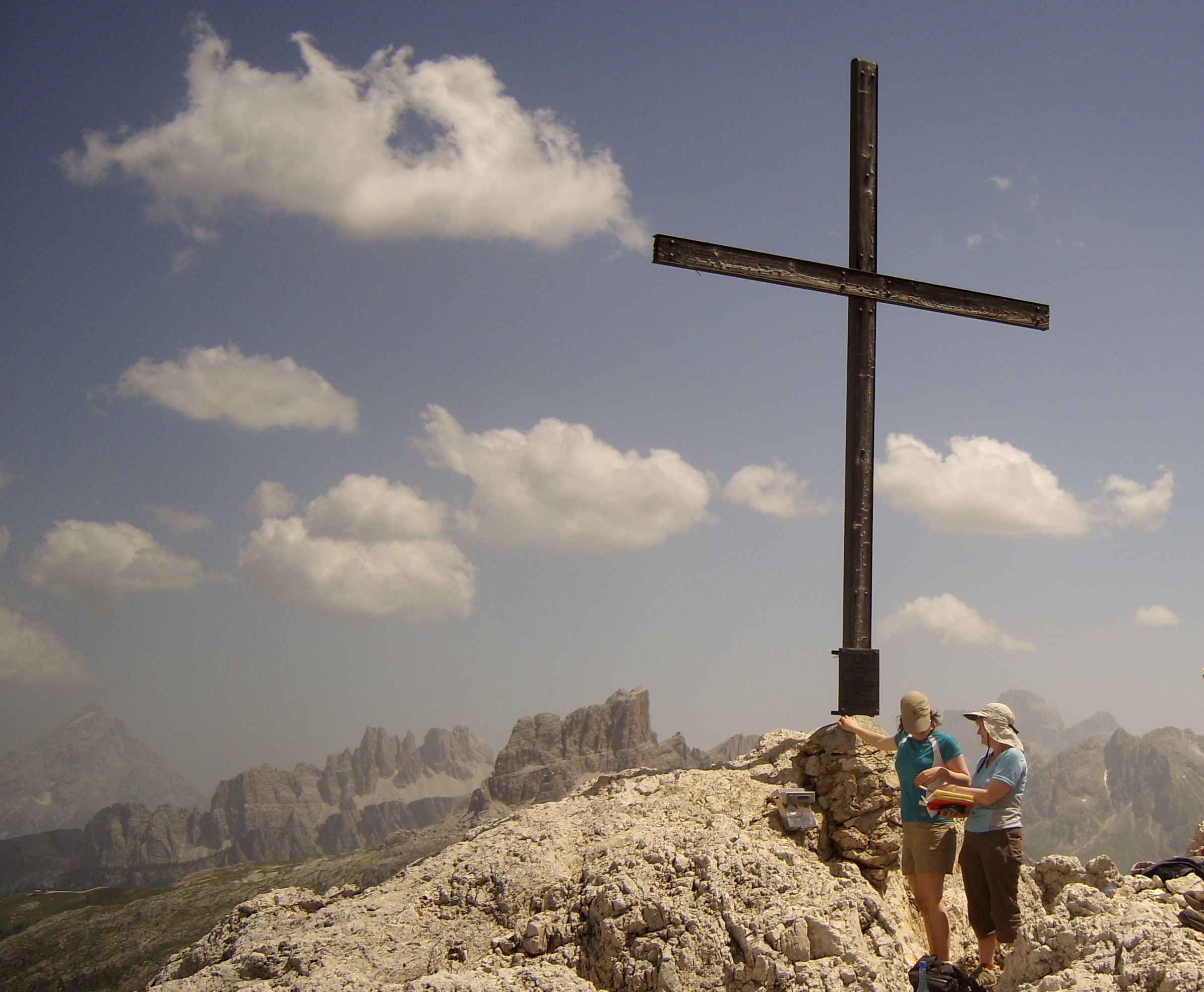
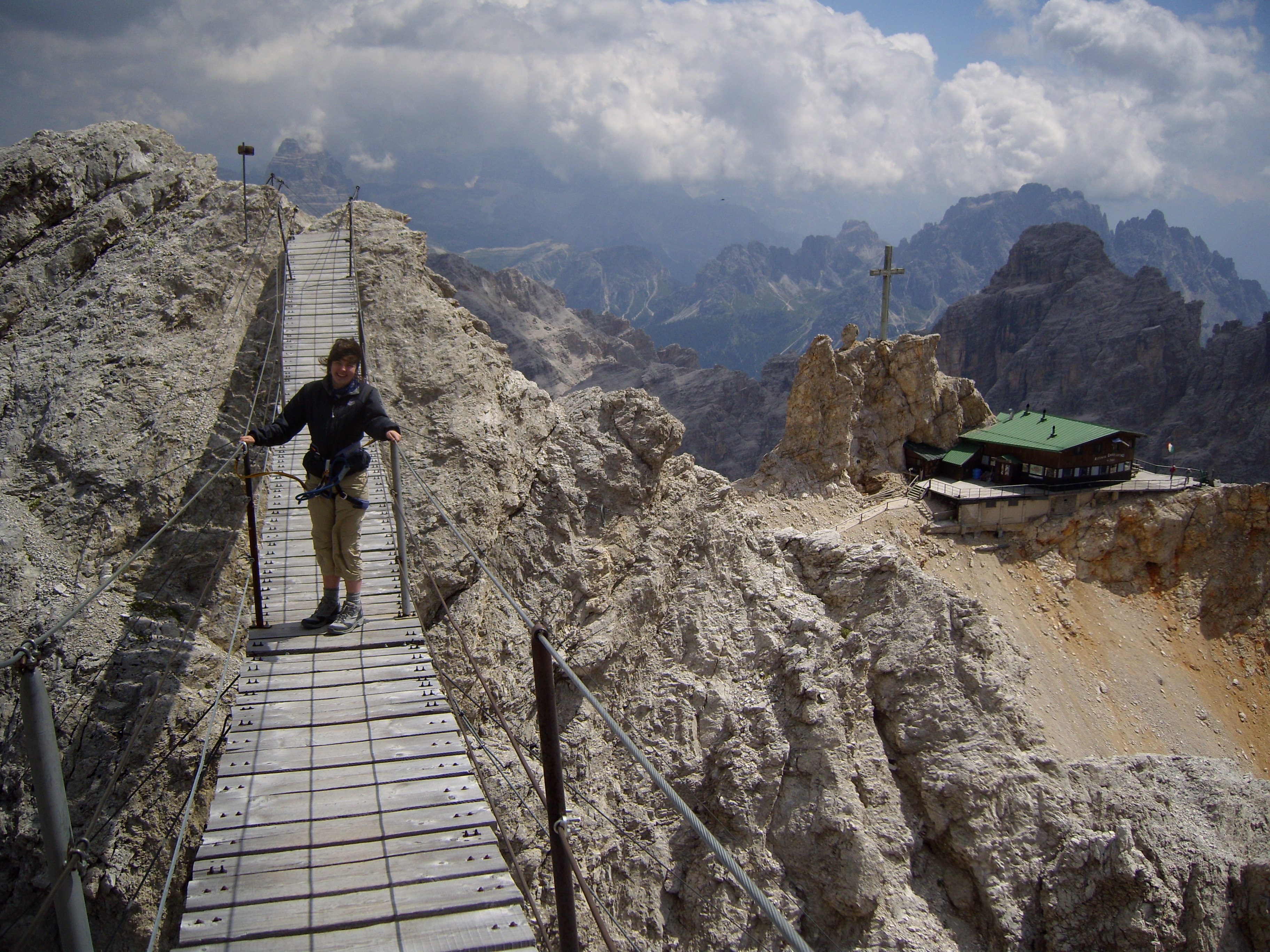
Rifugio Rosetta era molto movimentato quando sono arrivato in mezzo al temporale, perciò mi sono messo in fila ad aspettare il mio turno. Subito dopo sono arrivati i furetti e sono passati davanti a tutta la coda, in modo da poter pigliare i posti migliori. Normalmente avrei lasciato perdere, ma era già la terza volta che si erano infilati davanti a me durante la salita, quindi mi sono rivolto al furetto più grande e autoritario col tono meno provocatore possibile, che riservo per occasioni di questo genere, e gli ho chiesto “Perché tanta fretta, amico? C’è un incendio da qualche parte?”

A quanto pare, il suo bagaglio linguistico non comprendeva lo scouse (dialetto di Liverpool) e ha risposto borbottando qualcosa che assomigliava a “Nick non si ferma” – devo chiedere a Jurgen Klopp di decifrarlo per me quando torno a Liverpool. “Che buffone!” ho replicato con un sorriso e ho ripreso ad aspettare pazientemente il mio turno.

Quando finalmente ho fatto il check-in, la gentile signora saggiamente mi ha assegnato una camera diversa da quella dei furetti per evitare che si ripetesse un altro episodio stile Monty Python. Per fortuna la pace ha regnato indisturbata mentre cercavo di aumentare il mio testosterone con una cena di wurstel e crauti.

Stamattina mi sono allontanato inosservato mentre i furetti cincischiavano raccogliendo i propri asciugamani dai lavelli nei bagni.

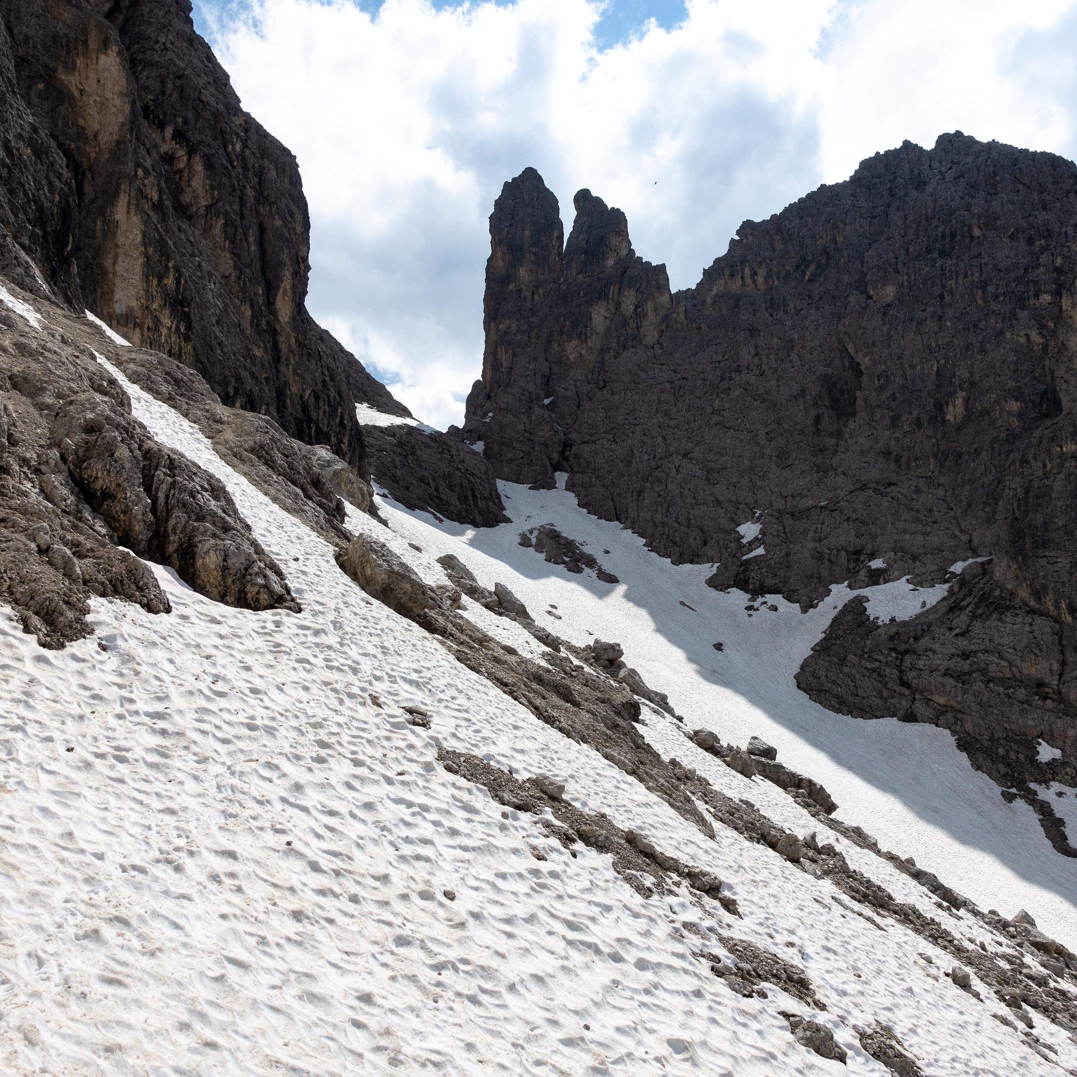
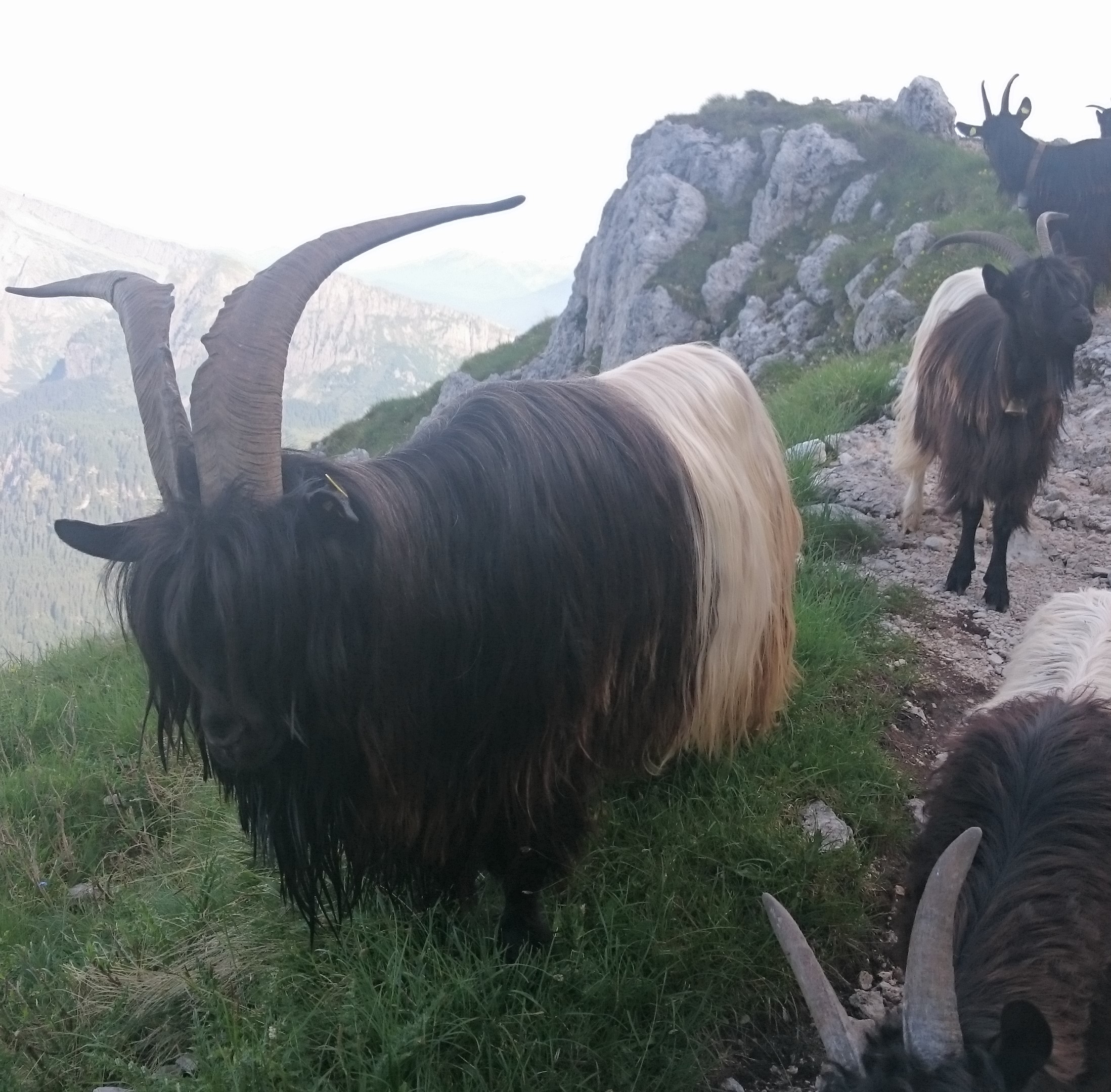
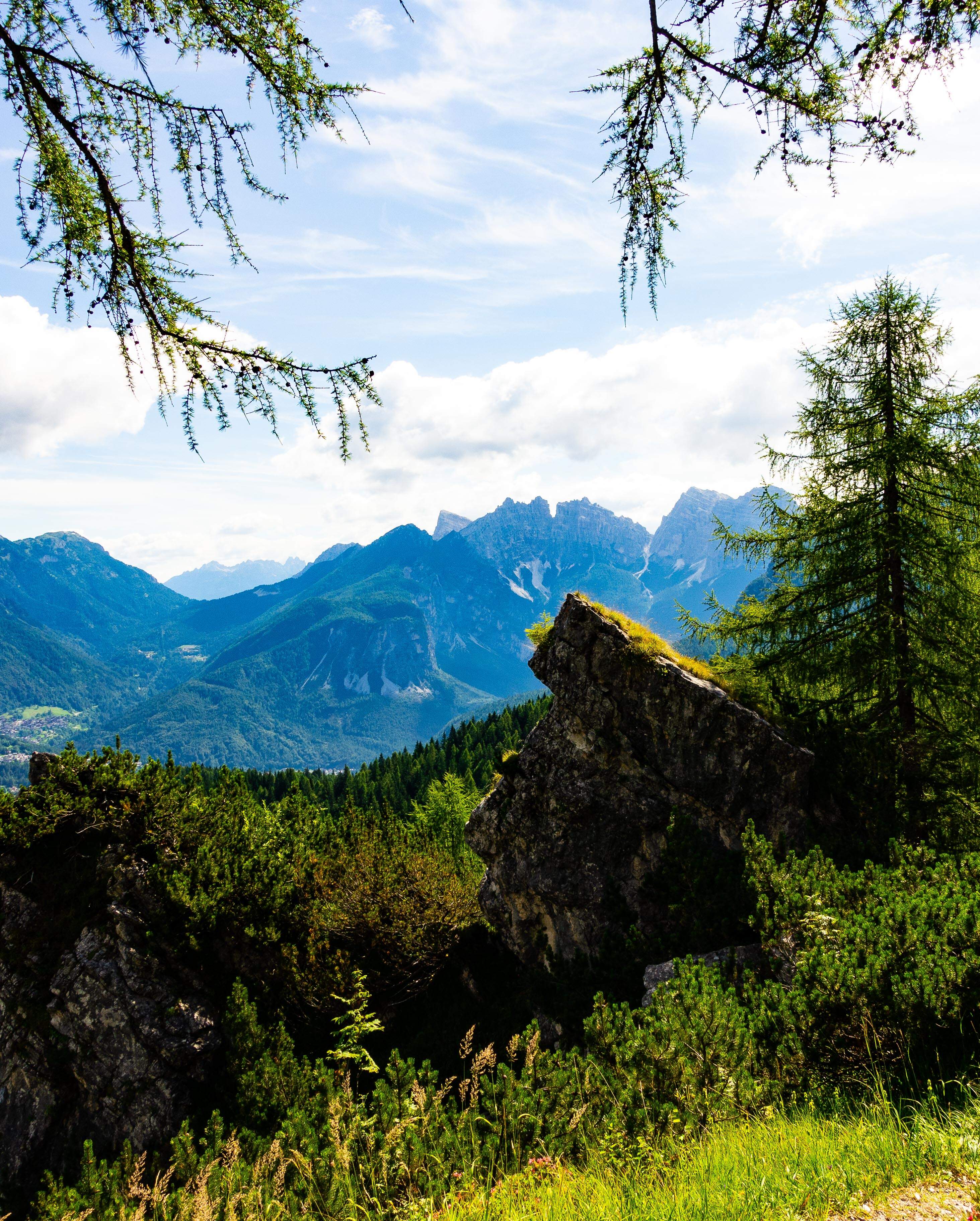
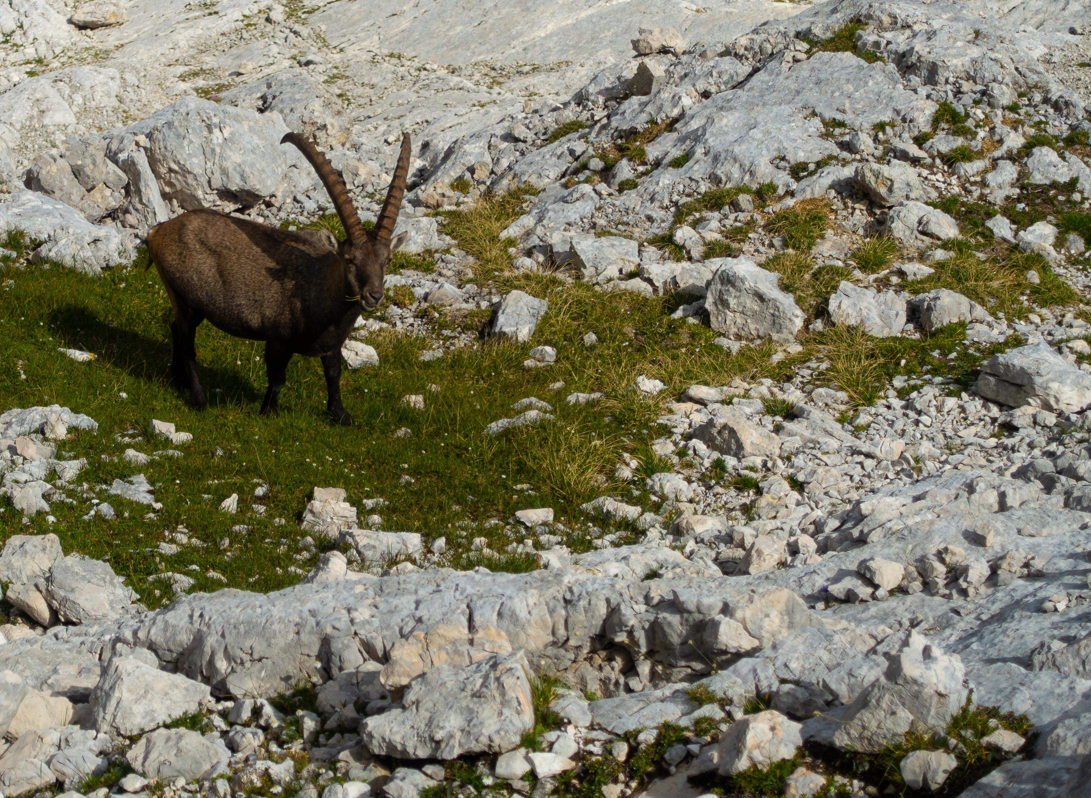
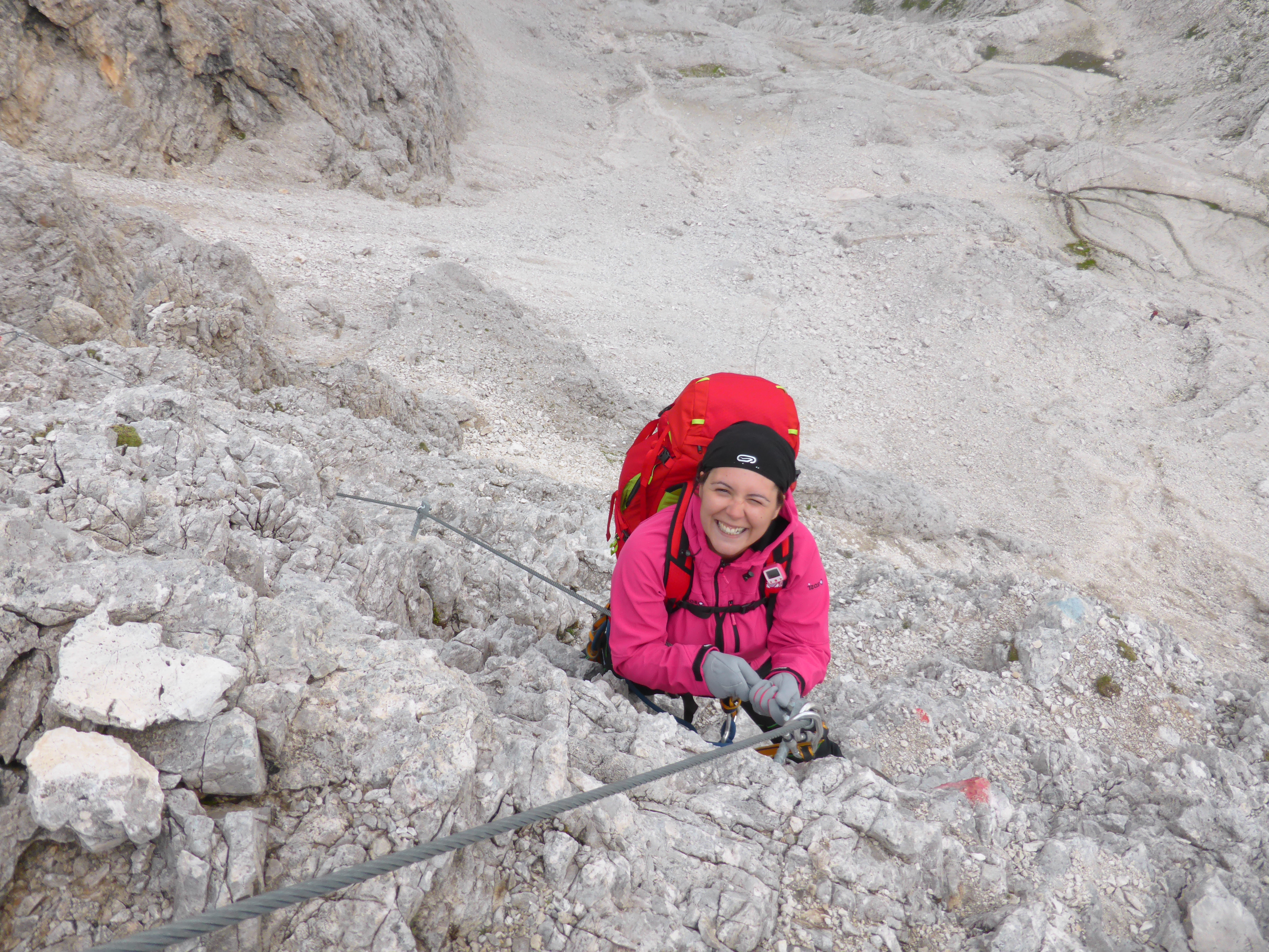
Il percorso seguiva il ripido sentiero 701 fino al Col Verde. Scendendo ho incontrato una famiglia di stambecchi che riposava su un cornicione nel sole mattutino. Mi sono avvicinato molto lentamente, cercando di non spaventarli nel tentativo di scattare una foto. Mi hanno guardato, tranquilli, mentre scendevo e presto ho notato che le corna del grosso Caprone erano lunghe 60 cm, e che le scuoteva con disinvoltura. Ho fatto le foto e li ho sorpassati delicatamente per non spaventarli. Subito dopo ho sentito un colpetto al sedere e mi sono girato per trovare un piccolo stambecco che m’inseguiva dandomi colpetti alla ricerca di qualcosa che non potevo fornire. Sono partito sparato prima che il Caprone potesse pensare che fossi un pedofilo caprino e venire a confrontarmi.

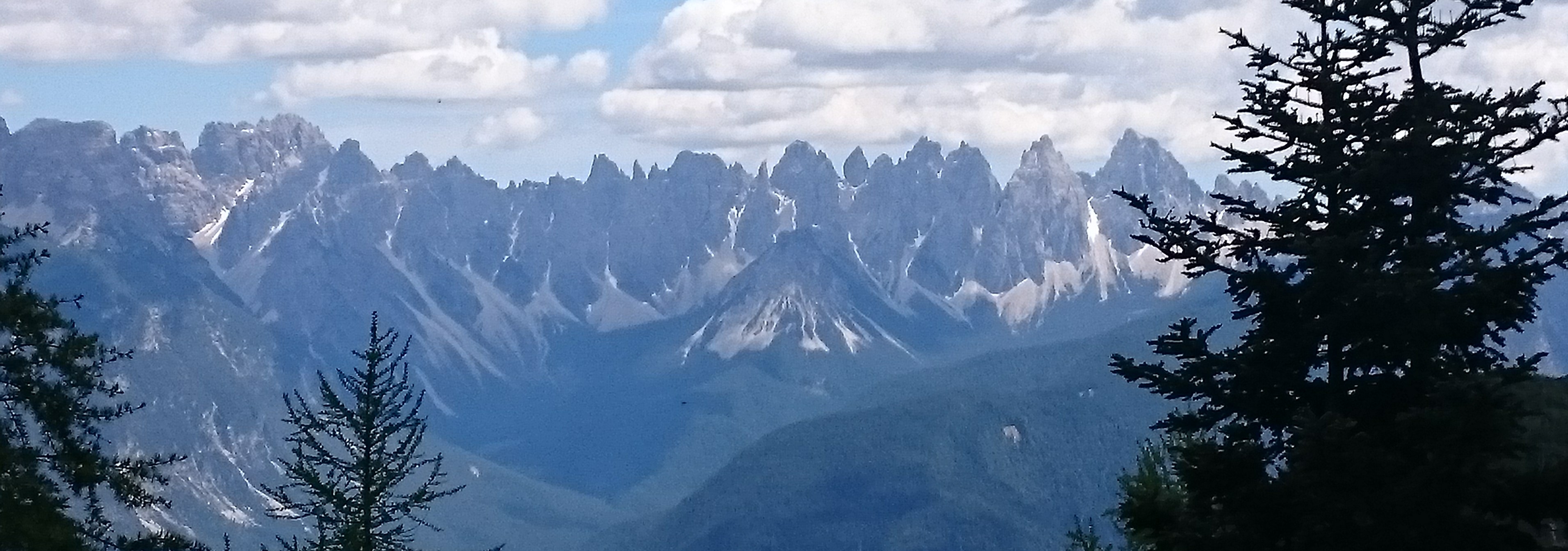
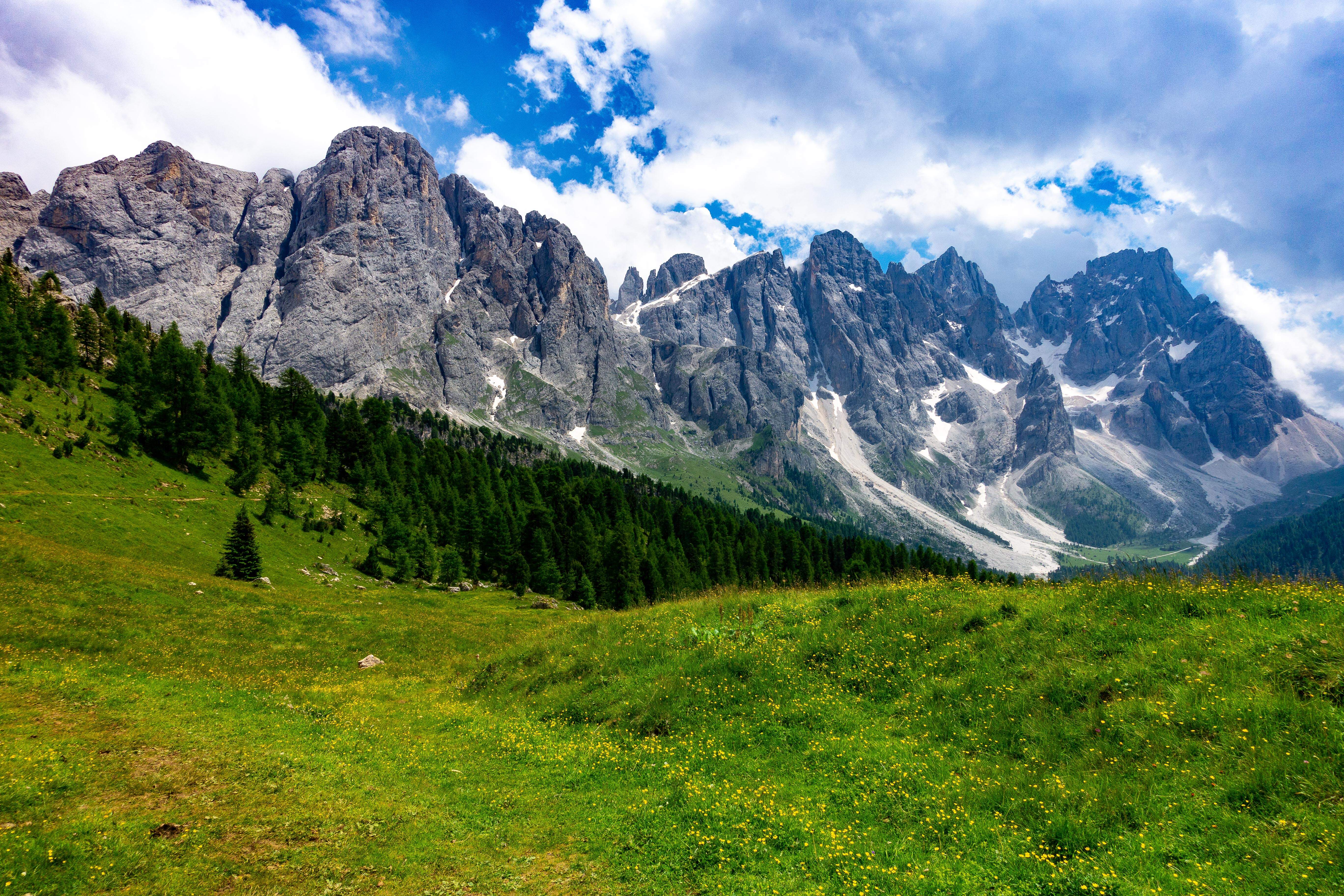
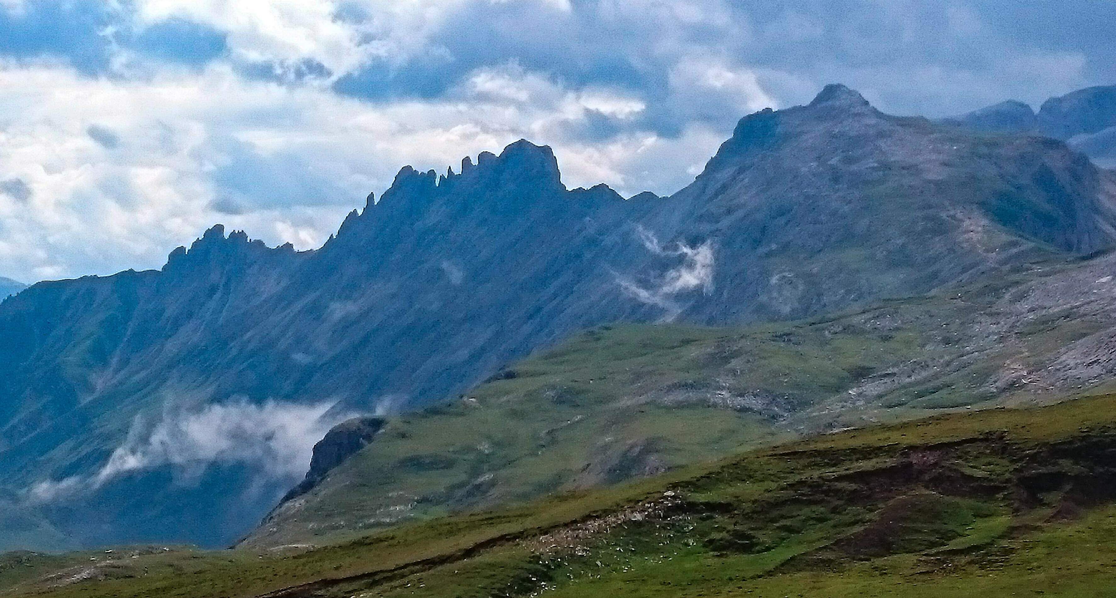
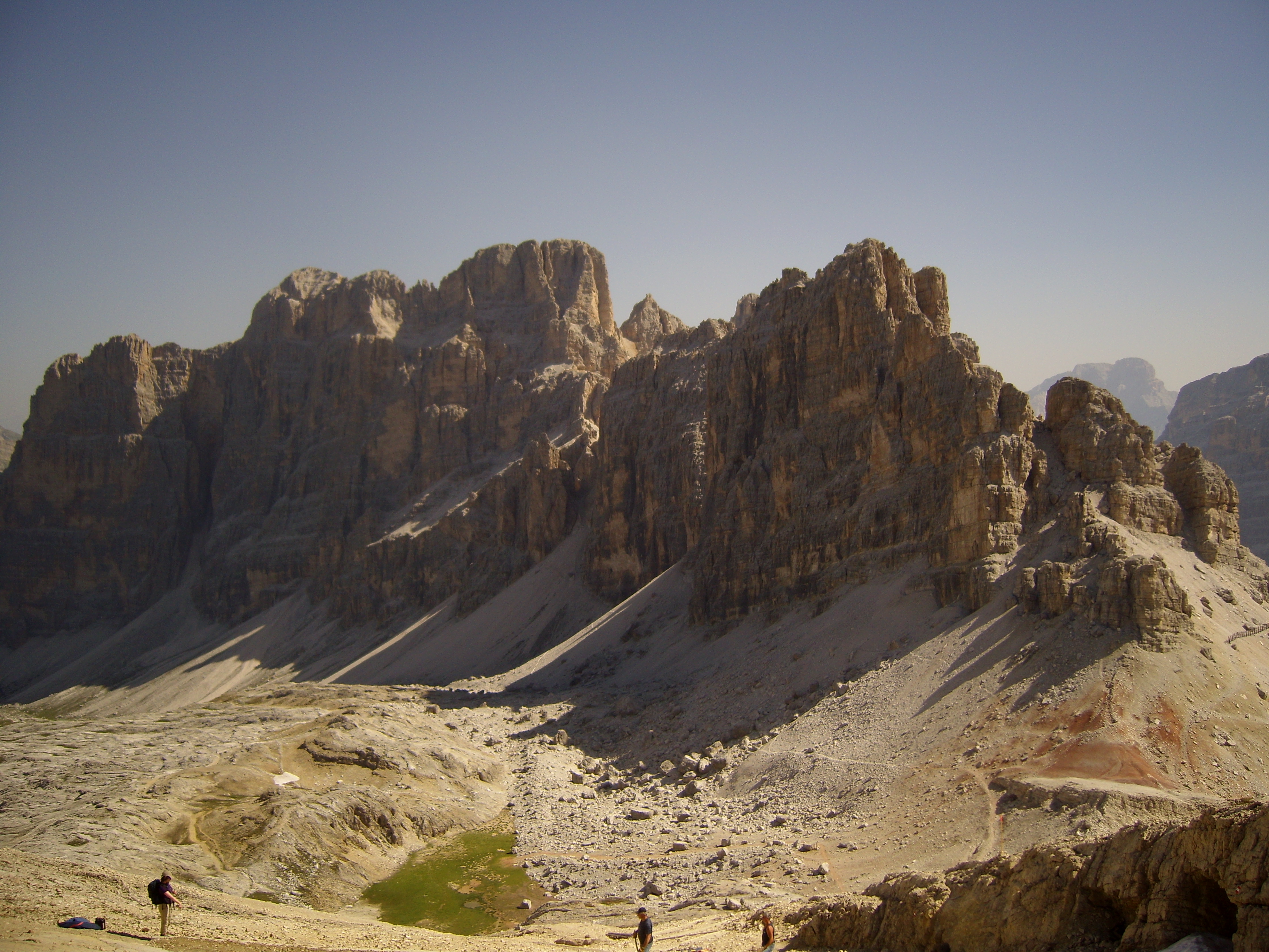
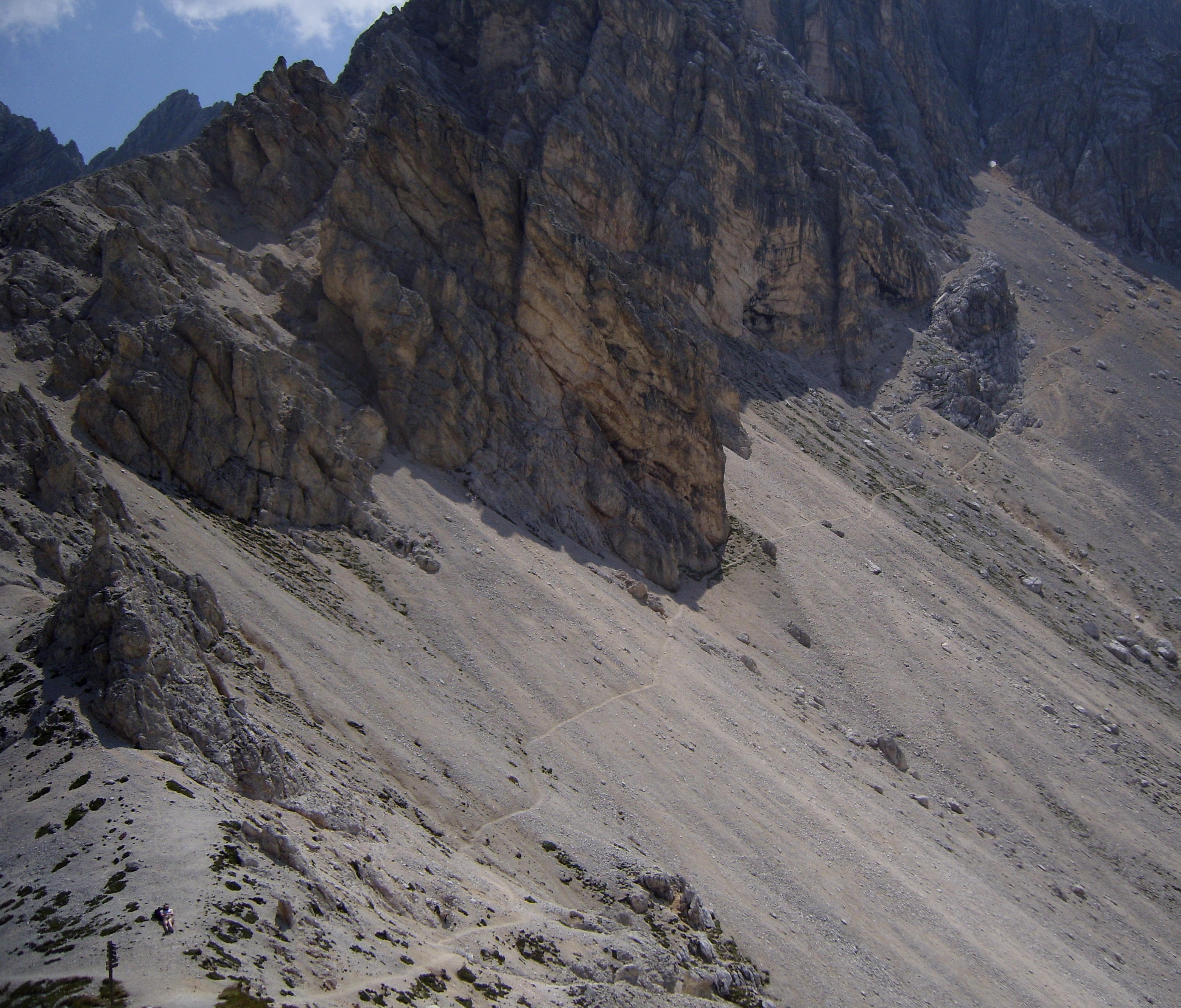
Attraversando Crode Rosse sono passato in mezzo a dei pony selvatici che pascolavano serenamente all’ombra. Lungo il sentiero continuavo a scorgere delle marmotte che scappavano via appena mi avvicinavo.

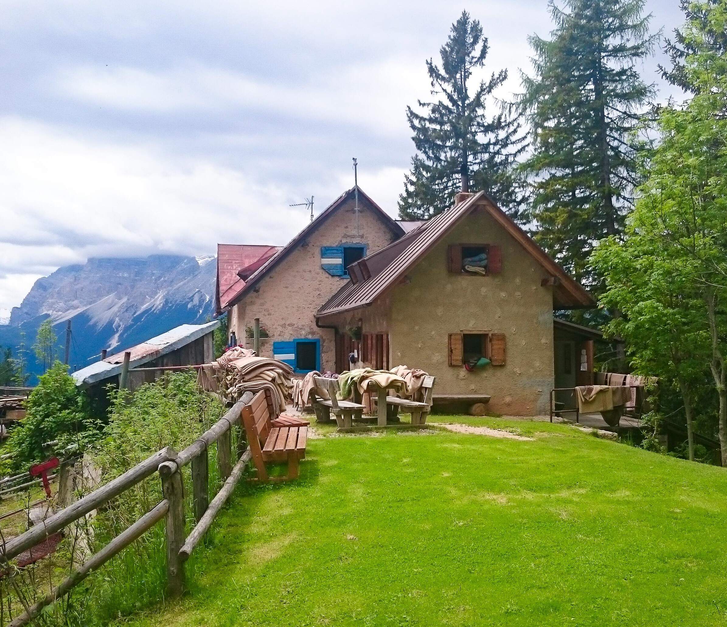
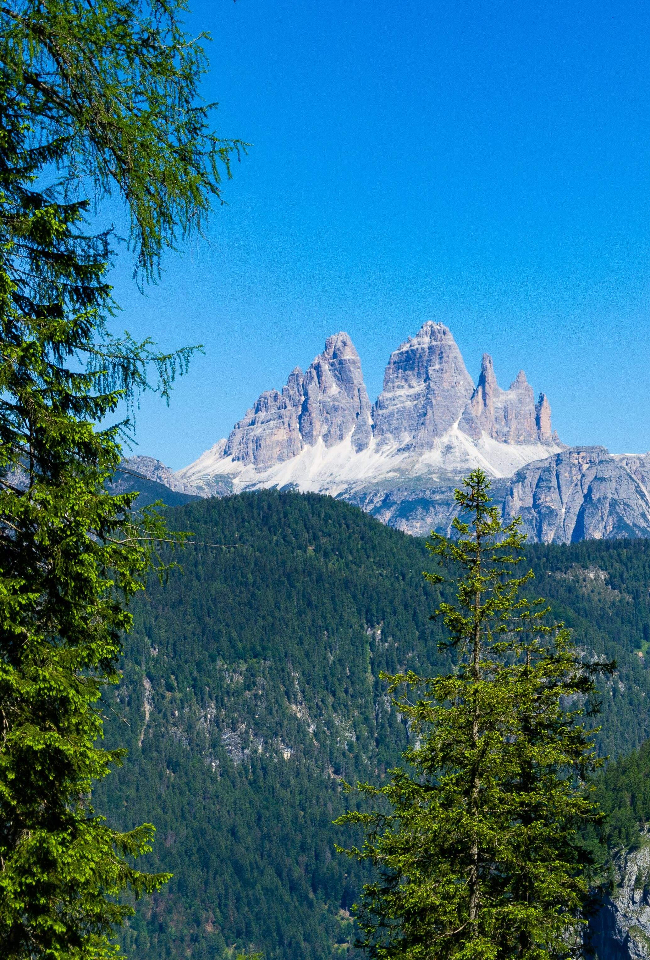
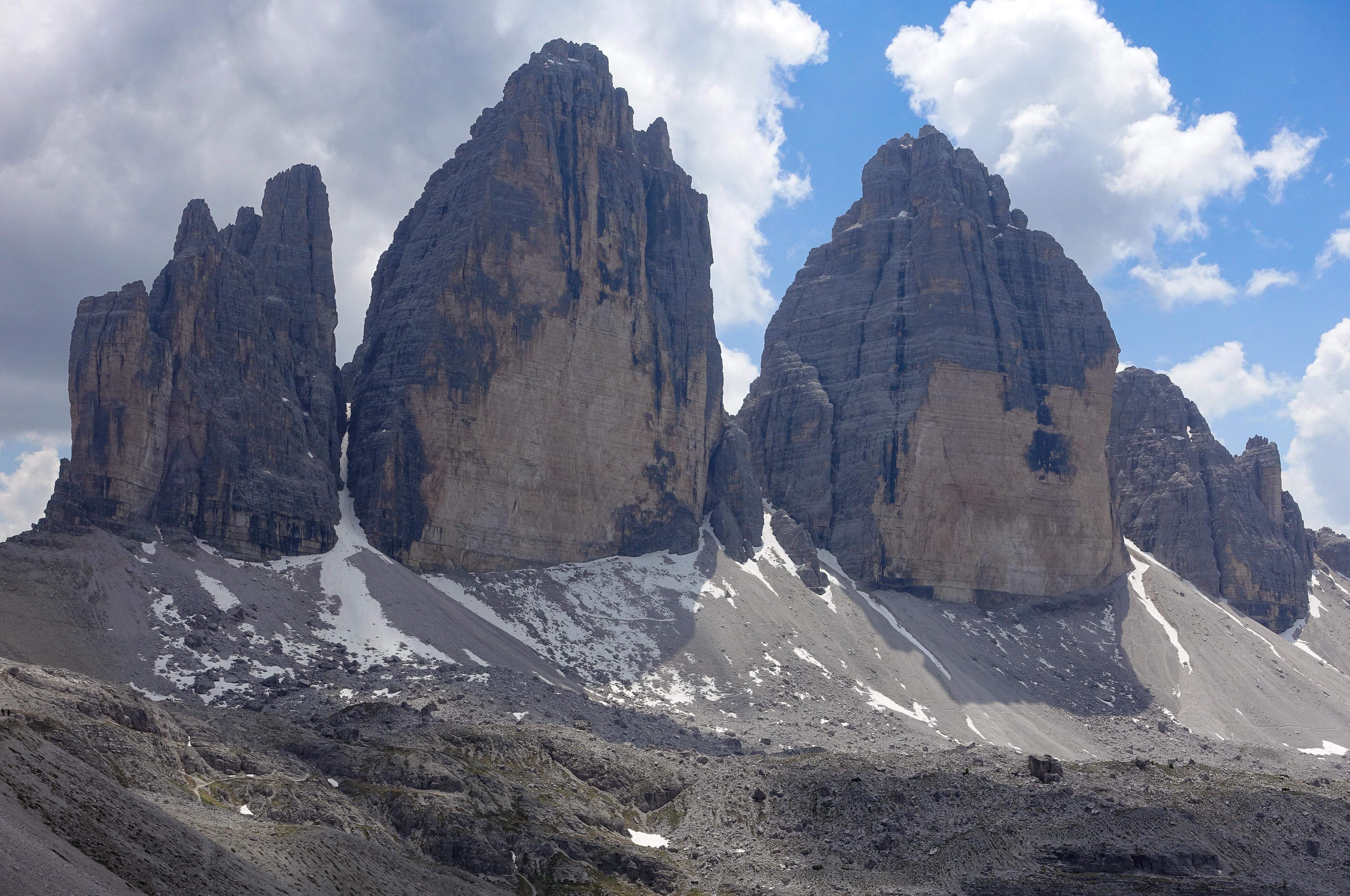
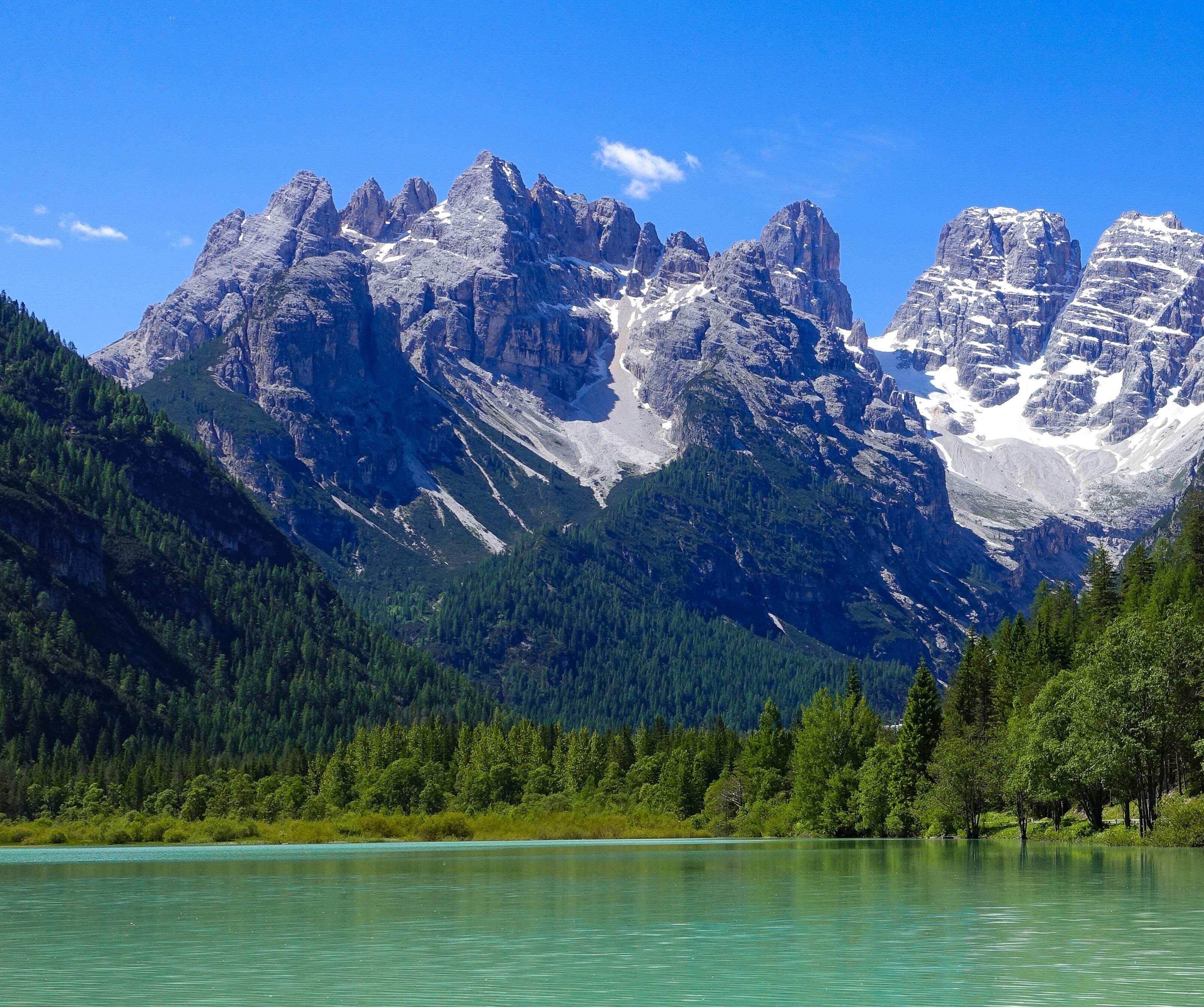
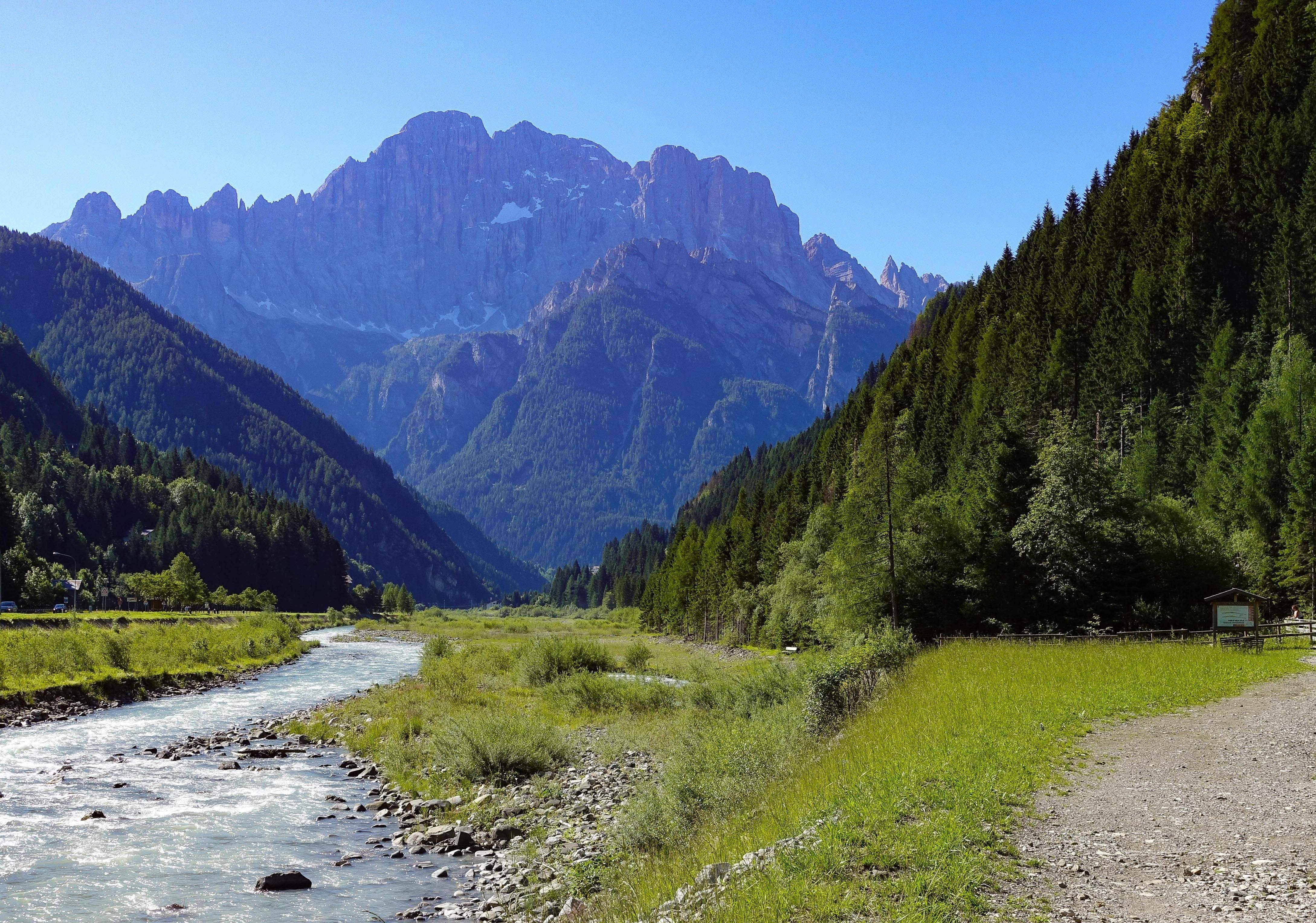
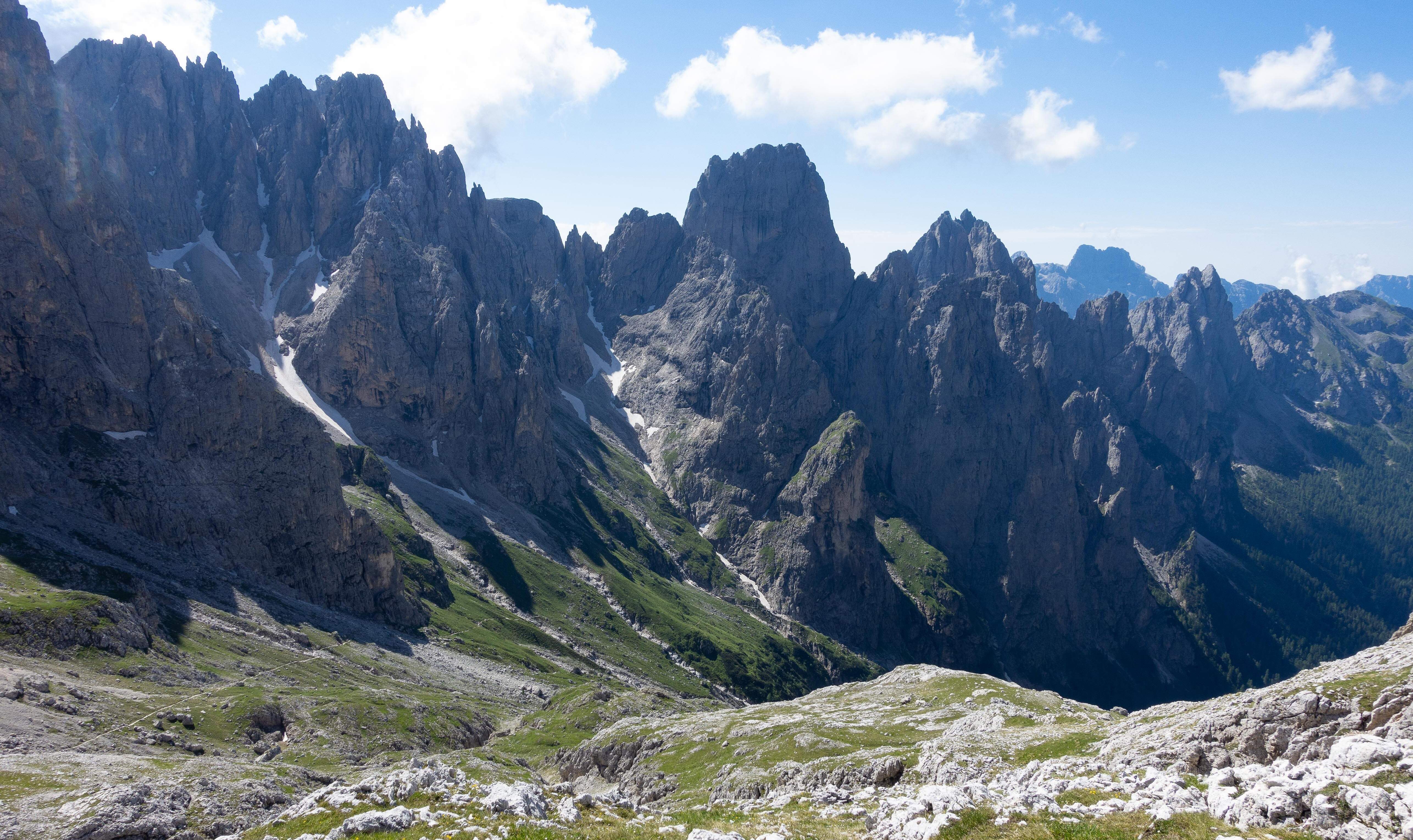
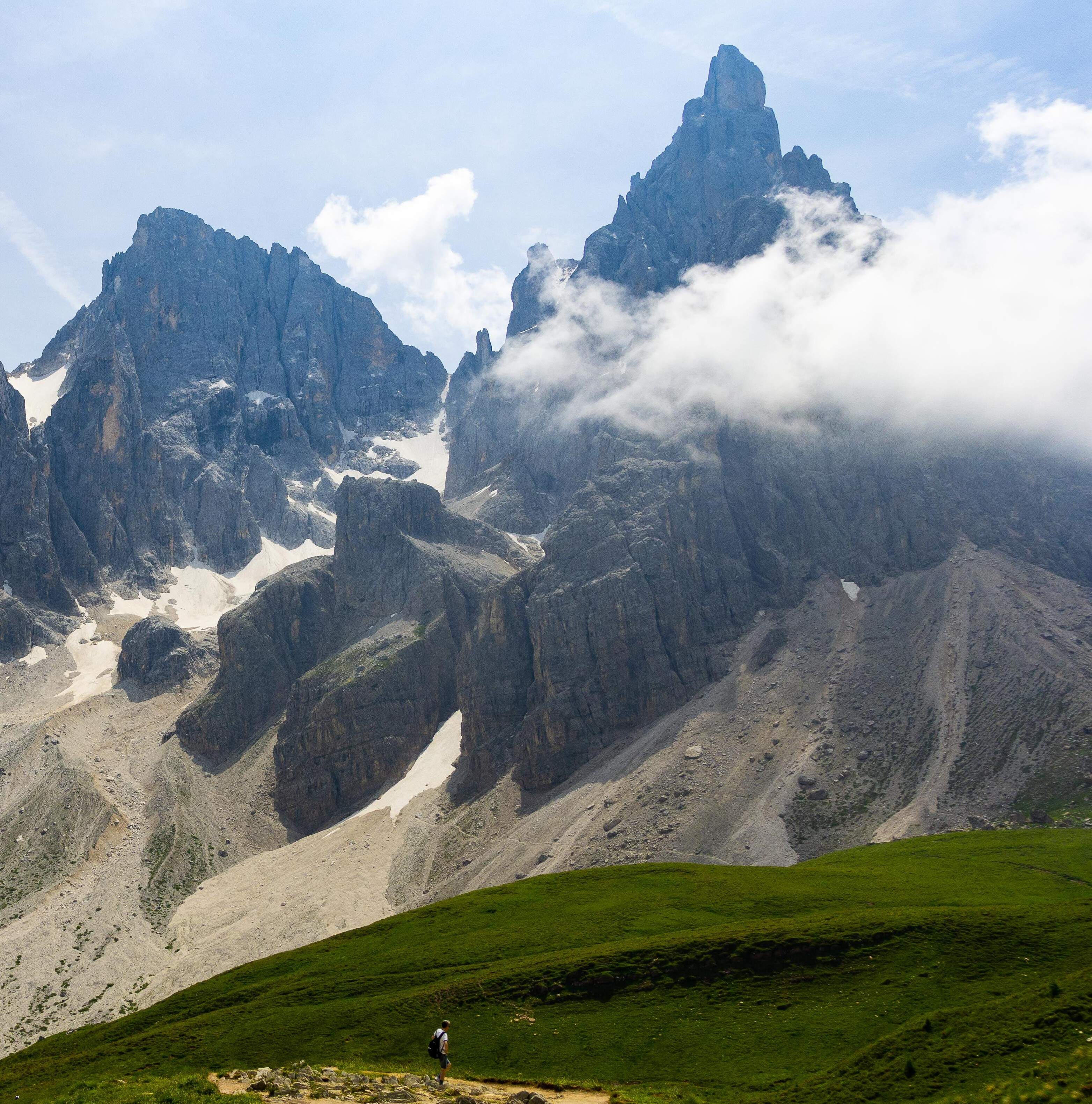
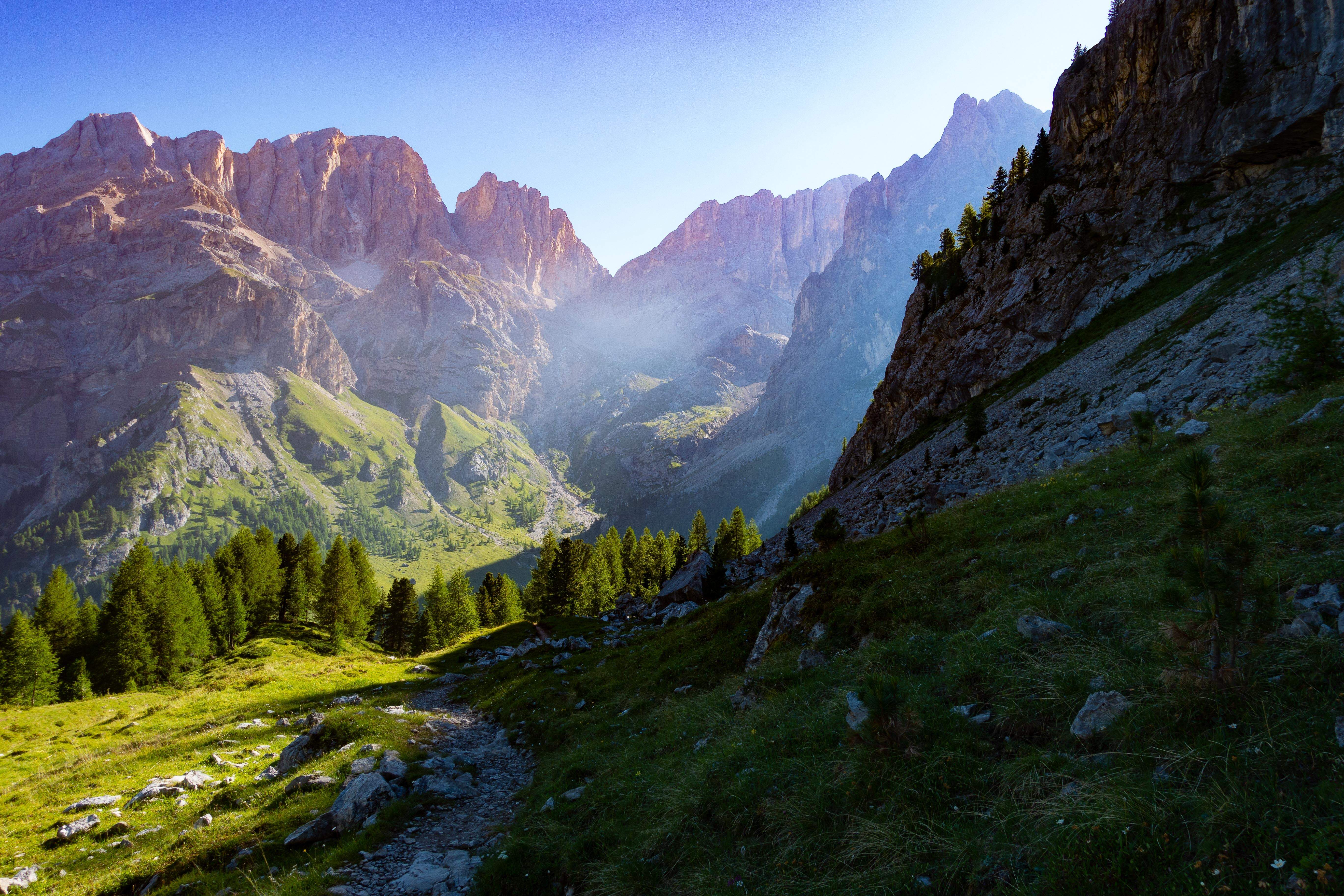
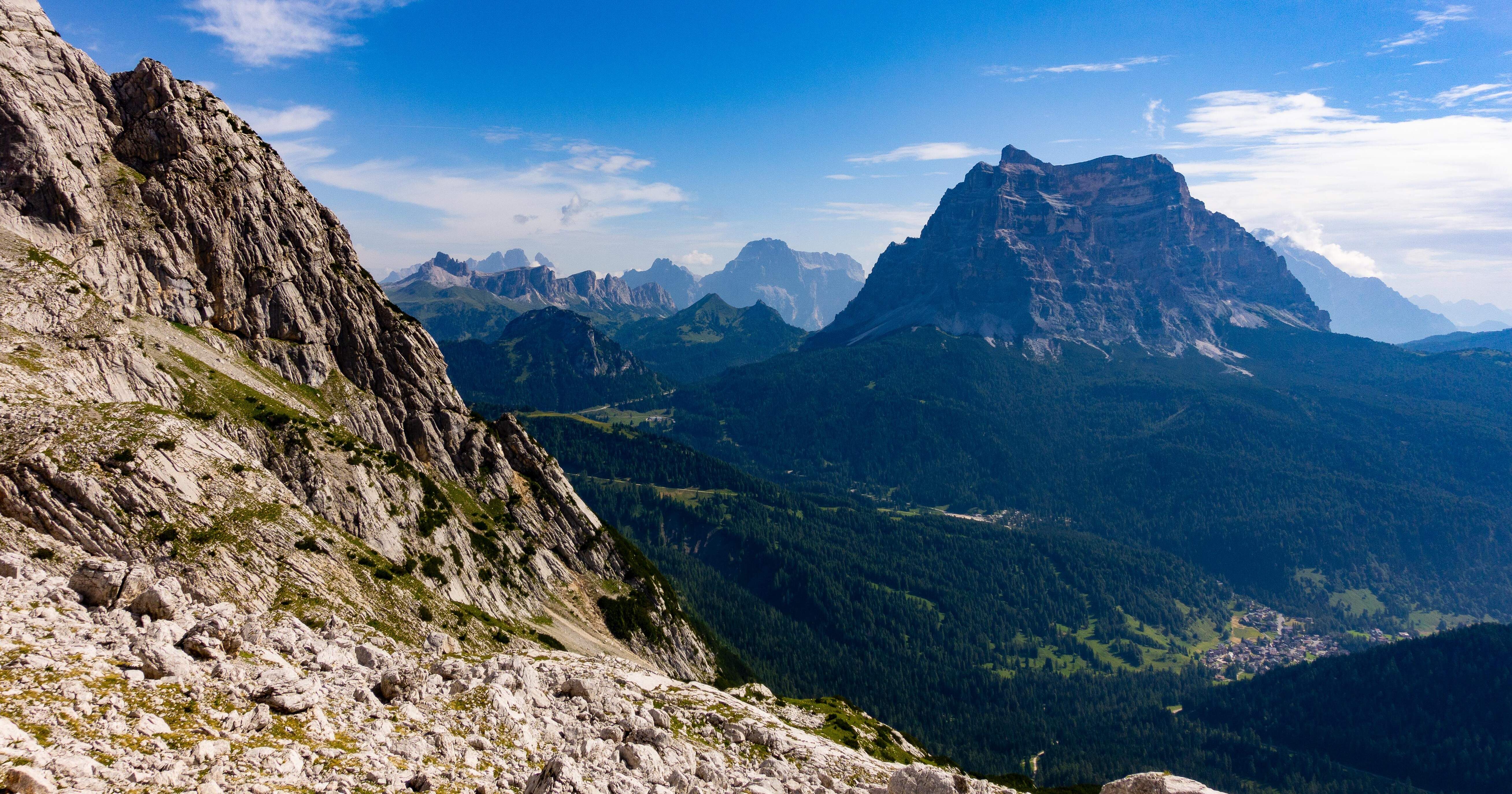
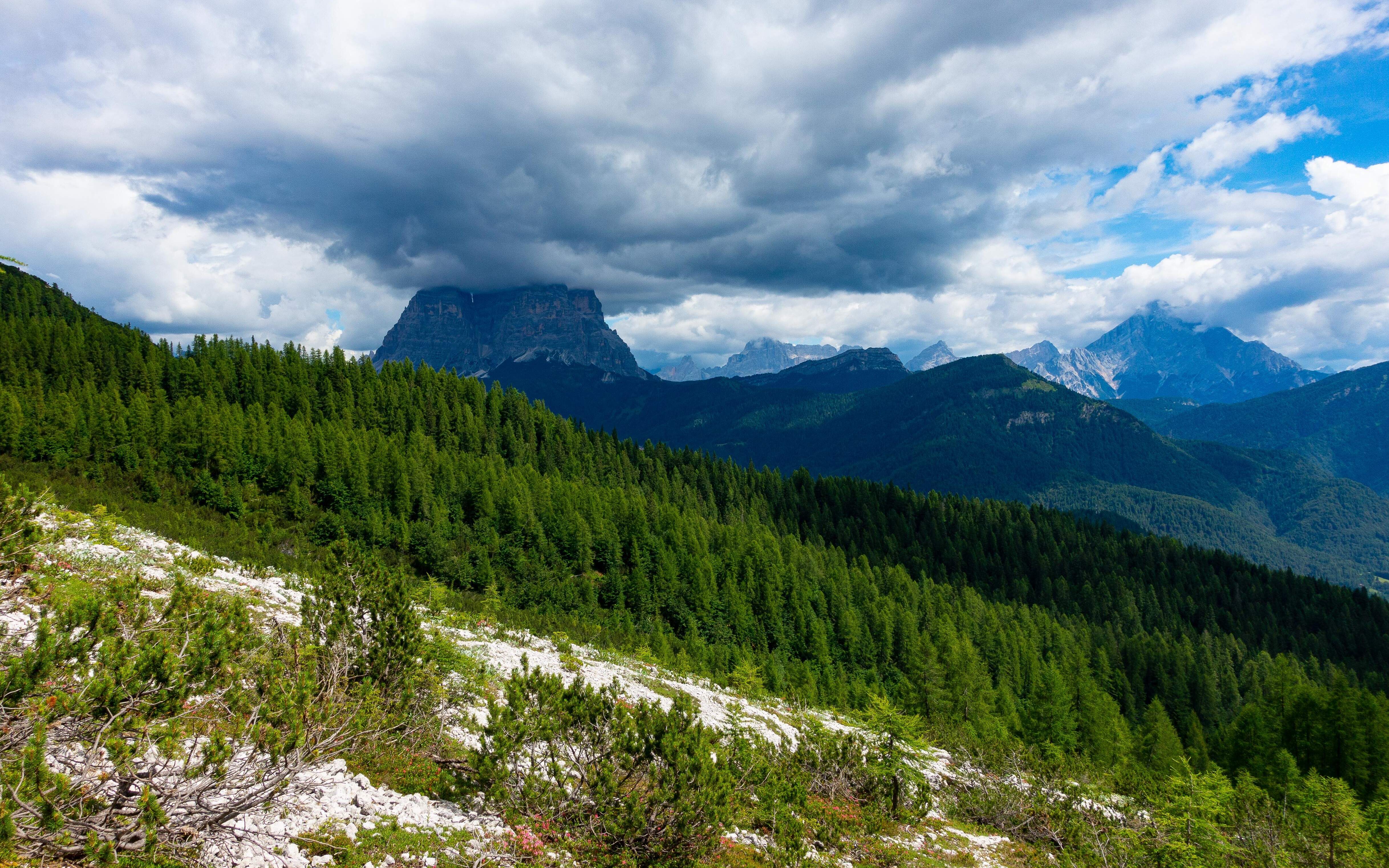
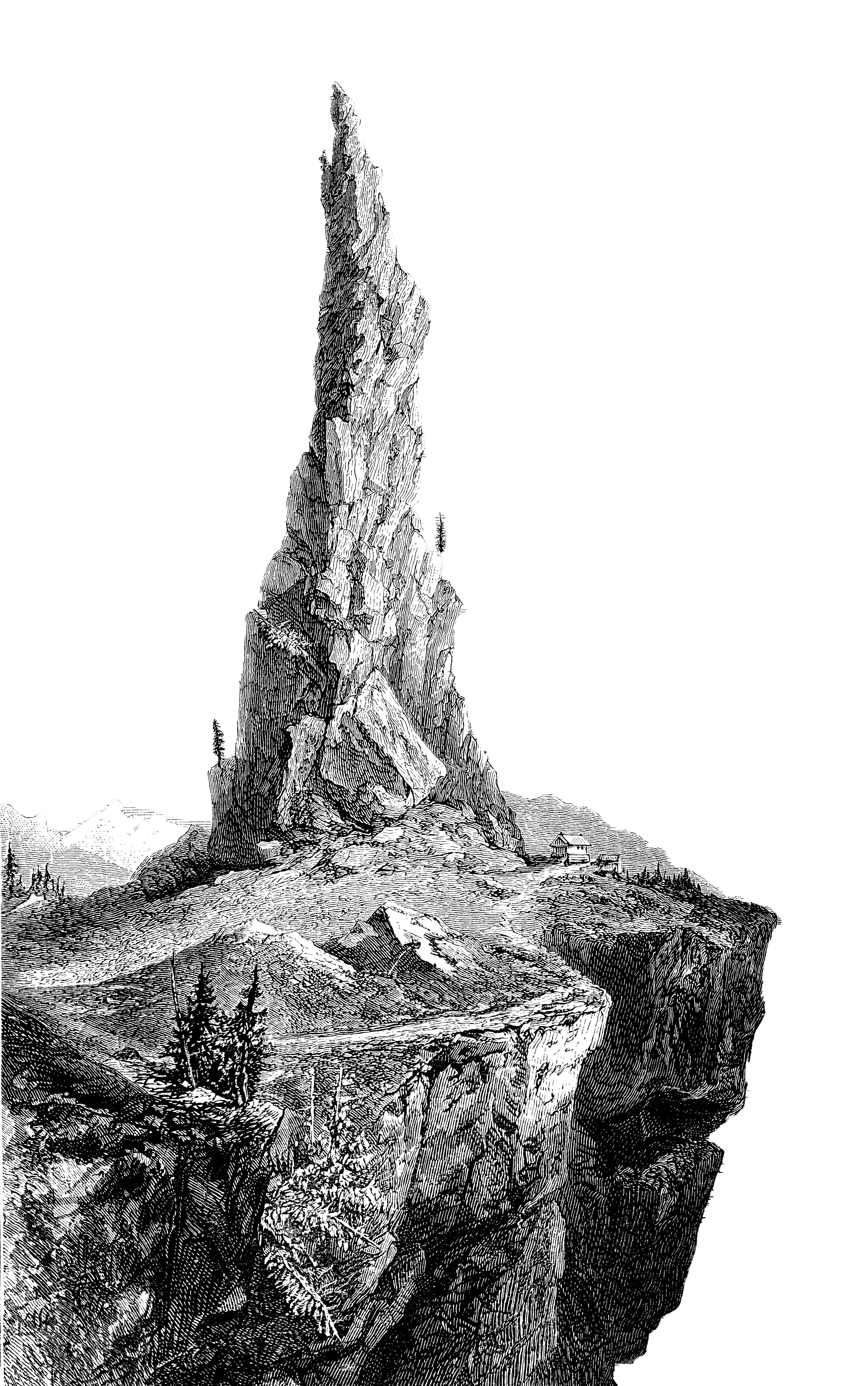
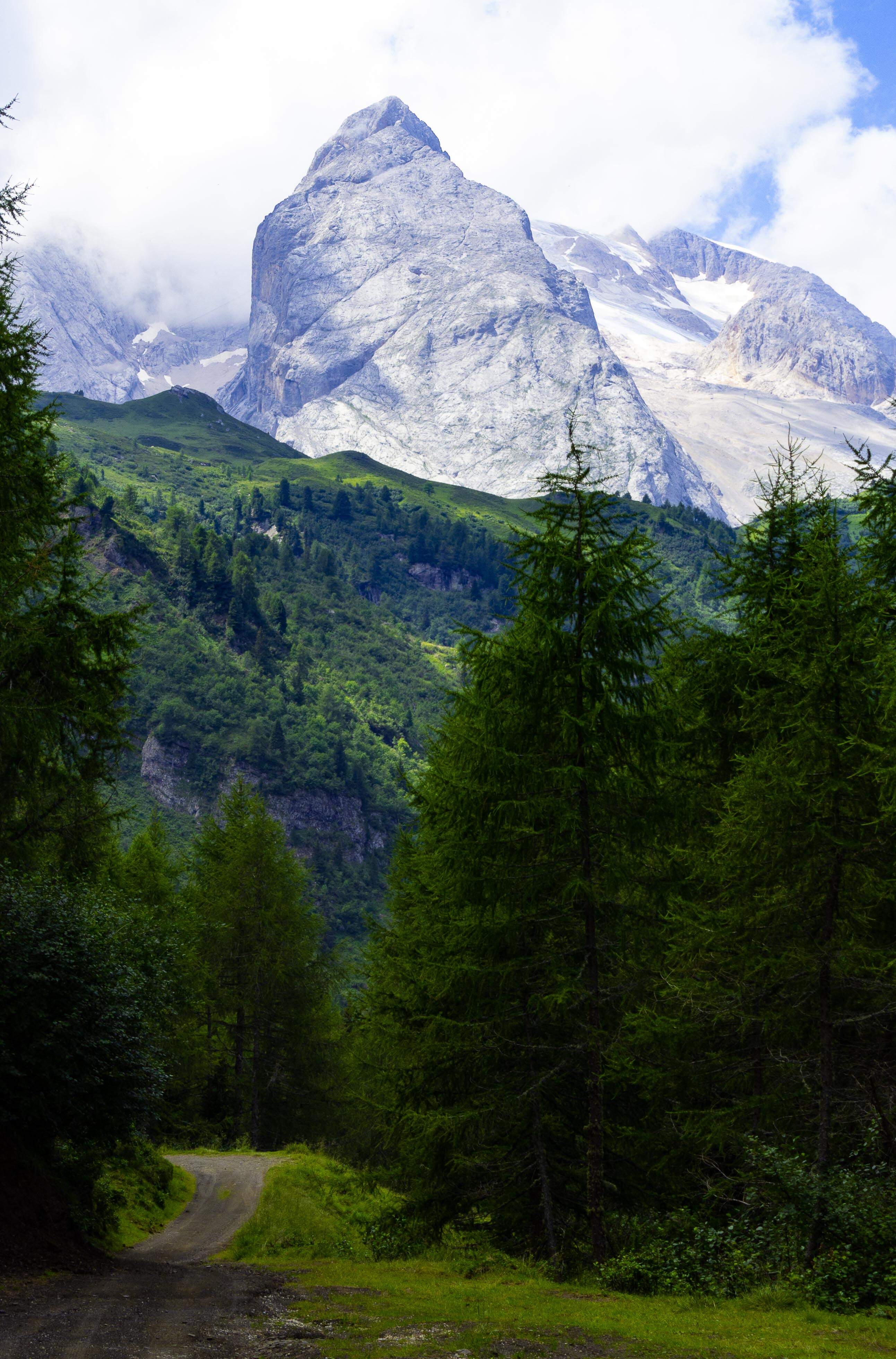
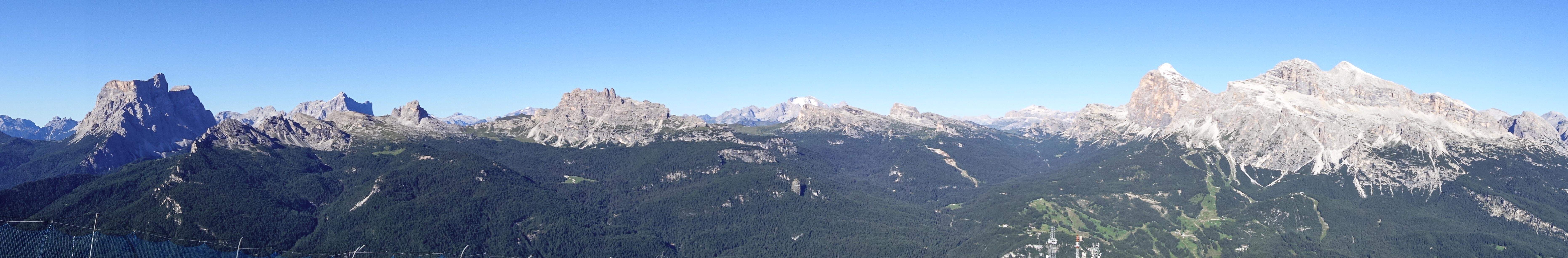
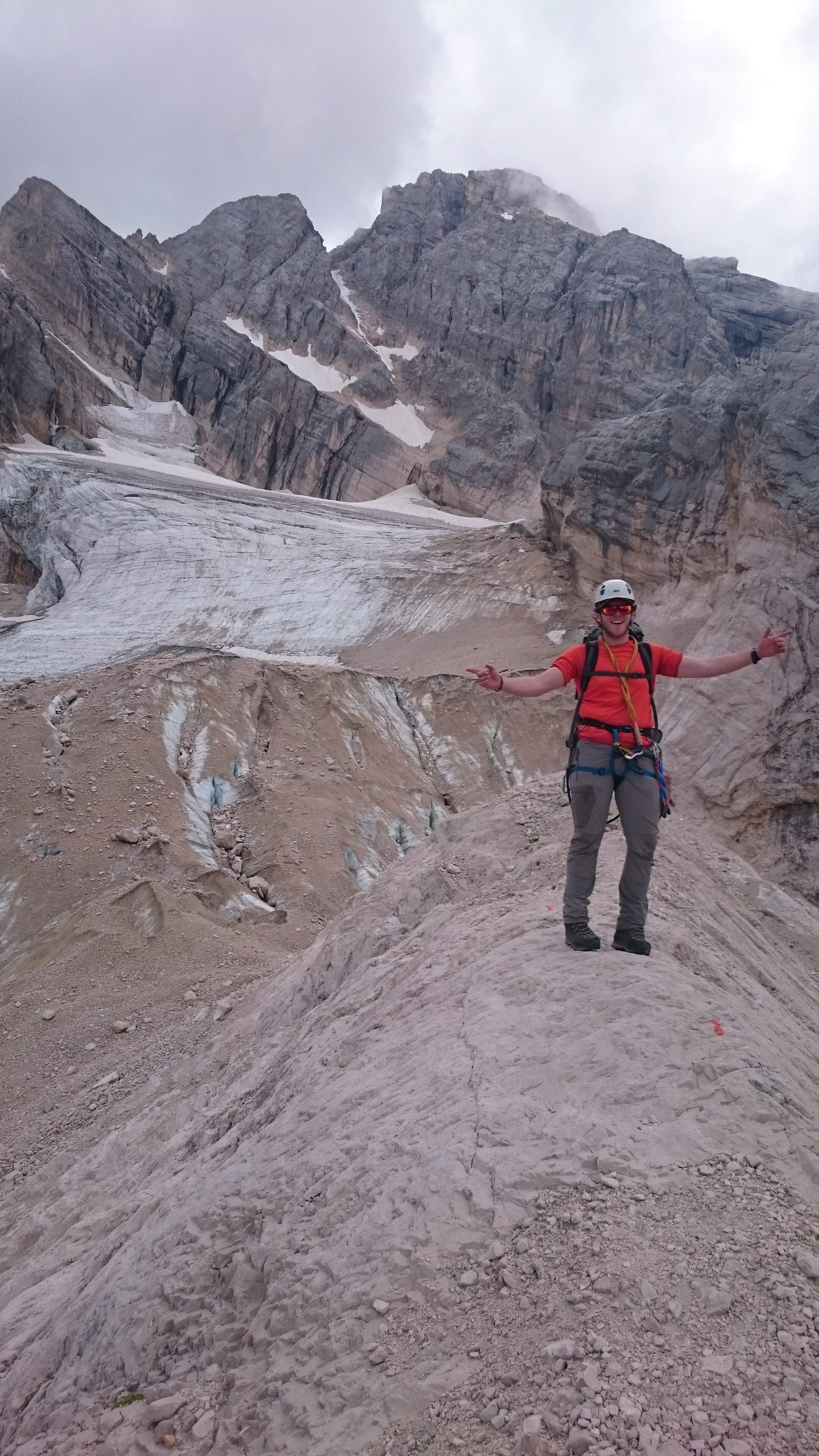
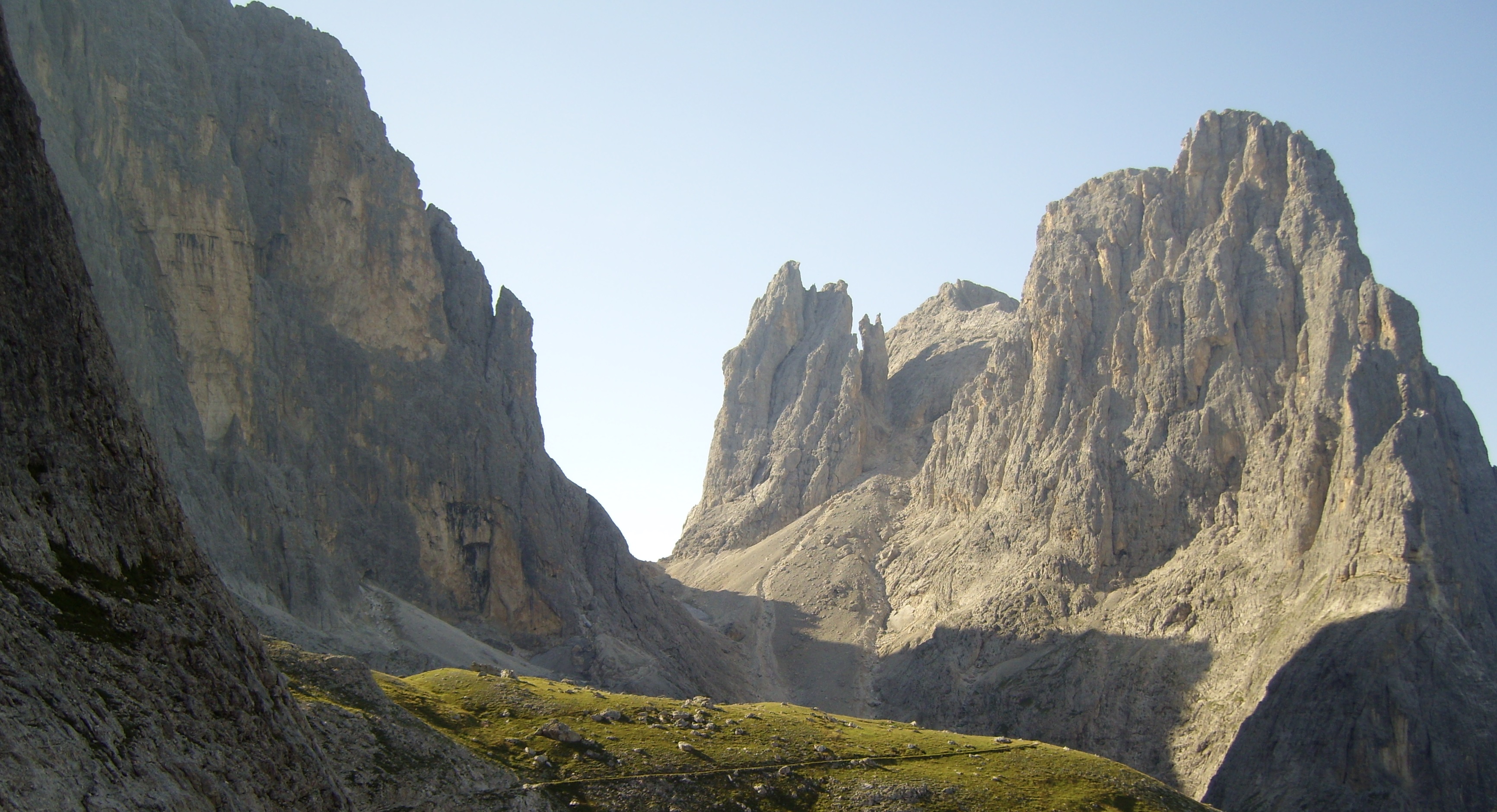
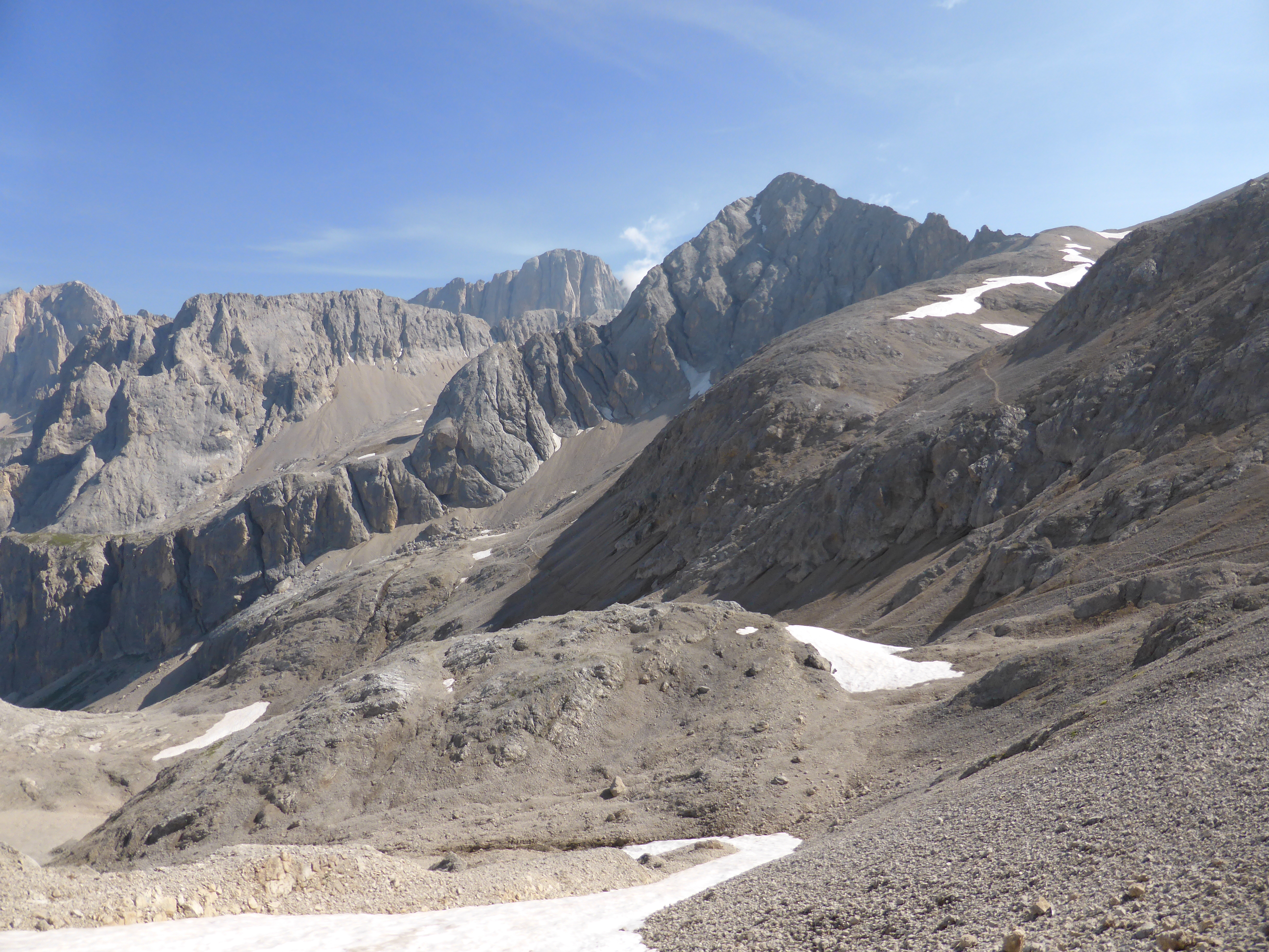
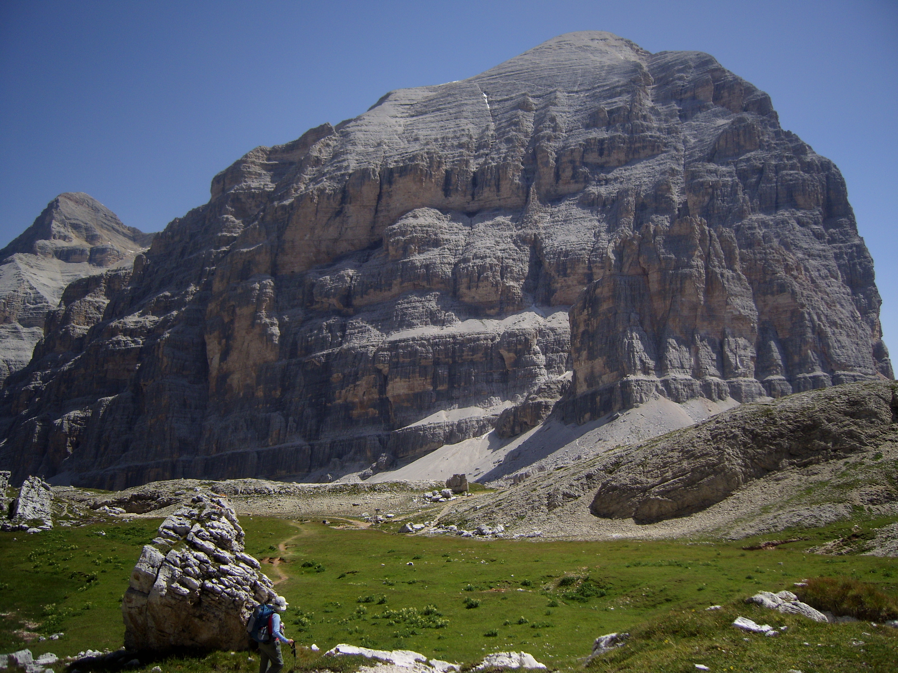
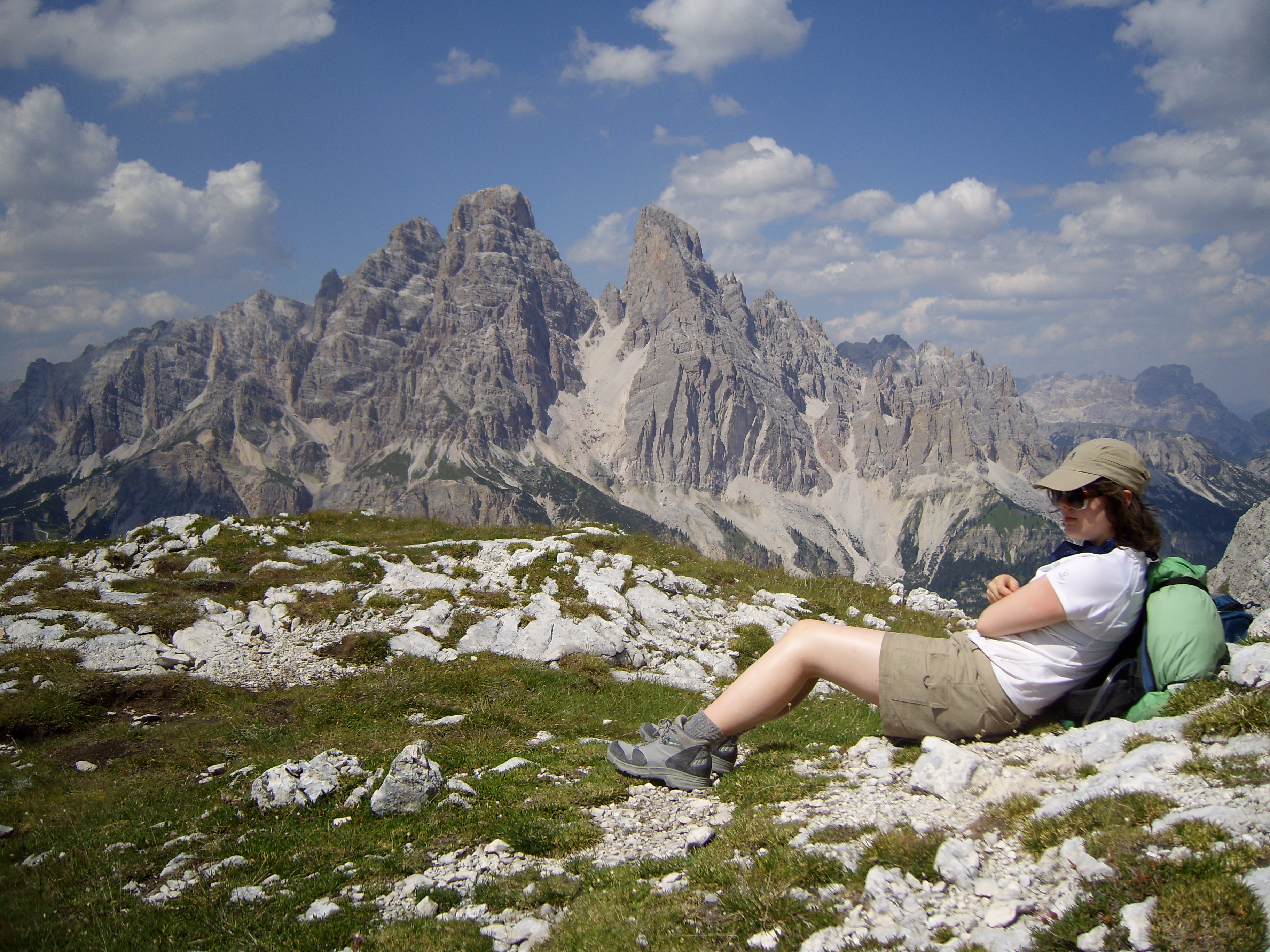
Ho preso una pausa alla Baita Segantini per fare qualche foto al Cimon della Pala, probabilmente la seconda immagine più iconica delle Dolomiti dopo le Tre Cime. Questa vetta spettacolare fu scalata per la prima volta da Whitwell, un amico di Amelia, qualche giorno prima ilsuo passaggio in questi luoghi nel 1872.

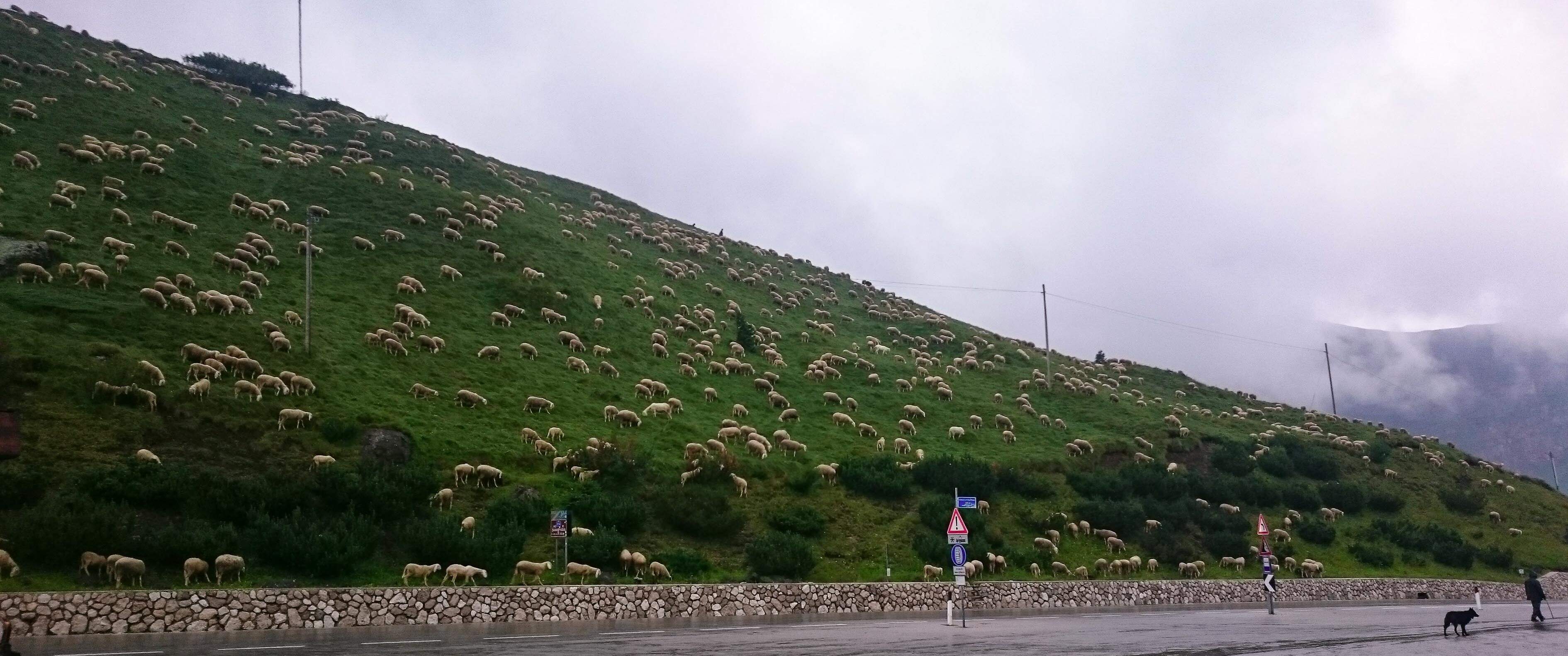
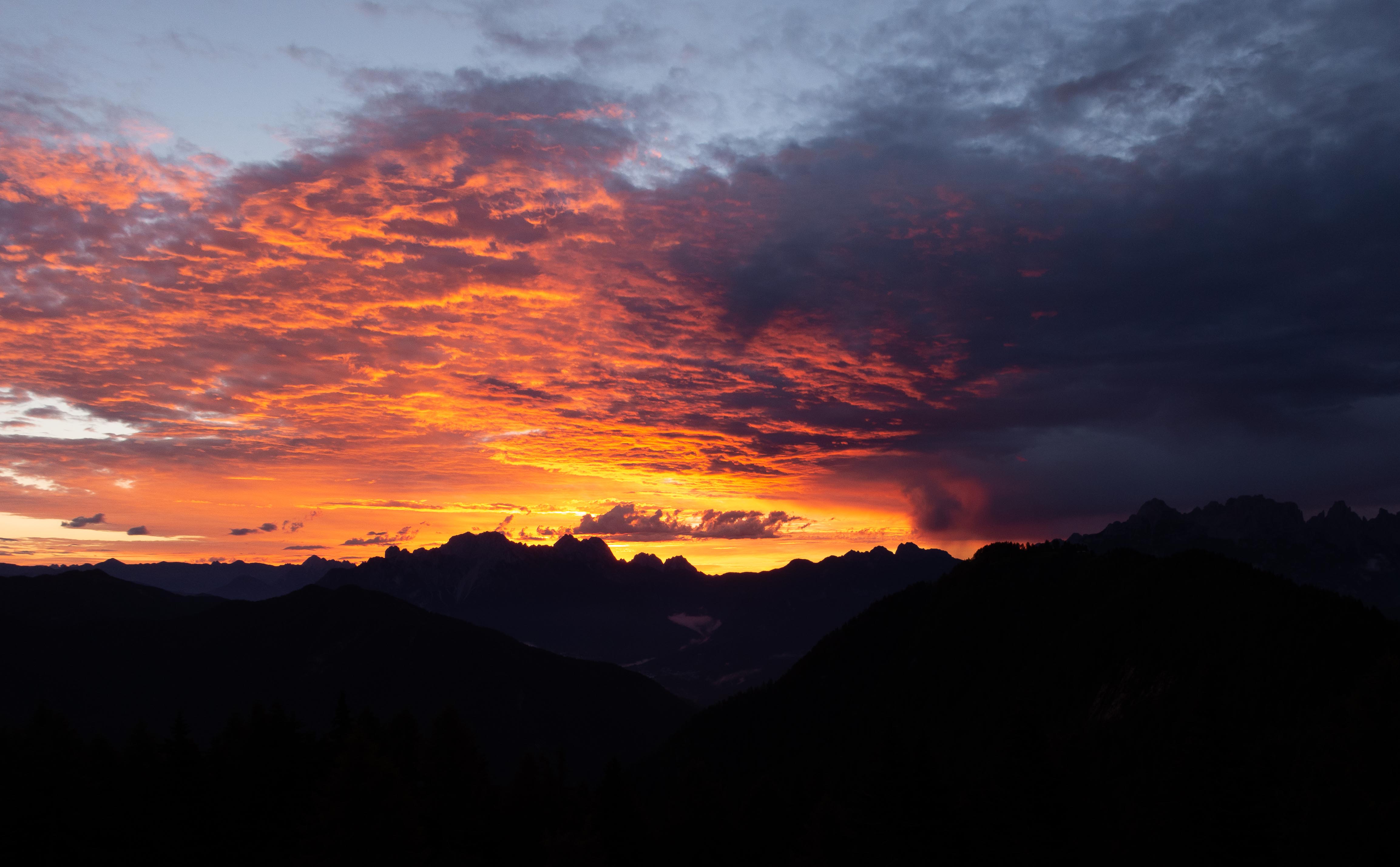
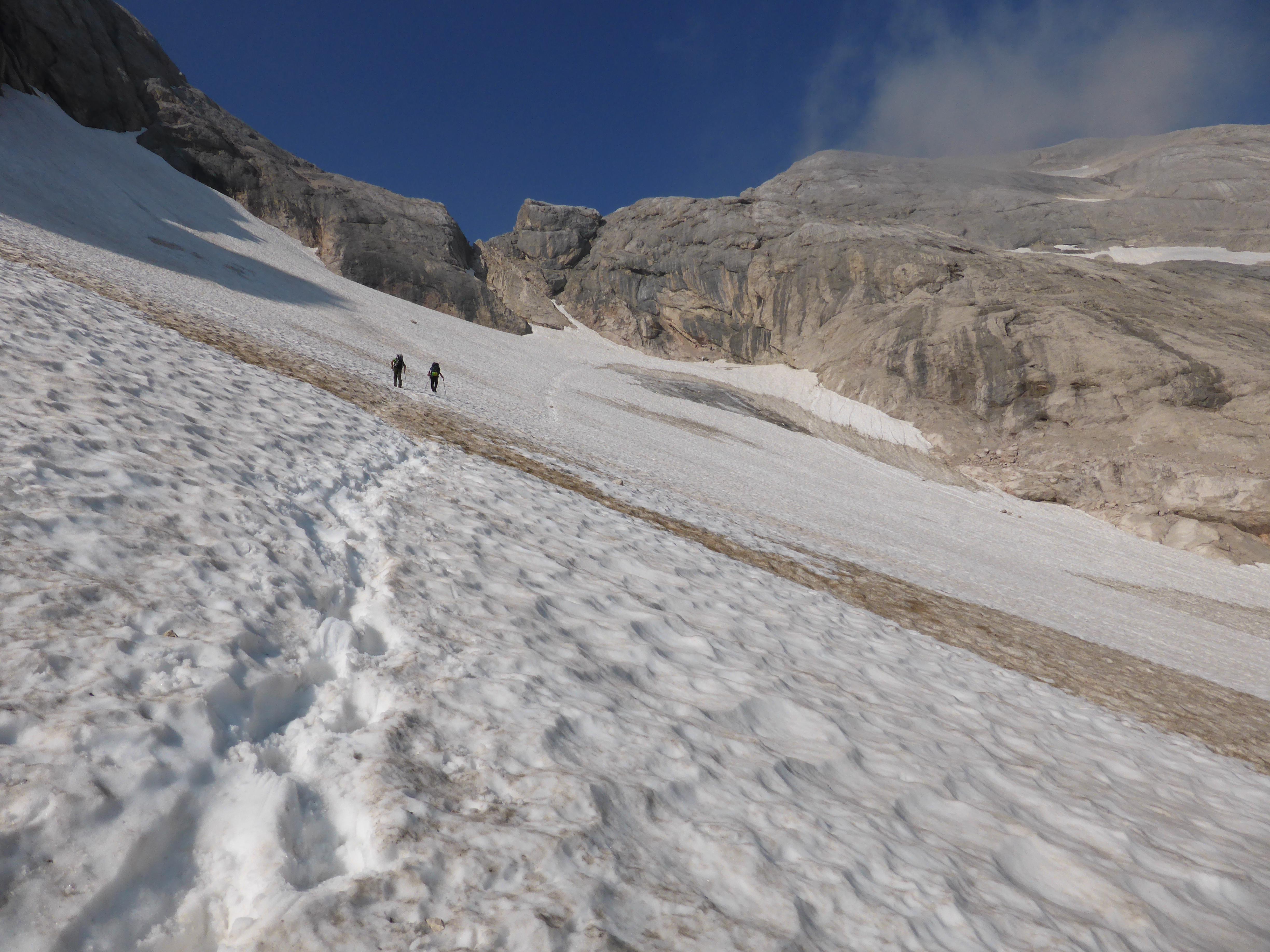
Giù fino a Val Venegia sotto il sole rovente di mezzogiorno e circondato dal suono dei campanacci di un gregge di mucche da latte che ruminavano accanitamente ogni filo d’erba. L’ultimo pezzo del sentiero 749 era di nuovo in salita verso Forcella Venegia a 2212m. Strada facendo ho incontrato anche due asinelli che si erano nascosti all’ombra. Dopodiché, discesa libera fino all’accogliente Rifugio Passo Valles con il suo enorme e bellissimo San Bernardo.

Cortina is famous for its squirrels and San Martino may be infamous for its ferrets. These lively and forceful creatures are renowned for their ability to squeeze into the smallest gap or tiniest crack in anything. On the way up from San Martino yesterday I came across six 50-year-old Furreti Alamanni, a notoriously arrogant species, overloaded with testosterone.

Rifugio Rosetta was busy when I arrived out of the thunderstorm, so I got in line at the counter waiting to be served. Next thing the Furreti Alamanni arrived and pushed in at the front of the queue so they could grab the best seats in the rifugio. Normally I'd let it go but this was the third time I'd been queue-bumped by them on the way up. So I said to the biggest and bossiest brute, in my least confrontational tone which I reserve for such situations, "What's the rush pal, is there a fire or something?"

Apparently his impressive linguistic repertoire didn't include Scouse. He looked sternly at me and spluttered something that sounded like, "Nick's not staying" - I'll need to get Jürgen Klopp to decipher this for me when I get back to Liverpool. So I just smiled and said "What a Walter" while I got on with patiently waiting my turn.

When I eventually checked in, the kind Rifugio lady wisely to put me in a different room than the ferrets in case it turned into another repeat of Monty Python. Fortunately peace ruled while I tried to boost my testosterone with a sausage and sauerkraut supper.

This morning I slipped out quietly while the ferrets were still faffing round collecting their towels off the sinks in the washroom.

My route took me down the very steep path 701 to Col Verde. Part way down I saw a family of goats sitting on a ledge in the early morning sun. I approached them slowly, not wanting to scare them before I had the chance to take a photo. They calmly watched me come down and I soon saw that big Billy goat had 60cm horns which he was waving around nonchalantly. I got my pictures and passed them gently so I wouldn't scare them. Next thing I felt a bump on my bum and looked round to see baby Billy was following me and butting my butt, clearly after something I couldn't provide. I shot off quickly before big daddy decided I was some sort of goat paedophile and came after me.

Across Crode Rosse I passed through some wild ponies grazing quietly in the shade. All the way I kept spotting marmots scattering out of the way as I approached.

I stopped for a break at Baita Segantini to take a picture of Cimon della Pala, probably the next most iconic view of the Dolomites after the Tre Cime. This spectacular peak was first climbed by Whitwell, a friend of Amelia's, a few days before she passed by in 1872.

Down into Val Venegia in the scorching midday sun and through a herd of bell-clanging dairy cattle fiercely munching every possible blade of grass. The last stretch on path 749 went uphill again to Forcella Venegia at 2212m. On the way I came across two friendly donkeys hiding in the shade. Then it was downhill to the welcoming Rifugio Passo Valles with its beautiful huge St. Bernard dog.


TAPPA / STAGE 15, Rifugio Passo Valles—Rifugio Passo delle Selle (Bergvagabundenhütte): Cammina ancora / Walk on, walk on, 12 luglio/July

Lunga 10 km, la cresta di cime e vette che va da Monte Palmina al nord fino a Cimon della Pala al sud ( tutte sopra i duemila metri e tre che superano i tremila), è spettacolare vista da qualsiasi punto. Il primo sguardo l'ho avuto mentre attraversavo l’Altipiano delle Pale all’est e poi ancora ieri da Passo Costazzo nella parte ovest. Nella foto, scattata ieri dal versante superiore di Val Venegia vicino a La Manda, si possono vedere meno della metà delle vette: da Cima del Focobon a sinistra a Cimon della Pala a destra.

Ieri sera a Rifugio Passo Valles, Fabio, quarta generazione della famiglia Cemin che da decenni offre eccezionale cura e comfort ai viaggiatori, mi ha mostrato un libro sulla storia di queste montagne scritto da Bepi Pellegrinon.  Mi sono lasciato incantare dalle mappe e dalle immagini di persone e di luoghi di un’altra epoca. Torniamo al presente e a una cena superba a base di specialità locali: salmerino alpino affumicato, pescato dal Lago Paneveggio, burro di produzione della Malga Rolle proveniente dalla stessa mandria di mucche che ho incontrato ieri e il formaggio più buono che abbia assaggiato nella mia vita.

Stamattina Fabio mi ha informato della costruzione di una nuova pista da sci che attraversa il sentiero 658. Le possibili deviazioni erano due: in salita verso Col Margherita oppure in discesa verso Lago di Cavia. Questa scelta era da vagliare meglio più avanti. Stavo procedendo bene sul sentiero 658 verso Forcella Pradazzo a 2200m quando è scoppiato un temporale con un gran boato. Visto che la gradine rimbalzava 50 cm da terra ho deciso di optare per la seconda scelta datami – giù verso il lago. Mentre camminavo contavo i secondi tra lampi e tuoni, 4 secondi…poi 2 secondi …poi 1 secondo, un botto enorme. Assordante. Noi del Kop (coro della curva del Liverpool) sappiamo come gestire situazioni simili e ho alzato la testa richiamando preziosi ricordi di quando, affianco a papà, ondeggiando nella folla, cantavamo a squarciagola l’inno del Liverpool (vedi sotto) in tante occasioni gloriose. Durante tutto ciò dovevo prestare la massima attenzione a dove poggiare i piedi per non scivolare sulla superficie rocciosa del sentiero, lisciata dal passaggio di tanti stivali in oltre cent’anni. La tempesta è durata due ore e mezza; quando finalmente ho raggiunto il Passo San Pellegrino, le nuvole temporalesche si sono disperse un po’. 

L’inno del Liverpool “You’ll never walk alone”

Quando cammini in mezzo alla tempesta, tieni alta la testa e non aver paura del buio,
Dopo la tempesta ci sarà un cielo d’oro, e il dolce canto argentato dell’allodola.
Cammina contro il vento, cammina contro la pioggia, Anche se i tuoi sogni sono spazzati via.
Cammina ancora, cammina ancora, con il cuore pieno di speranze, e mai da solo camminerai.

Esattamente 100 anni fa le prime linee austriache e italiane erano schierate l'una contro l'altra lungo la stessa cresta, quella di Costabella, che dà sul Passo S. Pellegrino. Si possono tuttora trovare relitti arrugginiti della guerra del 1915-1918 su queste vette. Nel luglio del 2015 in un burrone del Sasso di Costabella è stato ritrovato lo scheletro di un soldato italiano, un tragico promemoria dell'inutile costo sostenuto e della sofferenza patita da così tanti uomini.

Rifugio Passo delle Selle è in una location fantastica che sovrasta un altopiano verdeggiante e regala una vista mozzafiato sulle tutte le vette circostanti. Oggi Jasmine si è unita a me per la seconda parte della 15esima tappa, da Passo San Pellegrino a Passo delle Selle a 2528m.

The 10km ridge of peaks and pinnacles, all over 2000m and five over 3000m, from Monte Palmina at the north end to Cimon della Pala at its southern extremity, is equally awesome when viewed from every direction.  I first saw the range as I crossed the Altipiano delle Pale to the east and again yesterday from Passo Costazzo on the west side.  The picture, taken yesterday from the upper slopes of Val Venegia near La Manda, shows less than half the peaks, from Cima del Focobon on the left to Cimon della Pala on the right.

Last night at Rifugio Passo Valles, Fabio - fourth generation of the Cemin family providing exceptional care and comfort to travellers for decades - showed me a fascinating book about the history of these mountains written by Bepi Pellegrinon. I was engrossed by the maps and pictures of people and places from another era. Back to modern times for an outstanding dinner of local specialities - smoked char from Lago di Paneveggio; butter produced by Malga Rolle from the same dairy herd I had walked through earlier and the best cheese I've tasted for years.

This morning Fabio gave me a heads-up about the construction of a new ski run across path 658 which is where I was heading.  My options were to divert up to the top of Col Margherita or down to Lago di Cavia.  I left my decision until I got there. I was going well on 658 up to Forcella di Pradazzo at 2220m when a storm broke with a bang.  Hailstones were hopping 50cm off the ground so I decided on the lower option down to the lake.  I was counting seconds between the flashes and bangs, 4 seconds... 2 seconds... 1 second... then wallop!  The noise was deafening. Us Koppites know how to handle such things, so I kept my head up high and recalled those precious memories of swaying in the crowd, standing next to my dad, singing our hearts out with Liverpool's roaring anthem on so many glorious occasions.  All the while taking care where I put my feet in case I slipped on the rocky track polished by many boots for over 100 years. The storm continued for two and a half hours until I eventually reached Passo S. Pellegrino and the storm clouds cleared for a while.

Exactly 100 years ago the front lines between Italian and Austrian armies were strung along the Costabella ridge, looking down on Passo S. Pellegrino. Rusting relics from the 1915-1918 war lie scattered around these peaks. In July 2015 the skeleton of an Italian soldier was discovered in a gully nearby, a tragic reminder of the futile cost and suffering endured by so many. Rifugio Passo delle Selle is in a superb location on the ridge with amazing views of all surrounding peaks. Today Jasmine joined me for the second half of stage 15, up from Passo S. Pellegrino to Passo delle Selle at 2528m.


TAPPA / STAGE 16, Rifugio Passo delle Selle (Bergvagabundenhütte)—Rifugio Passo S. Nicolò: Partenza sbagliata / False start, 19 luglio/July

Floriano Zac del Rifugio Passo delle Selle ci ha preparato una favolosa prima colazione per iniziare la nostra giornata. Ci siamo messi in cammino sul percorso 640 in direzione del sentiero Gino Badia su un ottima mulattiera che attraversava un vasto ghiaione. Il sentiero era così piacevole che ci ha ingannato e abbiamo perso una brusca volta a destra in salita lungo la ripida parete rocciosa. Invece, abbiamo proseguito sul ghiaione e siamo finiti ai piedi di un canale ripido e stretto dell’aspetto molto brutto. Non m’ispirava per niente e quindi ho cercato una soluzione più morbida e ho trovato delle tracce che salivano il crinale sulla sinistra. L'abbiamo risalito finché non è diventato talmente ripido e precario che mi ha fatto venire dei ripensamenti. Non vedevo nessuna segnalazione di sentiero e nessun tumulo – cattive notizie.

Ho lasciato Jasmine aggrappata a una margherita mentre fiutavo il miglior modo per avanzare e ho constatato che era ora di retrocedere. Raggiunto il canale ripido e stretto che continuava a non piacermi - e meno male - mi sono spinto indietro sul ghiaione fino a vedere la segnalazione del sentiero sulla parete che saliva un canale molto più largo che avevamo passato prima senza guardarci alle spalle. In tutto abbiamo perso un’ora di tempo e molta energia preziosa.

Tornati di nuovo sul sentiero, siamo saliti fino a una gola molto stretta tra due pareti verticali e questo era il passo. Una sezione di sentiero attrezzato recentemente ricablato ci ha portati sani e salvi giù per il versante scosceso della montagna fino ad una valle deserta e isolata. Seguendo un sentiero ben segnalato attorno ad una cresta erbosa a livello ci siamo ritrovati a Sella Palacio, dove abbiamo trovato una combriccola che festeggiava con un picnic. Visto che non eravamo stati invitati, abbiamo proseguito giù per il sentiero ripido che ci ha condotto alla bellissima Val di San Nicolò. Un tardo pranzo alla Baita Cascada, di fianco ad una magnifica cascata, per poi impegnarci nelle ultime due ore di sgobbata in salita per raggiungere Rifugio Passo San Nicolò.

Floriano Zac gave us a fabulous breakfast to get us going from Passo delle Selle. We set off on 640 heading for Sentiero Gino Badia along a good path that cut across a wide scree slope. The path was so good it mislead us and we missed a sharp turn upwards against a steep rock wall. Instead, we continued across the scree and ended up at the foot of a steep, narrow & nasty-looking gully. Not fancying that much, I looked around for a softer option and found some tracks up the ridge on the left of the gully. Up we went until it got so steep and precarious that I had second thoughts. I couldn't see any path markers or cairns - definitely bad news.

I left Jasmine clinging to a daisy while I sniffed out the best way forward and eventually confirmed it was in reverse. We managed this OK down to the mean, nasty-looking gully and I still didn't fancy it. Good job, because it forced me further back across the scree until we spotted the path markers on the wall that ran up a much wider gully we had passed without looking behind us. Overall we wasted an hour and lots of precious energy.

Back on track we shot up to a very narrow gap between two vertical walls, which was the pass. A new cabled section took us safely and securely down the steep and loose slope into a deserted and lonely valley. The well-marked track brought us round to a grassy ridge and a level path to Sella Palacio where we found a picnic party. We weren't invited so we pushed on down the steep path into the beautiful Val Di San Nicolò.

Late lunch at Baita Cascada, next to a beautiful waterfall, then a final two-hour slog up to Rifugio Passo San Nicolò.


TAPPA / STAGE 17, Rifugio Passo S. Nicolò—Rifugio O. Falier: Spettatori della Regina / Queen's sudience, 20 luglio/July

Oggi abbiamo baciato la soleggiata facciata sud del Marmolada, la Regina delle Dolomiti, e mi sono sentito un nano in confronto a questa parete verticale alta 1000m e lunga 3km.

Ieri sera al S. Nicolò un gruppetto di ragazzi, di qualche oratorio dell’hinterland Milanese, ha messo in piedi il gioco di carte più rumoroso mai inventato ma fortunatamente la pace fu ristabilita alle 22:30.

Dopo colazione abbiamo perso circa 300mt di quota seguendo il sentiero 606 verso il Rifugio Contrin dove siamo arrivati troppo presto per pranzare e ne abbiamo approfittato per fare una seconda colazione. Tutti erano intenti a decorare le ringhiere con bandiere italiane in occasione del ritrovo annuale delle guardie forestali, accompagnati dalla musica della banda.

Riposati e rifocillati, ci incamminammo sulla 610 per la scalata di 700mt verso il Passo Ombretta. Sapevamo sarebbe stata calda e stancante e quindi abbiamo proceduto con passo lento e sostenuto, sicuri e implacabili, finchè ci siamo fermati per pranzo in una selvaggia, deserta, pendente valle appena sotto al passo… che picnic!

L’ultima parte della salita si snodava su un'intrusione vulcanica di roccia nera simile alla pece che spiccava in contrasto alla roccia dolomitica rosa circostante fino al raggiungimento del ventoso Passo Ombretta, con la sua croce di filo spinato ancora presente ai 2700mt, nel punto più alto di questo anello.

Da qui in poi è tutta discesa fino a Caprile, quindi ci siamo rimessi in viaggio con un sorriso lungo un buon sentiero e aiutati dalla gravità abbiamo disceso il ghiaione nell’alta Val Ombretta. Sopra alle nostre teste, molto più in alto, si vedeva la parte più alta della funivia di Punta Rocca a 3250m mentre zig-zaggavamo in un campo di massi e macigni che fornisce bivacchi naturali per gli arrampicatori più seri.

Il Rifugio Falier è in un posto stupendo tra la Valon de Ombretola e l’alta Val Ombretta con viste mozzafiato – anche sul Sasso Bianco, scalato per la prima volta da Amelia!

Today we kissed the sunny south face of Marmolada, the Queen of the Dolomites and felt dwarfed by this 1000m high, vertical rock wall which runs for 3km in length.

Last night at S. Nicolo a gang of teenagers, on a church outing from Milano, played the noisiest card game ever invented but fortunately peace was declared at10.30

After breakfast we dropped 300m altitude on path 606 to Rifugio Contrin where it was too early for lunch so we enjoyed our second breakfast.  They were busy putting the flags out for the annual Forestry Police get-together with a piped umpah band.

Well-rested and refuelled, we hit 610 for the long 700m climb up to Passo Ombretta.  We knew this would be hot and tiring so we kept a slow, steady plod, safe but relentless, until we stopped for lunch in a wild, deserted, hanging valley, just below the pass - what a picnic!

The last stretch crossed a volcanic intrusion of black, cinder-like rock that contrasted sharply with the surrounding pink Dolomite, until we reached the windy Passo Ombretta, with its rusty barbed-wire cross at 2700m, the high-point of the loop.

It's all downhill from here to Caprile so we set off with a skip and a smile along a good footpath and gravity-assisted as we slid down the scree into the high Val Ombretta.  High above our heads we could see the top cable car station on Punta Rocca at 3250m while we zig-zagged our way down through a boulder field providing natural bivouacs for serious rock climbers.

Rifugio Falier is in a great location at the junction of Valon de Ombretola and upper Val Ombretta with views to die for - including Sasso Bianco, first climbed by Amelia!


TAPPA / STAGE 18, Rifugio O. Falier—Caprile: Secondo anello / Second loop, 21 luglio/July

Rifugio Falier era originariamente un accampamento militare della Prima Guerra Mondiale e questa mattina abbiamo iniziato la nostra giornata su una mulattiera utilizzata per il trasporto dell'approvvigionamento e ho trovato difficile immaginare la guerra e la morte in questi paesaggi così sereni e stupendi.

L'agriturismo di Malga Ciapela, che abbiamo attraversato strada facendo, fa dei formaggi pluripremiati, quindi Jasmine ha fatto scorta per il viaggio mentre sorseggiavamo un cappuccino.

La strada originariamente passava attraverso i Serrai di Sottoguda, ed è la stessa che seguí Amelia, ma da anni chiusa al traffico e aperta ai visitatori; spendere 2 euro per discenderla ne è valsa largamente la pena. Amelia descrive questa gola nei minimi dettagli ed è facile riconoscere tutt'ora il suo racconto. Le pareti verticali alte 100m sono così vicine che in alcuni punti è praticamente possibile toccarle entrambe contemporaneamente.

Terminati i Serrai abbiamo attraversato la deliziosa cittadina di Sottoguda dove sono ancora presenti le costruzioni originali e le sue strette stradine. È facile immaginare Amelia che cammina sui nostri stessi passi.

Alla fine abbiamo raggiunto la parte alta del Sentiero Naturalistico che collega Sottoguda a Masaré, vicino ad Alleghe. Ho iniziato il secondo anello seguendo questo sentiero da Caprile a Masaré, quindi è stato molto piacevole completare l'anello terminando questo stesso bellissimo percorso fino a Caprile.

Rifugio Falier was originally a military HQ during World War I and today we left on the historic army supply trail finding it hard to imagine war and death among such peaceful and beautiful natural surroundings.

The farm Malga Ciapela makes award-winning cheeses so Jasmine stocked up for our journey while we supped our cappuccini.

The original track through the Sottoguda gorge, which Amelia followed, is now closed to traffic but open to visitors and is well worth the 2 euro entry fee.  Amelia describes the gorge in detail and it's easy to recognise her account today. The 100m high vertical walls are so close together it's almost possible to touch both sides in places.

At the end of the gorge we passed through the delightful Sottoguda village where the original buildings and narrow streets have been preserved. It's easy to imagine Amelia walking through the same street.

Finally we reached the upper end of the Sentiero Naturalistico which runs from Sottoguda to Masare, near Alleghe.  I started the second loop along this trail from Caprile to Masare so it was good to complete the loop, using the same beautiful trail, all the way down to Caprile.


TAPPA / STAGE 19, Caprile—Rifugio Sasso Bianco: Sasso Bianco, 23 luglio/July

Amelia compì quella che è la prima ascesa documentata del Sasso Bianco con la sua guida Clemente Callegari di Caprile. Clemente probabilmente era già salito da quelle parti ma Amelia fu la prima straniera a raggiungerne la vetta a 2407m. Non è una delle vette più importanti ma è abbastanza impegnativa dato che Caprile sta a 1400m. Come il famoso commento di Ginger Rogers su Fred Astaire quando gli veniva chiesto se era un bravo ballerino - "Mi sarebbe piaciuto vederlo facendolo all’indietro e con i tacchi alti” – pensavo ad Amelia mentre faceva questa risalita a dorso di mulo con un abito lungo fino alle caviglie. E al resto, visto che la mulattiera finisce ben prima della cima.

Il temporale di ieri sera ha restituito una giornata grigia e umida ma il sentiero era buono e facevo lenti progressi. A circa metà strada mi sono fermato a fare una foto delle capanne di tronchi in un micro villaggio chiamato Giardogn e fu in quel momento che fui attaccato da uno squadrone di zanzare. Colpivano ogni centimetro di pelle esposta nello stesso momento e non sapevo più quale parte fosse opportuna schiaffeggiarmi per prima. L’unica cosa da fare era muoversi il più in fretta possibile. Anche facendolo, mi sono ugualmente ritrovato la testa piena di bernoccoli.

Terminata la foresta, ho attraversato l’alpe allo scendere delle prime gocce d’acqua quindi la vista dalla cima era limitata al tumulo e alla targa sulla vetta. Nonostante questo, mi sentivo appagato come la volta in cui ho scalato la Marmolada nel 1979.

La discesa verso il rifugio è stata fangosa e bagnata ma ho conosciuto delle bellissime persone: Michele, Luciana, Giorgia, Germano e Berta il cane - che si è preso attentamente cura di me.  Ancora una volta ho goduto della compagnia delle persone più gentili che si possano incontrare.

Amelia made the first recorded ascent of Sasso Bianco with her guide Clemente Callegari from Caprile. Clemente had probably been up there before but Amelia was the first foreigner to reach the summit at 2407m. It's not a major peak but it's a tough climb up 1400m from Caprile. Like Ginger Rogers' famous remark about Fred Astaire when asked if he was a good dancer - "I'd like to have seen him do it going backwards in high heels" - I thought of Amelia doing this climb sitting side-saddle on a mule wearing a dress down to her ankles. The mule path ends well below the top.

It was a cloudy damp day after the thunderstorm last night but the path is good and I made steady progress. About halfway up I stopped to take a photo of the log cabins in a microvillage called Giardogn when I was attacked by a squadron of mosquitoes.  They hit every bit of exposed flesh at the same time and I didn't know where to slap first.  The only thing to do was to move as quickly as possible.  Even so I ended up with a lumpy head.

Out of the woods I crossed the alp as the rain started so my views from the top were restricted to the cairn and the summit plaque. Despite this, I still felt as good as I did when I climbed Marmolada in 1979.

My descent to the rifugio was wet and muddy but there I met the kindest people: Michele, Luciana, Giorgia, Germano and Berta the dog - who looked after me carefully.  Yet again I enjoyed the company of the most gracious people you could ever wish to meet.


TAPPA / STAGE 20, Rifugio Sasso Bianco—Rifugio Coldai: Deliziosa discesa / Delightful descent, 24 luglio/July

La frana che creò quello che è ora il Lago di Alleghe nel 1771 affogandone i dormienti abitanti a valle ha lasciato nella montagna una cicatrice rocciosa e selvaggia attraverso la frondosa e verdeggiante vallata addirittura creando una nuova cima chiamata Il Piz.  

Il percorso di oggi andava in salita fino al punto più alto della vallata per poi discendere a lato di questa scarpata lasciata dalla valanga. L’aria era ferma e tutto era silenzioso mentre seguivo il sentiero in discesa, immerso nei miei pensieri – percependo che la mia mente e il mio corpo erano in armonia spirituale con la montagna.

La prima delle tante delizie in questa discesa fu Malga Bur, una fattoria disabitata in alto su questa montagna, con pareti di pietra nel piano inferiore, dove si trovavano una cucina e una sala, e un loft di legno che fungeva da enorme camera. La cucina è provvista di una stufa a legna con carburante a sufficienza accanto e anche una sorgente di acqua fresca 100m più a valle.

La passeggiata in discesa attraverso la foresta che portava a Bramezza era indescrivibilmente stupenda, la cittadina era un insieme di vecchie case di pietra costruite su una piccola ma abbastanza alta piattaforma sul lago piatto e fermo, con viste strabilianti sul Monte Civetta.

Il piacere successivo era Saviner – più urbana con i numeri sulle case ma ugualmente stupenda. Da quel punto un sentiero ti porta giù fino a raggiungere un ponte tibetano traballante dove incontrai Jasmine e Fabio che mi attendevano per accompagnarmi verso il prosecco e la zuppa di orzo con cui abbiamo pranzato a Col dei Baldi.

Dopo di che mi sono rimesso sotto nell’affollato viaggio verso il Rifugio Coldai, incrociando le comitive del pranzo che tornavano a valle.

The landslide that created Lago Alleghe in 1771 and drowned the sleeping villagers left a savage, rocky scar through the green wooded valley side and formed a new peak called Il Piz.  

Today's route went uphill from the rifugio to the top of the valley side then down the edge of the escarpment left by the avalanche. The air was still and perfectly silent as I followed the slope down, deep in thought - feeling that my mind and body were in spiritual harmony with the mountain.

The first of many delights on this descent was Malga Bur, an uninhabited farmhouse high on the mountain, with stone walls on the ground floor containing a kitchen and living room and a wooden loft attic which works as a huge bedroom.  The kitchen has a wood burning stove with plenty of fuel around plus a fresh water supply 100m downhill.

The downhill path through the forest is undescribably beautiful leading to Bramezza, a tiny village of old stone houses built on a small plateau high above the still, smooth lake with eye-popping views across to Monte Civetta.

Next delight is Saviner - more urban with house numbers but still stunning. From there a footpath takes you down to the wobbly suspension bridge where Jasmine and Fabio were waiting to take me to a prosecco and orzo zuppa lunch at Col dei Baldi.  

Then it was back to business for the climb up to the busy Rifugio Coldai passing all the lunch parties on their way down.


TAPPA / STAGE 21, Rifugio Coldai—Rifugio San Sebastiano: Pranzo in paradiso / Lunch in paradise, 25 luglio/July

Un deretano all’aria con la testa immersa nel proprio zaino è uno degli ostacoli più difficili da superare in un rifugio affollato. Questa mattina al Coldai c’erano sederi ovunque: bloccavano ogni corridoio e ogni soglia. In qualche modo sono riuscito a destreggiarmi e a evitare collisioni senza offendere nessuno.

Quest’oggi ha unito la maestosità alla desolazione. Se la Marmolada è conosciuta come la Regina delle Dolomiti, Monte Pelmo ne è il Re, dominando la vista dal Rifugio Coldai. Pelmo fu la prima tra le cime più importanti a essere scalata nelle Dolomiti nel lontano 1857 dall’irlandese John Ball ed è solitamente riconosciuta come la nutrice dell’escursionismo della regione. Il notevole viaggio di Amelia fu soltanto 15 anni dopo.

Ero l’unico a viaggiare lungo il Sentiero Tivan, un percorso ad alta quota che attraversa il versante nord-est del Monte Civetta. È un bel sentiero roccioso su cui inerpicarsi che mi ha portato al limite della mia confort-zone su alcuni precipizi dai dirupi spaventosi.

Allo Schenel del Bech il sentiero si divide tra la Via Ferrata Alleghese - che va alla cima e che ho scalato nel 1980 con Steve Wells e Alfie Noakes - e la strada che ho preso quest’oggi, più facile, in direzione Forcella Grava e ho pranzato al Rifugio San Paradis, dove il cielo si è annuvolato iniziando a incupirsi.

In discesa fino alla solitaria Val della Grava dove ho raggiunto un ponte di legno che attraversava il fiume portandomi sul difficile sentiero 578 a Casara Moiazza. È sempre stretto - largo uno scarpone – e spesso ripido visto che sale di 300m attraverso cespugli di pino e rocce che affiorano da terra. È stato un cammino lento che richiedeva concentrazione per trovare dove mettere i piedi, schivando le radici esposte nascoste tra l’erba.

Dopo le rovine di Casara Moiazza il sentiero prosegue similarmente a quello di prima ma andando in discesa. Infine, il sentiero s’inoltra nel bosco e la discesa diventa molto più facile fino ad arrivare al rifugio.

A bum in the air with the head in a rucksack is one of the trickiest obstacles in a crowded rifugio. This morning at Coldai there were air bums everywhere - blocking corridors and every doorway. Somehow I managed to squeeze by without contact or offending anyone.

Today combined majesty and seclusion. While Marmolada is known as the Queen of the Dolomites, Monte Pelmo is the King, dominating the view from Rifugio Coldai.  Pelmo was the first major peak in the Dolomites to be climbed, in 1857, by the Irish man John Ball and is generally recognised as the birth of mountaineering in the region.  Amelia's remarkable journey was just 15 years later.

I was the only traveller on Sentiero Tivan, the high-level trail that crosses the north-eastern slopes of Civetta. It's a good, rock path with plenty of scrambling that took me to the edge of my comfort zone across precipices with scary drops below.

At Schenel del Bech the path splits with Via Ferrata Alleghese going to the summit which I climbed in 1980 with Steve Wells and Alfie Noakes.  Today I took the easiest way down to Forcella Grava and lunch at Rifugio Sun Paradis, where it clouded over and looked grim.

Down into the secluded Val della Grava I reached the wooden bridge over the river to the difficult path 578 to Casara Moiazza. It's always narrow - one bootwidth - and frequently very steep as it climbs 300m in altitude through pine bushes and rocky outcrops. It was slow going with total concentration on where to put your feet, avoiding exposed tree roots hidden in the grass.

After the ruins of Casara Moiazza the path continues much the same but now going downhill. Eventually the path drops to the treeline and the going is much easier through the forest to the rifugio.


TAPPA / STAGE 21, Rifugio San Sebastiano—Forno di Zoldo: Paradiso in Terra / Heaven on Earth, 26 luglio/July

Navigare in una folta foresta è quasi impossibile se le uniche cose che vedi attorno a te sono gli alberi. Sta tutto nel trovare il sentiero giusto augurandoti che la tua mappa sia affidabile perché lo sguardo non riesce a fare a meno di posarsi sulla bellezza selvaggia circostante. Il viaggio di oggi è stato prevalentemente per fitte foreste, entrandoci giusto 100m dopo il rifugio.

Inizialmente era un bel sentiero, e col passo spedito attraversavo le passerelle di legno rialzate che coprivano le parti più fangose. Ho raggiunto Col de le Buse in 1h 45mins continuando ad andare su e giù ma senza grandi ostacoli. Da quel punto è iniziata la salita che mi ha portato in quota fino a Forcella della Val dei Barànce.

Uscito dalla foresta, ho potuto ammirare le vette spettacolari che circondano la Val di Zoldo e potevo vedere il sentiero avanti a me che attraversava un largo corridoio che è il Van dei Gravinai, scendendo dalla vetta di San Sebastiano Nord e su per un ripido sentiero sul versante opposto. Si rivelò più facile del previsto con un po’ di arrampicata verso la cima.

Improvvisamente ho notato che sulla mia sinistra ero sull’orlo di un precipizio e la cosa mi ha fatto rabbrividire al punto che cercai qualcosa con cui aggrapparmi alla mia destra. La cosa migliore che ho trovato è stata un ciuffetto di erica che cresceva tra le crepe nella facciata di roccia, sicuramente non poteva reggere il mio peso ma è stata d’aiuto mentre cercavo di avanzare lentamente e con grande cautela.

Ancora una ripida scalata fino alla Baita Angelini – una piccola capanna con letti a castello di legno, un tavolo, la stufa e delle sedie – che si iniziava a intravedere attraverso una stretta valle con un ruscello spumeggiante che la percorreva. Il panorama da qui è incredibile e potevo giusto vedere una tempesta che avvolgeva il Pelmo dirigendosi minacciosa nella mia direzione.

Dopo una discesa ripida, il sentiero scende per un largo burrone con pareti di roccia verticali che ti portano nuovamente nella foresta nelle vicinanze del piccolo lago Al Vâch che al momento era circondato di persone che si rilassavano sulle panchine e sui tavoli da picnic presenti. Non volendo disturbarli, ho proseguito il mio cammino tra gli alberi su un gran sentiero fino a Colcervèr, una piccola comunità composta di case di pietra storiche e vecchi rustici una volta utilizzati per lo stoccaggio del fieno. Ho deciso di entrare nella piccola chiesa, costruita nel 1739, e sono rimasto a bocca aperta dalla semplice ma incredibile bellezza dell’altare, decorato da bellissimi fiori. Questo posto deve essere la cosa più vicina al paradiso sulla Terra.

Una piccola pausa per soffermarsi ad apprezzarla prima della breve discesa attraverso la foresta per arrivare in valle diretto al mio posto preferito dove alloggiare - Tana de 'l Ors a Forno di Zoldo.

Navigating in a thick forest is almost impossible when all you can see are tall trees everywhere. It's about finding the right path and hoping your map is reliable while you gaze at nature's wild beauty all around. Today's route was through deep forest for most of the way, going into the trees about 100m from the rifugio.

It was good going initially as I sped across raised duck boards which covered the muddy sections. Lots of ups and downs but no big obstacles for 1h45mins to Col de le Buse. Here it started uphill, eventually topping a ridge at Forcella della Val dei Barànce.

Out of the trees I gazed at the spectacular peaks that surround the Zoldo valley.  I could see the path ahead across a wide couloir Van dei Gravinai, running down from the peak of San Sebastiano Nord, and up a steep path on the opposite side.  This turned out easier than it looked with a bit of scrambling at the top.

Suddenly I noticed that I was right on the edge of a fearsome drop down to my left which made me shiver while I searched for something to cling onto on my right. The best I could find was some heather growing out of the cracks in the rock face, unlikely to hold my weight but it felt better as I moved ahead cautiously.

Still more steep climbing until Baita Angelini - a small hut with wooden bunks, a table, stove and some chairs - came into view across a narrow valley with a stream bubbling through. The views from here are incredible and I could see a storm breaking around Pelmo and heading my way.

After a steep descent the path runs through a wide gorge with vertical rock walls before turning into the forest again near the small lake Al Vâch which was surrounded by people dozing on benches and picnic tables. Not wishing to disturb them, I pushed on through the trees on a great footpath to Colcervèr, a small community of historic stone houses and old rustic barns used to store hay. Here I stepped into the tiny church, built in 1739, and gasped at the plain, astonishing beauty of the floral-decorated altar. This place must be the closest you'll get to heaven on earth.

Time to linger and appreciate before the short climb down through the forest to the floor of the valley and my favourite place to stay - Tana de 'l Ors in Forno di Zoldo.


TAPPA / STAGE 22, Forno di Zoldo—Rifugio Venezia: Linee posteriori / Back lines, 2 agosto/August

Nella 16esima tappa abbiamo attraversato le prime linee della Grande Guerra a Passo Selles, oggi ho visitato la linea arretrata italiana su Col de Salera e Monte Punta - l'ombelico di Zoldo.

Per difendere Passo Duran e Passo Staulanza, distanti oltre 5km, l’esercito scavò dei tunnel sotto la vetta di Col de Salera e costruirono dentro la montagna due piazzole per l’artiglieria pesante, una per coprire ciascun Passo. Oggi si può ancora accedere ai 170m di tunnel, ma tutto il resto è stato portato via.

Il sentiero per raggiungere Monte Punta parte con una scala di roccia dietro la fermata dell’autobus a Forno di Zoldo. La salita è lunga e stancante, ma il sentiero è ben costruito, visto che serviva per portare su le armi. Non mi scorderò mai l’ingresso alla foresta lungo un vialone di altissime betulle bianche attraverso le quali spuntavano i raggi di sole per illuminare la strada. Un osservatorio fu costruito sulla cima, per guidare gli spari dai tunnel sottostanti, la vista da qui è mozzafiato ma oggi tutte le vette sono avvolte da nuvole.

Da qui sono sceso lungo un sentiero ripido e scivoloso fino a Passo Tamai, dove ho ripreso a salire su un sentiero altrettanto ripido costeggiando un muretto secco ricoperto da muschio costruito per chissà che scopo. Poi, attraverso gli alberi ho visto l’enorme parete verticale di Sass de Formedal e all’improvviso il sentiero è diventato ancora più ripida, tanta che mi sono trovato a cercare di aggrapparmi alle impronte fangose appena avanti semplicemente per mantenere l’equilibrio, ed ero sollevato quando finalmente ho raggiunto la cima.

Da qui il sentiero attraverso dei campi fangosi fino ad arrivare a Rifugio Venezia da dove le vedute della Val d’Ampezzo sono tra le migliori in assoluto. Mentre cenavo, guardavo le nuvole che ballavano attorno alle vette da dove sono partito sull’Alta Via Amelia a giugno e dove tornerò settimana prossimo con Alex per percorrere alcune varianti.

On stage 16 we crossed the front lines of World War 1 at Passo Selles, today I visited the Italian back line on Col de Salera and Monte Punta - l'ombelico (belly-button) di Zoldo.

In order to defend Passo Duran and Passo Staulanza, over 5km distant, the army tunnelled through Col de Salera just below the summit and built two heavy artillery gun emplacements inside the mountain, one to cover each pass. Today you may still access the 170m long tunnels although everything else has been removed.

The path to the summit of Monte Punta starts with a stone staircase behind the bus stop in Forno di Zoldo. It's a long, tiring climb to the top but the path is well constructed as it was built to supply the big guns. I'll never forget the entrance to the forest through an avenue of tall, mature silver birch trees with sunbeams breaking through the branches to light the way ahead. An observatory was built on the summit to direct the gunfire from the tunnels below and the view from here is amazing although today all the peaks were shrouded by cloud.

From the top I descended on a steep, slippy path to Passo Tamai then started climbing again up a steep forest track, following a mossy, dry-stone wall which was built for some non-apparant purpose. Then through the trees I saw the massive, vertical rockface of Sass de Formedal and the path suddenly got much steeper, so steep that in places I was clinging to the muddy footsteps above just to keep my balance and I was relieved to reach the top.

From there the trail goes over muddy meadows to Rifugio Venezia where the views across Val d'Ampezzo are up there with the best. I ate my dinner watching the clouds dancing round the peaks where I started Alta Via Amelia back in June and where I'll return next week with Alex to climb some of the variants.


TAPPA / STAGE 23, Rifugio Venezia—Caprile: Terzo anello / Third loop, 3 agosto/August

Quando il dublinese John Ball feci la prima scalata di Monte Pelmo, ingaggiò un cacciatore di camosci di Forno di Zoldo per dimostrargli la cengia stretta che taglia le pareti rocciose verticali alla base della montagna. Raggiungessero un punto dove il tetto sopra la cengia scende per formare un passaggio alto circa 50cm, quindi si dimenarono pancia in giù come dei serpenti per 10m finche il tetto non si apra di nuovo. Questa mossa ardita fu la chiave per raggiungere i versanti più alti, più facili, che portano alla vetta e il resto è storia. John Ball fu il primo presidente dell’originale Club Alpino e il suo racconto di questa salita attirò alle Dolomite i principali alpinisti britannici, seguiti a breve da Amelia.

Lasciando il Rifugio Venezia ieri mattina sono passato sotto la Cengia di Ball con tanti bei ricordi. Quando ho scalato il Monte Pelmo nel 1980 con Steve Wells e Ian McCullough, ci siamo legati in cordata e abbiamo scalato la parete attorno alla costrizione, temendo di non riuscire a fare passare i nostri posteriori tra lo spazio ristrettissimo.

Ieri il Fitbit mi ha assegnato il marchio Volcano per aver salito oltre 500 piani in un giorno e ho festeggiato con una cena di zuppa di fagioli seguita da polenta con gulasch e un’insalata di fagioli. Verso le 2:00 ha eruttato il vulcano nella pancia e mi sono svegliato troppo terrorizzato per scorreggiare. Alla fine mi sono dovuto alzare per liberare la pressione esplosiva nel bagno, ma il sollievo era solo temporaneo.

Stamattina con cielo serenissimo le cime principali delle Dolomiti dominavano, ma verso le 9:00, quando ero già a buon punto sul sentiero verso Passo Staulanza dove mi aspettava un cappuccino e un pasticcino, incominciava ad annuvolarsi. Dal Passo le scelte erano due: una salita facile fino al Belvedere seguita da una ripida discesa di mille metri fino a Caprile, oppure una salita molto più ripida fino a Col dei Baldi, con discesa in funivia, seguita da una passeggiata sulla riva del fiume fino a Caprile. Per il bene delle mie ginocchia ho optato per la soluzione più facile, guadagno il tempo da lavare le calze e le mutande!

Di nuovo a Caprile, il terzo anello dell’Alta Via Amelia è completo, e sono pronto per il tratto finale che attraversa delle vette spettacolari.

When Dubliner John Ball first climbed Monte Pelmo he hired a chamois hunter from Val di Zoldo to show him a narrow ledge that cuts across the huge vertical rock walls at the base of the mountain. They reached a point where the roof above the ledge drops to create a narrow passage about 50cm high, so they squirmed through on their bellies, like snakes, for 10m until the roof lifted again. That bold move was the key to reaching the easier upper slopes that lead to the summit and the rest is history. John Ball became the first president of the original Alpine Club and his account of this climb drew the leading English alpinists to the Dolomites, soon followed by Amelia.

Leaving Rifugio Venezia this morning I passed under Cengia Ball (Ball's Ledge) with fond memories. When Steve Wells, Dave McCullough and I climbed Monte Pelmo in 1980 we roped up and climbed the wall around the constriction, unsure we could squeeze our bums through the tiny gap.

Yesterday I earned the Volcano badge from Fitbit for climbing over 500 floors in a day and for dinner I had bean soup prima followed by polenta with goulash and a bean salad. About 2am the volcano erupted in my gut and I woke up too frightened to fart. Eventually I had to get up and release the explosive pressure in the loo, but it was only temporary relief.

This morning the big peaks were cloudless for a while but the cloud cover started building up by 9.00am when I was well on my way to Passo Staulanza for a cappuccino and cake break. From there I had two choices: an easy climb up a good path to Belvedere followed by 1000m of descent to Caprile or a much steeper climb to Col dei Baldi followed by the funivia to Alleghe and an easy walk along the river to Caprile. For the sake of my knees I took the soft option, leaving me with time to wash my socks and underpants.

Back in Caprile we have now completed Amelia's third loop and I'm ready to start the final stretch over some spectacular summits.


TAPPA / STAGE 25, Caprile—Rifugio Fedàia: L'apice / The pinnacle, 4 agosto/August

Il disegno che feci Amelia del Sasso di Ronch è probabilmente l’immagine più potente del suo libro. Ha sicuramente attirato la nostra attenzione e ci ha obbligati a venire qua in prima istanza, e per 40 anni continuo a tornare con amici, parenti e, talvolta, da solo. Stranamente, non avevo mai visto il vero Sasso di Ronch, quindi oggi per me era una giornata molto speciale.

A volte tanta aspettativa crea della frustrazione se le cose non vanno per il verso giusto, è così è andato stamattina. In piedi al canto del gallo, poco dopo le 8 ero già arrivato alla Rocca Pietore salendo con entusiasmo sul sentiero sbagliato – colpa mia per non aver controllato la cartina. Tornato alla Rocca, ho trovato il sentiero giusto, ma dopo un po’ c’era una diversione dovuta a una frana e mi sono ritrovato a Caprile alle 9, assai frustrato, ma nello stesso tempo contento di aver controllato il percorso per quelli che lo seguiranno.

La salita fino al Sasso di Ronch è ripida, ma il sentiero è buono e c’è fresca sotto gli alberi. Il Sasso di Ronch è simile al InPin della Cuillin Ridge – dall’estremità assomiglia a uno spuntone, ma visto dal lato è effettivamente una lama di roccia.

Mentre lo schizzo di Amelia è spettacolarmente accurato, è impossibile fare una foto dalla stessa posizione oggi perché la vista è ormai oscurata dalla crescita di nuovi alberi. Ho scattato questa foto da punto più vicino possibile e la capanna di legno c’è ancora, nascosta dietro gli alberi.

Dopo una pausa per caffè e torta, mi sono messo in viaggio su un’altra strada militare costruita durante la Grande Guerra che attraversa un passo a Col de Cajiera e costeggia i versanti più alti della Val de Davedin, un’altra bellissima valle appartata. Attraversando il passo, il Pelmo e il Civetta si perdono di vista e appare di fronte la Punta Serauta, l’estremità orientale della Marmolada.

Si prosegue su un buon sentiero attraverso dei gruppi di capanne di legno fino al Passo El Jof a 2157m. Qui l’orlo del precipizio è costituito da un sentiero erboso largo tutto 15cm sopra il passo, che era una botta di adrenalina! Ho avanzato lentamente come un funambolo con le braccia tese sotto le rupi di Crepe Rosse, con totale concentrazione sul dove poggiare ogni piede finché la pendenza diventava meno ripida, o forse avevo superato la mia ansia. Un’ora più tardi ero fortunatamente su bordo strada con una camminata in salita di 45 minuti su asfalto per raggiungere il favoloso Rifugio Fedaia e un caloroso benvenuto da parte di Giorgio, seguito da una doccia molto calda!

Amelia's engraved drawing of Sasso di Ronch, used on the front cover of the 2nd edition, is probably the most powerful image in her book. It certainly caught our eyes and compelled us to come here in the first place and over the next 40 years I kept coming back with friends, family and sometimes alone. Surprisingly, I had never seen the real Sasso di Ronch until today so, for me, it was a very special day.

Sometimes too much anticipation creates frustration when things don't work out so well and that was true this morning. Up with the lark, I was in Rocca Pietore just after 8 pushing enthusiastically uphill but on the wrong path - my own fault for not checking the map. Back to Rocca I found the right path but after a while it was diverted due to a landslide and I ended up back in Caprile at 9, frustrated but glad that I checked out the route for others to follow.

It's a steep climb up to Ronch but the path is good and cool in the trees. Sasso di Ronch is similar to the InPin on the Cuillin Ridge - from the end it looks like a spike but from the side it's actually a blade of rock. While Amelia's drawing is spectacularly accurate, it's impossible to photograph from where she sketched because new trees obscure the view. This photo is the closest I could get and the little log cabin is still there hidden by trees.

After coffee and cake at Rifugio Migogn I set off along another military track built during World War 1, across a pass at Col de Cajiera and around the upper slopes of Val de Davedin, another beautiful secluded valley. Crossing this pass you lose sight of Pelmo and Civetta to be confronted with Punta Serauta, the eastern end of Marmolada.

The good track continues through log-cabin communities to a pass at El Jof,  2157m. The 15cm-wide path over the pass is an adrenaline-pumping, grassy, high-wire with a bottomless drop down on your left. I crept along like a tight-rope walker with my arms outstretched below the Crepe Rosse crags, with total concentration on where I placed each foot until the slope eased, or maybe I got over my anxiety. An hour later I was thankfully down at the roadside with 45mins more uphill on tarmac to the fabulous Rifugio Fedaia, a welcome from Giorgio and a hot shower.


TAPPA / STAGE 26, Rifugio Fedàia—Passo Campolongo: Passo al Passo / Pass to Pass, 5 agosto/August

Dopo le fatiche di ieri e di due giorni fa, non vedevo l’ora di riposarmi per mezza giornata. Dal Passo Fedaia è un’ascesa facile di 300m al Passo Padon, seguita da una discesa graduale su un buon sentiero fino ad Arabba, con pausa pranzo, e una salita facile di 200m verso Passo Campolongo. Sebbene i rombi di tuoni mi abbiano svegliato durante la notte, mi sono girato e speravo che la tempesta passasse e che lasciasse dietro un cielo limpido e sereno entro l’ora della prima colazione. Invece, quando ho aperto le tende mi sembrava di vedere il Passo di Llanberis* in una buona giornata – fitta nebbia grigia abbinata a costante, insistente pioggerellina. Ricordandomi che non esiste cattivo tempo, solo cattivi attrezzi, non mi sono preoccupato più di tanto perché il mio kit è buono.

Sono successe due cose che mi hanno fatto ripensarci. Prima, la pioggerellina era diventata un diluvio accompagnato da lampi e tuoni assordanti. Seconda, come sono uscito da rifugio, ho visto un pastore che portava la sua greggia di centinaia di pecore al riparo nei pascoli più in basso. Sentendomi un po’ pecorella anch’io, ho deciso di arrendermi e ho elaborato un percorso di tre autobus che mi avrebbe scaricato asciutto e incolume su Passo Campolongo, la mia destinazione finale.

Sono tornato più tardi per completare questa tappa e ho cambiato percorso così la tappa si conclude al Rifugio Kostner.

*vicino allo Snowdon nel Galles

I was looking forward to half a rest day today after the strenuous climbs yesterday and two days ago. From Passo Fedaia it's an easy 300m climb to Passo Padon followed by a gradual steady descent to Arabba, on a good path, for lunch with an easy 200m ascent to Passo Campolongo. Although the rumbling thunder woke me in the night, I turned over hoping it would pass over and reveal a cloudless blue sky at breakfast. But when I drew the curtains it reminded me of the Llanberis Pass on a good day - thick grey mist and a steady, persistent drizzle. Reminding myself that there's no such thing as bad weather - just bad equipment - I wasn't too bothered as my kit is good. 

Two things caused a re-think. First the drizzle turned into a torrential cloudburst partnered with lightning flashes and very loud thunder. Second, as I stepped out of the warm rifugio a shepherd was leading his flock of hundreds down to the safety of lower pastures. Feeling sheepish myself I decided to pass and worked out a triple bus journey that discharged me dry and without any shocks on Passo Campolongo, my intended destination.  

I returned later to complete this stage and changed the route so the stage ends at Rifugio Kostner.


TAPPA / STAGE 27, Passo Campolongo—Rifugio Boé (Bambergerhütte): Agosto ghiaccioli / August icicles, 6 agosto/August

Oggi, in cima al Piz Boé a 3152m, ho attraversato il punto più alto dell’Alta Via Amelia, probabilmente anche quello più trafficato al momento, visto che siamo al primo sabato di agosto. L’unico posto più trafficato di questo è il Rifugio Boé 300m sotto la vetta, anche se c’è molto più spazio laggiù è comunque difficile trovare dove sedersi.

Cielo sereno e azzurro stamattina con una brezza fredda che arriva da nord. Il dissiparsi delle nuvole dopo il temporale di ieri, ha reso visibile la vetta innevata del Piz Boé perciò non c’era da meravigliarsi se si sentiva il freddo. Avevo già attraversato l’altopiano Sella da nord a sud con Anna e Jasmine nel 2004 e di nuovo da solo l’anno scorso dopo la resa dei tre professori. Alta Via Amelia invece lo attraversa da est a ovest, un percorso molto meno frequentato finché non si raggiunge la vetta gremita dalla folla di gente che arriva a piedi dalla funivia di Passo Pordoi.

Dal Passo Campolongo il sentiero 638 è buono e offre due possibili pause caffè: una al Lago Boé e una presso il Rifugio Kostner. Da lì si costeggia la base della parete verticale, che fa della Sella una fortezza, per poi risalire per un ripido burrone, dove ho trovato la prima chiazza di neve. Naturalmente, più salivo, più neve trovavo, ma ero serenamente in compagnia di tre gruppi di italiani e tedeschi. Finito il burrone, segue un’ora di cammino su pendii meno ripidi per raggiungere la vetta. Il tratto finale mi ha lasciato senza fiato, ma come al solito, il vento mi rinfrescava e ho raggiunto la vetta in miglior forma rispetto alle visite precedenti.

Caffè veloce e strudel consumati nell’angusto rifugio sulla vetta per poi discendere prima la cresta nord e poi un crepaccio, ed è qui che è cominciato il divertimento!

Enormi ghiaccioli sgocciolanti decoravano la parete sporgente del buio canale e, perdendo presa, precipitavano. Il chiasso del ghiaccio che si frantumava risuonava sulle pareti verticali, persuadendo gli escursionisti funiviari a fare una rapida marcia indietro e ritornare sulla stessa via d’arrivo, e quindi non ho più dovuto sopportare le gomitate di chi mi voleva passare avanti e non ho neppure dovuto schivare le punte dei loro bastoncini.

Al Rifugio Boé ho trovato una comitiva di persone non più giovanissime che pernottava lì, di conseguenza il posto era pieno zeppo, ma in compenso mi ha fatto sentire giovane!

Questa tappa inizia ora a Rifugio Kostner.

Today I crossed the highest point on Alta Via Amelia at 3152m on top of Piz Boé, also likely to be the most crowded, especially on the first Saturday in August. The only place busier is Rifugio Boé, 300m below the peak, but while there's more room to spread out down there it's still difficult to get a seat.

Clear blue skies this morning and a cold breeze blowing in from the north. With the clouds cleared after yesterday's storm I could see the snow-covered peak of Piz Boé, no wonder it felt chilly. I crossed the Sella plateau from South to North with Anna and Jasmine in 2004 and from North to South alone after the three professors gave up last year. Alta Via Amelia goes from East to West - a less popular route until you reach the top of Boé where you meet the hoards walking from the Passo Pordoi funivia.

Path 638 from Passo Campolongo is good with two optional cappuccino breaks at Lago Boé and Rifugio Kostner. From there it traverses the foot of the vertical wall that turns the Sella into a fortress. Eventually it finds a way up through a steep gully where I came across the first snow patches. Naturally the higher I went the more snow I met but I had good company with three parties of Italians and Germans. Out of the gully there's an hour to climb up easier slopes to the summit. The final stretch left me gasping as usual but the breeze kept me cool and I reached the top in better shape than any of my previous visits.

A quick coffee and strüdel in the cramped summit hut and then down the north ridge and gully which is where the fun started. Huge dripping-wet, melting icicles decorating the overhanging walls of the dark gully were losing their grip and crashing down. The sound of smashing ice echoing round the vertical walls persuaded the funivia travellers to quickly reverse and go back the way they came so fortunately I no longer had people pushing past or poking me with their pole points.

Down at Rifugio Boé there was a party of twirlies staying the night and it was completely packed. It made me feel young again.

This stage now starts at Rifugio Kostner.


TAPPA / STAGE 28, Rifugio Boé (Bambergerhütte)—Rifugio Vicenza (Langkofelhütte): Giganti addormentati / Sleeping giants, 7 agosto/August

Tre giganti rocciosi dominano Passo Sella, da sinistra a destra: Punta Grohmann, Cinque Dita e Sassolungo. All’alpinista austriaco Paul Grohmann furono riconosciute le prime ascensioni di molte delle maggiori vette dolomitiche, questa compresa, più o meno nello stesso periodo in cui Amelia compì il suo viaggio. Il gruppo del Sassolungo è a forma di ferro di cavallo e il Rifugio Vicenza è nel cuore di Sassolungo dietro a questa imponente veduta, con un altrettanto incredibile veduta dalla parte opposta. Distante, l’orizzonte a punte di cime innevate si estende verso le Alpi austriache, mentre nel primo piano i bellissimi pascoli verdeggianti delle Alpi di Siusi si affacciano sulla Val Gardena.

Ho dormito poco e male stanotte al Rifugio Boë a 2871m, il pernottamento più alto dell’Alta Via Amelia. Questo era dovuto, per la maggior parte, all’altitudine, ma anche al continuo scalpiccio degli incontinenti durante la notte. Ho deciso di non mettermi in gioco per la lotta ai servizi igienici che era già in atto dalle 5:00.

Lo staff solerte ha servito la colazione a tutti in orario e alle 7:30 ero già in cammino attraverso il paesaggio lunare dell’altopiano Sella godendo di un’ultima sbirciata a Corvara, dove Amelia si fermò dopo aver lasciato Caprile, e ho continuato giù per la Val Lasties sotto un cielo sempre sereno e azzurro. Il sentiero è ben segnalato con dei pali alti. Più in basso in questa vallata appartata, il sentiero segue un torrente impetuoso che forma delle cascate che brillano sotto il sole, prima di salire per incontrare la strada sotto le Torri del Sella, cosparse di scalatori.

Dopo un pranzo e un prosecco sotto i tre giganti di Passo Sella, ho proseguito nel mio cammino verso il bellissimo Rifugio Vicenza, dove mi aspettava una dormita colossale.

Three rocky giants dominate Passo Sella, from left to right: Punta Grohmann, Cinque Dita (five fingers) and Sassolungo. The Austrian climber Paul Grohmann claimed the first ascents of many major Dolomite peaks, including this one, around the time of Amelia's visit. The group of Sassolungo peaks form a horseshoe and Rifugio Vicenza is in the heart of the Sassolungo, behind this impressive frontage, with another amazing view on the other side. The distant, spiky horizon of snow-covered peaks stretches over the Austrian alps while in the foreground lies the beautiful green pastures of Alpe di Siusi, overlooking Val Gardena.

It was a hard night's sleep last night in Rifugio Boë at 2871m, the highest beds on Alta Via Amelia, mostly the altitude but the continued patter of incontinents' feet during the night didn't help and I decided not to join the wacky races for the washroom which began at 5am.

The hard-working staff served everyone breakfast on time and I was on my way by 7.30 across the lunar-like Sella plateau with a last glimpse of Corvara where Amelia slept after leaving Caprile, and down into Val Lasties under more cloudless, blue skies. The path is good and well-signposted with tall poles. Lower down this secluded valley the path follows a rushing, mountain stream with sparkling waterfalls in the bright sunshine, eventually going uphill to meet the road under the Sella Towers, dotted with rock climbers.

After a prosecco lunch beneath the three giants on Passo Sella, I continued my trek to the beautiful Rifugio Vicenza ready for a giant sleep.


TAPPA / STAGE 29, Rifugio Vicenza (Langkofelhütte)—Rifugio Alpe di Tires (Tierser Alpl Schutzhaus): L'ultima notta della vita alta / Last night of the high life, 8 agosto/August

Ieri sera, dopo cena, al Rifugio Vicenza le famiglie con bambini si divertivano a giocare a carte; io, invece, ero impegnato a guardare il calare del sole sopra le Alpi lontane. Il sole era appena sparito sotto l’orizzonte e stavo pensando di andare a letto ancora più presto del solito, quando all’improvviso la calma è stata interrotta dall’inconfondibile, inquietante rumore di un elicottero. Ci siamo precipitati tutti fuori sotto le luci lampeggianti che passavano sopra il Rifugio in direzione l’anfiteatro roccioso del Sassolungo. Mentre guardavamo stupiti, l’audace pilota ha portato l’elicottero a distanza pericolosamente ravvicinata alle pareti della vetta e ha lasciato cadere una corda con dei soccorritori. In pochi minuti aveva già tirato su la corda, e il velivolo è partito con il ferito a bordo. Incredibilmente, il tutto è accaduto in meno di 10 minuti. Dopo tanta eccitazione, avevo ancor più bisogno di riposarmi e ho piantato una bellissima dormita da solo nella sala delle guide.

Stamattina sono partito sul sentiero 527 che taglia i versanti settentrionali del Sassolungo con scorci sulla Val Gardena dove Amelia viaggiò e scoprì gli artigiani scultori di legno, che producevano a mano gli stessi giocattoli che adorava e con cui giocava in infanzia. Queste doti artistiche sono state tramandate da generazioni e sono ancora vive oggi.

Pausa per cappuccino e torta al Rifugio Sasso Piatto per poi seguire il sentiero ondulato che costeggia l’Alpe di Siusi e scendere successivamente nella Val Duran. Il sentiero era affollato con un andirivieni di gente in entrambe le direzioni: chi rideva, chi chiacchierava; e io mi godevo il calore del sole e l’aria fresca. L’ultima sezione fino a Passo Alpe di Tires alle volte è difficile, ma abbastanza larga da permettere ai ciclisti di MTB di sorpassarti sfrecciando in discesa.

L’appuntita cresta di Terrarossa separa le spettacolari vette del Catinaccio dai verdeggianti alpeggi ad alta quota dell’Alpe di Siusi e il Rifugio Alpe di Tires dal rosso tetto, situato sulla sella all’estremità settentrionale del Catinaccio e ai piedi della Terrarossa. In passato avevo già pernottato in questo rifugio con Anna e le sue amiche prima di seguire la Via Ferrata Maximilian.

Rifugio Alpe di Tires è l’ultimo dei rifugi sull’Alta Via Amelia, recentemente ristrutturato con finiture molto eleganti, ed è il posto ideale per festeggiare prima dell’ultima tappa domani.

After dinner at Rifugio Vicenza last night the families with young children were having fun playing cards while I was busy watching the sun set over the distant alps. Just after the sun dropped below the horizon, I was thinking about going to bed even earlier than usual when the still silence was broken by the unmistakable, noisy clack-clack-clack of a helicopter. We all rushed out as the flashing lights passed overhead and into the high, rocky amphitheatre of Sassolungo. As we watched, in amazement, the daring pilot brought the helicopter perilously close to the summit walls and dropped a line below with rescuers attached. Within minutes somebody was winched up and the chopper was on its way with the injured party. Incredibly the whole thing was over in under ten minutes. After so much excitement I definitely needed a rest and turned in for a great night's sleep, alone in the guides room.

This morning I set off along path 527 which cuts across the northern slopes of Sassolungo with views into Val Gardena where Amelia stayed and discovered artisan wood sculptors who made the same wooden toys, by hand, that she loved and played with in her childhood. The same skills have passed through generations and exist today.

Time for a cappuccino and cake at Rifugio Sasso Piatto and I was off along the undulating trail on the edge of Alpe di Siusi where it drops into Val Duran. It was a busy path with people coming and going in both directions, laughing, chatting and enjoying the warm sun and cool air. The last stretch up to Passo Alpe di Tires is stiff in places but wide enough to let mountain bikers zoom past downhill.

The sharp-edged Terrarossa ridge separates the spectacular peaks of the Catinaccio (Rosengarten) from the high, lush, pastures of Alpe di Siusi and the red-roofed Rifugio Alpe di Tires sits on the pass at the northern end of the Catinaccio, at the foot of the Terrarossa. I stayed here before with Anna and her friends before climbing Maximilliansteig along the skyline ridge.

This, the last rifugio on Alta Via Amelia, was recently refurbished to a very high standard and is a great place to celebrate before the last stage tomorrow.


TAPPA / STAGE 30, Rifugio Alpe di Tires (Tierser Alpl Schutzhaus)—Bad Ratzes / Siusi / Bolzano: Giù in sicurezza / Down safely, 9 agosto/August

Ieri sera il Rifugio Alpe di Tires brulicava di persone di madrelingua tedesca e, per la prima volta dal Rifugio Galassi nella tappa 1, alcuni di madrelingua inglese. David Booth, che lavora e vive a Parigi, si godeva la sua prima escursione nelle Dolomiti. Ho condiviso la camera con tre grintosi britannici: Pete Smith, 'Saint' Pete McCartney e Tony Clifford, i primi di Whatstandwell, vicino a Matlock, e l’ultimo di Chester. In poco tempo abbiamo scoperto di avere così tanto in comune che è strano che non ci fossimo mai incontrati prima. Mi hanno intrattenuto con racconti sulle loro avventure coraggiose a Piz Badile.

Essendomi alzato più tardi del solito, trovai una lunga fila che girava tutto il rifugio per la prima colazione self-service, ma per fortuna c’era cibo a sufficienza per tutti.

I miei grintosi connazionali erano venuti con l’intenzione di percorrere la Via Ferrata Laurenzi, una via impegnativa anche nelle giornate migliori, per poi scoprire che era stata temporaneamente chiusa a causa di corda mancante o instabile. Come se non bastasse, le previsioni davano pioggia nel pomeriggio, quindi hanno deciso di seguire la Via Ferrata Maximilian. Questa via ferrata, meno difficile dell’altra, è la variante per la tappa 30 dell’Alta Via Amelia. Sale dietro il rifugio sulla cresta dentata e costituisce un’esilarante traversata aerata. Li ho lasciati che si preparavano e mi sono messo in cammino sul percorso normale per l’ultima tappa.

Sentiero numero 4 costeggia i piedi della parete rocciosa, prima di salire 200m sull’Altopiano dello Sciliar. Un vento freddo del nord soffiava forte sull’altopiano spoglio e quindi l’inizio giornata è stato fresco. Qualche ora più tardi mi sono girato per guardare per l’ultima volta quella cresta frastagliata di vette, con nubi scure che si formavano sopra il Catenaccio, e mi sono messo sul sentiero 1 che porta fino a Seis am Schlern, perdendo 2000m di quota. È stata una bella sorpresa scoprire che questo sentiero non è solo ben costruito ma anche ben mantenuto e scende zig-zagando per dei pendii ripidi, così tranquilli che le mie ginocchia non si sono lamentate per tutta la giornata.

Ho pranzato a base di minestrone al Rifugio Malghetta Sciliar e dopo di che sono sceso attraverso la foresta fino a Bad Ratzes, dove Amelia passò la sua ultima notte nelle Dolomiti. La stessa sorgente fornisce l’acqua per le terme e oggigiorno l’albergo accoglie i seguaci di Amelia. Da lì è una breve passeggiata fino alla stazione dei pullman, dove termina Alta Via Amelia.

Alex mi raggiungerà venerdì per affrontare alcune delle varianti da Cortina.

Last night Rifugio Alpe di Tires was bursting with lots of German-speakers and, for the first time since Rifugio Galassi on stage 1, some native English-speakers. David Booth, who lives and works in Paris, was enjoying his first trip to the Dolomites. And I shared a room with three true-grit Brits: Pete Smith and 'Saint' Pete McCartney from Whatstandwell, near Matlock, and Tony Clifford from Chester. In a short time we discovered we had so much in common it's a wonder we'd not met before and they entertained me with tales of their daring adventures on Piz Badile. 

Up later than usual for breakfast, there was a long queue, snaking round the rifugio, for the self-service breakfast. Fortunately there was plenty to go round.

The true-grits came up to climb the Laurensteig, a challenging via ferrata on a good day, only to discover that the route was closed because the cables were loose or missing. On top of that the weather forecast was rain this afternoon so they decided to do Maximilliansteig instead. This easier via ferrata is a variant for stage 30 of Alta Via Amelia. It climbs up onto the stickle-backed ridge behind the rifugio and provides an exciting, airy, traverse. I left them sorting their gear as I headed off on the normal route for this last stage.

Path 4 goes along the foot of the rockface before climbing 200m onto the Altipiano dello Sciliar. A cold north wind was gusting across the bare, high plateau giving me a chilly start to the day.  After a couple of hours, I turned back to take my last look at the pinaccled ridge, with dark clouds gathering over Catinaccio, and headed down path 1 which runs all the way to Seis am Schlern, losing 2000m altitude in the process. It was a great surprise to find this is a well-constructed and maintained footpath that zig- zags down the steep slopes,  so easy that my knees never complained all day.

After minestrone for lunch at Rifugio Malghetta Sciliar I dropped down through the forest to Bad Ratzes where Amelia stayed for her last night in the Dolomites. The same natural spring provides the bath water and today the hotel welcomes Amelia's followers.  From there it's a short walk down the road to the bus station which is where Alta Via Amelia ends.

Alex is joining me on Friday to tackle some of the variants from Cortina.


  VARIANTE / VARIANT 1, Rifugio Tondi—Rifugio San Marco: Grappa di serpente / Rattlesnake grappa, 13 agosto/August

Alex took taxi to Manchester, plane to Venice, taxi to Mestre, three trains to Calalzo where I was waiting with Alberto's taxi to take us to the last Faloria funivia of the day at 4.30.  Out of the cable car we avoided the land-rover taxi and walked to Rifugio Tondi while Alex tried to figure out if he was coming or going.

The view from the dining room at Rifugio Tondi across Cortina astonished us while we tucked into our supper. Thinking about a digestivo we looked at the amazing range of grappa - including one with snakes in the jar. A great introduction to the Dolomites. 

This morning we descended to Forcella Faloria, with a herd of chamois grazing below, before climbing up tortuous scree to Punta Negra. The drop down the other side into the wild, remote corrie is protected with cable but still required careful descent.

Lunch, then a short climb to the exposed ledge called Cengia del Banco, always on the edge of an enormous drop down to the valley on your right, you tip-toe along the path watching every footstep with total concentration.

The path traverses the vertical wall below the Sorapis glacier to a natural stonechute where Alex had a close call with a falling rock. That sobered us up a bit from the euphoria of such an enjoyable route with views across all the Dolomites. After a cool drink from the only stream on the rockface we reached the start of the proper via ferrata.

Still traversing, we suddenly had to climb down steep cables and ladders to cross a gully and upwards steeply on the other side. The cable disappeared between vertical ridges above our heads then broke right to a narrow, sloping, rubble-strewn ramp across a vertical wall with a bottomless drop below. Look closely and you will see Alex in his element.

Safely across onto easier ground we came across a pair of Ibex who grazed on the scraps of vegetation between the rocks and watched us without much concern as we passed by a couple of metres away.

We sped up along the path to Forcella Grande and down to the old, charming Rifugio San Marco for the night.

Alex ha preso un taxi per l’aeroporto di Manchester, un volo fino a Venezia, un taxi per Mestre, ben tre treni per arrivare a Calalzo dove lo aspettavo nel taxi di Alberto che ci ha portato a Faloria per prendere l’ultima funivia del giorno che parte alle 16:30. Dopo la funivia abbiamo evitato il taxi-Land Rover e abbiamo camminato fino al Rifugio Tondi, mentre Alex cercava di capire se era ancora al mondo.

Siamo rimasti stupiti dalla veduta di Cortina dalla sala da pranzo mentre gustavamo la cena al Rifugio Tondi. Pensando di prendere un digestivo, abbiamo trovato un’incredibile gamma di grappe di tutti tipi – compreso una bottiglia contenente delle vipere. Ottima introduzione alle Dolomiti per Alex!

Stamattina siamo scesi fino a Forcella Faloria, con una bella compagnia, un branco di camosci laggiù che ruminavano, prima di salire il tortuoso pendio sassoso fino a Punta Negra. La discesa dall’altra parte cade in un remoto bacino glaciale, pur essendoci corde da protezione è necessario comunque scendere con prudenza.

Pausa pranzo e poi una breve arrampicata fino all’esposta Cengia del Banco, sempre sul margine dell'enorme precipizio sulla destra, si procede sul sentiero in punta di piedi guardando ogni passo con totale concentrazione.

Il sentiero attraversa la parete verticale sotto il ghiacciaio del Sorapiss fino a un naturale scivolo per pietre, dove Alex si l’è cavata per un pelo schivando una frana. Questo ci ha fatto smaltire l’euforia di un percorso così divertente con veduta di tutte le Dolomiti. Dopo un rinfrescante sorso dall’unico ruscello sulla facciata rocciosa, siamo giunti all’inizio della via ferrata vera e propria.

Attraversandola, all’improvviso siamo dovuti scendere aiutandoci con i cavi e percorrere delle scale per varcare il canale e poi ci toccava una ripida salita dall’altra parte. Il cavo è sparito tra i crinali verticali sopra le nostre teste e di seguito girava a destra portandoci a una rampa stretta, pendente e coperta di macerie lungo la parete verticale, con un precipizio nel vuoto sotto. Guardate bene la foto e vedrete che Alex è nel suo ambiente naturale.

Giunti sani e salvi al terreno più facile, abbiamo avvistato una coppia di stambecchi che brucavano la scarsa vegetazione tra le rocce e ci guardavano con disinteresse mentre passavamo a pochi metri di distanza da loro.

Abbiamo superato in fretta il sentiero per Forcella Grande e poi siamo scesi fino al vecchio, affascinante Rifugio San Marco per la notte.


VARIANTE / VARIANT 2, Rifugio San Marco—Rifugio Antelao: Grappa e risatine / Grappa and giggles, 14 agosto/August

Deutsch Berarter Annette Haussmann & Nadine Kugler

Cielo sempre sereno per la nostra salita dal Rifugio San Marco fino al Rifugio Galassi dove abbiamo fatto la nostra seconda colazione 90 minuti più tardi. Stavamo per partire quando abbiamo incontrato Annette e Nadine che avevano pernottato al San Marco la notte precedente. Volevano attraversare Ghiacciaio Forcella fino al Rifugio Antelao, che era anche la nostra meta, ma non avevano le necessarie attrezzature di sicurezza, quindi hanno deciso di scendere la vallata, risalire la successiva in parallelo e raggiungere il sentiero per Rifugio Antelao dopo il ghiacciaio. Una discesa lunga, seguita da una salita ripida e faticosa. Le abbiamo fatto i nostri auguri.

Il sentiero da Rifugio Galassi fino alle lastre sotto Forcella Ghiacciao è duro da seguire, sempre ripido e roccioso sotto il sole torrido. Ero già sfinito ai piedi delle lastre, dove ci siamo fermati a pranzare e abbiamo dovuto schizzare via per evitare un masso gigantesco che cadeva dai pendii ghiacciati sovrastanti.

Salire le lastre è favoloso, sempre protetti dal cavo, sono necessarie buone tecniche di arrampicata per attraversare le lastre lisce e scoscese e i cammini ripidi e stretti. Tutto il tempo scorgevamo dei camosci che ci spiavano dal bordo delle lastre qualche centinaio di metri sopra di noi.

Superate le lastre, ci siamo trovati su una cresta strettissima con una discesa a piombo dall’altra parte fino al ghiacciaio sottostante. L’abbiamo attraversata con grande cura e con le braccia distese.

La discesa era lunga sulle morene irregolari fino al sentiero che ci conduceva fino ad un altro passo che dovevamo varcare. Con nostra grande sorpresa, lì abbiamo incontrato Annette e Nadine che ci hanno accompagnato fino al rifugio.

C’era aria di festa al rifugio e abbiamo concluso la serata tra grappa e risate, per poi cercare i nostri posti letto nel buio aiutati dalla luce stroboscopica di un ragazzo che dormiva.

More cloudless sky as we left Rifugio San Marco climbing quickly to Rifugio Galassi for our second breakfast 90 minutes later. Just as we were leaving we met Annette and Nadine who had stayed in San Marco last night. They wanted to cross Forcella Ghiacciao to Rifugio Antelao, where we were heading, but had no safety equipment and decided to go down one valley and climb back up the next parallel valley to join the path to Rifugio Antelao beyond the glacier - a long descent followed by a steep, tiring climb. We wished them well.

 The path from Rifugio Galassi to the slabs below Forcella Ghiacciao is tough to follow, always steep and rocky under the roasting sun. I was worn out at the foot of the slab where we stopped for lunch and had to run fast to dodge a huge boulder dropping from the steep ice slopes above.

 The climb up the slabs is fabulous, always protected with cable, it requires good climbing techniques to cross steep, smooth slabs and narrow, steep chimneys. All the time we could see chamois peeking over the edge of the slabs a few hundred metres above.

 When we topped the slabs we were on a narrow ridge with a much steeper drop on the other side to the glacier below. We crossed this carefully with arms outstretched.

 It was a long descent on the other side over the rough moraines and down to the footpath that led to another pass we had to cross. There, to all our surprise, we met Annette and Nadine who led us all the way to the rifugio.

 There was an air of celebration in the rifugio and the evening ended with grappa and giggles as we crept into the dormitory trying to find our bunks in the dark while some guy's headlamp was strobing away.


VARIANTE / VARIANT 8, Rifugio Pomedes: Viagio nel tempo / Time travel, 16 agosto/August


Scalare con Alex è come fare un viaggio nel tempo. Abbiamo tantissimo in comune: i nostri sentimenti e le nostre emozioni riguardo alle montagne; il nostro senso di divertimento e di avventura; il nostro atteggiamento verso la vita, la natura e l’umanità; e soprattutto, la libertà di seguire i nostri sogni. Al punto che, negli ultimi quattro giorno mi sembra di viaggiare con me stesso quando avevo 45 anni in meno, ma con due differenze importanti: Alex è uno scalatore molto più abile di quanto non fossi mai stato – e poi tifa per Everton!

Quando mi sono alzato stamattina, ho lasciato la testa al Rifugio Pomedes, insieme al mio passaporto. Mi sono accorto quando eravamo ai piedi della parete rocciosa, e sapevamo che ci toccava scendere e risalire al rifugio, facendo uso di un’altra via ferrata dopo la salita. Non era un buon inizio di giornata.

La Via Ferrata Punta Anna è di difficoltà 4, di là dalla mia zona di conforto oggigiorno, e un’avventura montana impegnativa ed eccitante – un’arrampicata tra un costone ripido e stretto con precipizi verticali da tutte e due le parti fino alla valle lontana laggiù. Per fortuna Alex mi ha tenuto “al guinzaglio” per la maggior parte del percorso.

Il sentiero era molto frequentato, con altri scalatori che si godevano quello che è, in tutta probabilità, la migliore arrampicata di tutta la vallata. Le viste erano incredibili, il percorso sostenuto e tutto il giorno ho apprezzato il calore del sole e l’aria fresca della montagna. Era il miglior modo per completare il percorso dell’Alta Via Amelia e alcune delle sue varianti, con una sbornia di entusiasmo.

Dopo la salita, Alex mi ha insegnato come correre velocemente per la pietraia anche alla mia tenera età! Tornati al Rifugio Pomedes, ci siamo goduti il resto del pomeriggio con uno strano senso di euforia per aver compiuto la salita fino all’esaurimento fisico, stappandoci una Weiss, mentre Alex esercitava il suo italiano con l’accogliente e graziosa proprietaria Sig.ra Ghedina.

Climbing with Alex is like travelling through time. We share so much in common: our feelings and emotions about mountains; our sense of fun and adventure; our attitudes to life, nature and humanity; and, most of all, the freedom to follow our dreams. So much so, that for the last four days it felt as if I was climbing with myself when I was 45 years younger, with two mportant differences - Alex is a much better climber than I ever was and an Everton-blue.

When I woke up this morning I left my head in the rifugio, together with my passport. When I realised at the foot of the rockface, we knew we had to climb down and then back up to Rifugio Pomedes, using another via ferrata after our climb. Not a good start to the day.

Via ferrata Punta Anna is Grade 4, which is now beyond my comfort zone, and a challenging, exciting mountain adventure - climbing a steep, narrow rocky arête with huge vertical drops on both sides to the valley far below. Thankfully Alex kept me on a tight rope for most of the way.

The route was busy with other climbers enjoying what is probably the best climb in the whole valley. The views are amazing, the climbing is sustained and all day long we appreciated warm sunshine and cool mountain air. It was the best way to end my completion of Alta Via Amelia and some of the variants - on a real high.

At the end of climb, Alex taught me how to scree run quickly, even at my age. Back up at Rifugio Pomedes, we enjoyed the rest of the afternoon with a strange sense of exhilaration that we had completed the climb, combined with exhaustion and Weissbier, while Alex practised his Italian with the rifugio's welcoming and gracious owner, Signora Ghedina.


Die Alta Via Amelia ist eine lebendige Hommage an eine großartige Freundin und Bewunderin der Dolomiten. Wenn wir ihr zu Fuß folgen, kommen wir Amelias Erfahrung näher, entwickeln eine tiefere Beziehung zu den Bergen, erbringen eine körperlich herausfordernde Leistung und bekommen eine Verbindung zu ihrer Seele, wie es ihre eigenen Worte überliefern:


Ich besuchte die Dolomiten vergangenen Sommer und kehrte nicht nach England zurück bis kurz vor der Weihnachtszeit, und war den größten Teil des Frühjahrs damit beschäftigt, die Veröffentlichung der Reise vorzubereiten, die mit dem Titel „Unbetretene Gipfel und entlegene Täler“ überschrieben war. Die Zeit wurde mir schließlich knapp, denn meine Verleger wollten die erste Auflage im Juni veröffentlichen; und als ich schließlich zum Ende kam, saß ich eine wunderschöne Nacht im Mai hindurch am Schreibtisch, bis die Abschiedsworte geschrieben waren. In diesem Moment, als ich mit einem Seufzer der Zufriedenheit meinen Stift niederlegte, begann eine umherstreifende Nachtigall in einem Birnbaum vor meinem Bibliotheksfenster mit solcher Inbrunst in einem Vielklang von Liedern zu singen, wie ich es nie wieder vorher noch danach gehört habe. Der Birnbaum stand in voller Blüte; der Himmel dahinter leuchtete blau und wolkenlos und als ich dieser ungewohnten Musik lauschte, konnte ich nicht umhin zu denken, dass, wenn ich eine fromme Schreiberin des Mittelalters gewesen wäre, die eben das arbeitsame Leben eines verstorbenen Heiligen verschriftlicht hatte, ich sofort geglaubt hätte, dass der Vogel ein geisterhafter Bote des Heiligen selbst sei, der mir zur Vollendung der Aufgabe gratulierte.

Falls Sie mit uns zusammenarbeiten wollen oder sich auf unseren Newsletter setzen lassen wollen, füllen Sie bitte dieses Formular aus: